Property Record
917 S Staples St, Corpus Christi, TX 78404
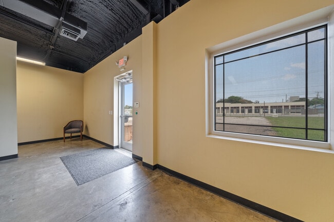

This Property Is For Sale
Property Detail
917 S Staples St
248976
JOHNSON 1.1564 ACS OUT LTS 9, 10 & 11 BK 1 AKA GRINNAGE TR B C & D
Commercialnec
Nueces
B-5
Texas
B and X Area of moderate flood hazard, usually the area between the limits of the 100-year and 500-year floods.
d
2024
1.16 AC
2025
CBD
001202
Corpus Christi
9,800 SF
Corpus Christi, TX
NEARBY LISTINGS FOR SALE OR LEASE
DEMOGRAPHICS near 917 S Staples St
1 mile
3 mile
5 mile
2025 Total Population
13,908
66,998
126,109
2030 Population
14,116
66,671
125,045
Pop Growth 2025-2030
+ 1.50%
(0.49%)
(0.84%)
Average Age
42
40
40
2025 Total Households
5,054
24,531
46,533
HH Growth 2025-2030
+ 2.04%
(0.42%)
(0.77%)
Median Household Inc
$41,071
$45,424
$52,017
Avg Household Size
2.30
2.50
2.60
2025 Avg HH Vehicles
1.00
2.00
2.00
Median Home Value
$110,326
$112,037
$137,469
Median Year Built
1964
1957
1962
Nearby Places
Map Layers
Map Styles
 Street
 Aerial
Layers
 Traffic
 Biking
Places
Listings with unknown addresses are not visible on the map
- Restaurants
- Banks
- Shops
- Fitness
- Groceries
PUBLIC TRANSPORTATION
AIRPORT
Corpus Christi International
Drive
Walk
Distance
Corpus Christi International
14 min
7.6 mi
Freight Ports
Port of Corpus Christi
Drive
Walk
Distance
Port of Corpus Christi
3 min
1.9 mi
Nearby Properties
Address
Land Use
TOTAL SIZE
Lot Size
Zoning
Address
Land Use
TOTAL SIZE
Lot Size
Zoning
567,638 SF
18.37 AC
B4
Address
Land Use
TOTAL SIZE
Lot Size
Zoning
382,448 SF
14.98 AC
Address
Land Use
TOTAL SIZE
Lot Size
Zoning
674,927 SF
10.54 AC
B4
Address
Land Use
TOTAL SIZE
Lot Size
Zoning
594,377 SF
29.96 AC
B5
Address
Land Use
TOTAL SIZE
Lot Size
Zoning
1 SF
62.73 AC
III
Address
Land Use
TOTAL SIZE
Lot Size
Zoning
24,217 SF
4.39 AC
B2
Address
Land Use
TOTAL SIZE
Lot Size
Zoning
370,000 SF
1.47 AC
B-2
Address
Land Use
TOTAL SIZE
Lot Size
Zoning
15.10 AC
I3
Address
Land Use
TOTAL SIZE
Lot Size
Zoning
1 SF
13.71 AC
B5
Address
Land Use
TOTAL SIZE
Lot Size
Zoning
302,344 SF
5 AC
Address
Land Use
TOTAL SIZE
Lot Size
Zoning
392,617 SF
2.20 AC
B2
Address
Land Use
TOTAL SIZE
Lot Size
Zoning
176,076 SF
19.84 AC
R1B
Address
Land Use
TOTAL SIZE
Lot Size
Zoning
131,533 SF
23.24 AC
I3
Address
Land Use
TOTAL SIZE
Lot Size
Zoning
1 SF
10.53 AC
I2
Address
Land Use
TOTAL SIZE
Lot Size
Zoning
10,000 SF
35.96 AC
R1B
Address
Land Use
TOTAL SIZE
Lot Size
Zoning
72,106 SF
1.96 AC
B-5
Address
Land Use
TOTAL SIZE
Lot Size
Zoning
11.03 AC
I3
Address
Land Use
TOTAL SIZE
Lot Size
Zoning
75,120 SF
1.93 AC
B2
Address
Land Use
TOTAL SIZE
Lot Size
Zoning
65,301 SF
7.37 AC
B-4
Address
Land Use
TOTAL SIZE
Lot Size
Zoning
177,545 SF
7.75 AC
B2
Address
Land Use
TOTAL SIZE
Lot Size
Zoning
52,121 SF
27.73 AC
Address
Land Use
TOTAL SIZE
Lot Size
Zoning
74,261 SF
4.44 AC
R1B
Address
Land Use
TOTAL SIZE
Lot Size
Zoning
361,000 SF
2.20 AC
B6PUD2
Address
Land Use
TOTAL SIZE
Lot Size
Zoning
105.49 AC
R1B
Address
Land Use
TOTAL SIZE
Lot Size
Zoning
13,773 SF
28.82 AC
R1B
Address
Land Use
TOTAL SIZE
Lot Size
Zoning
103,628 SF
2.61 AC
Address
Land Use
TOTAL SIZE
Lot Size
Zoning
145,296 SF
1.21 AC
B6
Address
Land Use
TOTAL SIZE
Lot Size
Zoning
186,106 SF
6.54 AC
B1
Address
Land Use
TOTAL SIZE
Lot Size
Zoning
94,600 SF
9.29 AC
R2
Address
Land Use
TOTAL SIZE
Lot Size
Zoning
129,210 SF
11.63 AC
R1B
The World's #1 Commercial Real Estate Marketplace
Connect with us
© 2026 CoStar Group
The information above has been obtained from sources believed reliable. While we do not doubt its accuracy we have not verified it and make no guarantee, warranty or representation about it. It is your responsibility to independently confirm its accuracy and completeness. Any projections, opinions, assumptions, or estimates used are for example only and do not represent the current or future performance of the property. The value of this transaction to you depends on tax and other factors which should be evaluated by your tax, financial, and legal advisors. You and your advisors should conduct a careful, independent investigation of the property to determine to your satisfaction the suitability of the property for your needs.