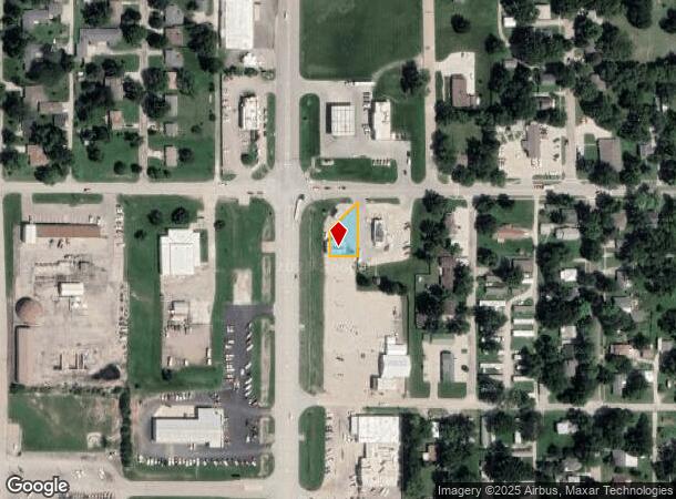
Property Record
917 W 4Th St, Holton, KS 66436

NEARBY LISTINGS FOR SALE OR LEASE
-
-
View all Holton listings for sale on LoopNet.com
Property Detail
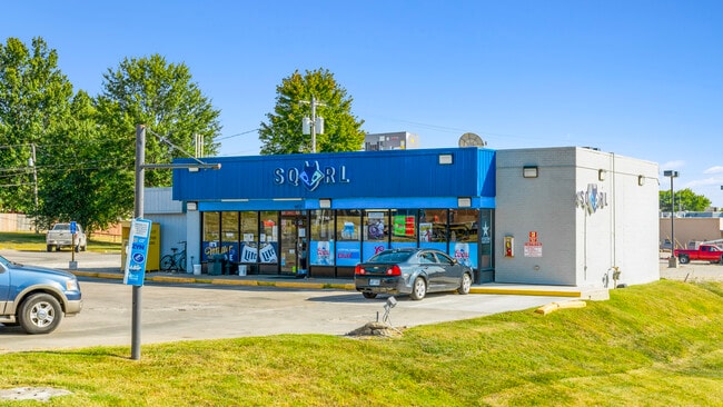
917 W 4Th St
Topeka, KS
Westview Add.
092-09-0-10-09-003.00-0
WESTVIEW ADD., S09, T07, R15E, ACRES 0.19, E44.5 LOTS 1,2 & 3 BLK 3 & 30 FT VAC ARIZONA AVE ADJ LESS HWY75 ROW SECTION 09
Conveniencestore
Jackson
X
Kansas
20085C0280E
1-3
2024
0.19 AC
2025
Topeka
082700
Kansas City
1,700 SF
DEMOGRAPHICS near 917 W 4Th St
1 Mile
3 Mile
5 Mile
2024 Total Population
3,593
4,469
5,232
2029 Population
3,669
4,561
5,331
Pop Growth 2024-2029
+ 2.12%
+ 2.06%
+ 1.89%
Average Age
41
41
41
2024 Total Households
1,477
1,820
2,108
HH Growth 2024-2029
+ 2.17%
+ 2.14%
+ 1.94%
Median Household Inc
$47,151
$51,087
$54,683
Avg Household Size
2.30
2.30
2.40
2024 Avg HH Vehicles
2.00
2.00
2.00
Median Home Value
$144,362
$148,546
$149,256
Median Year Built
1965
1966
1966
Nearby Places
Map Layers
Map Styles
 Street
 Aerial
- Restaurants
- Banks
- Shops
- Fitness
- Groceries
SALE & LEASE HISTORY
LISTING DATE
SALE/LEASE

Nov 08, 2022
For Sale
Feb 15, 2023
For Sale
Nearby Properties
Address
Land Use
TOTAL SIZE
Lot Size
Zoning
Address
Land Use
TOTAL SIZE
Lot Size
Zoning
131,701 SF
8.59 AC
Address
Land Use
TOTAL SIZE
Lot Size
Zoning
56,664 SF
9.85 AC
Address
Land Use
TOTAL SIZE
Lot Size
Zoning
56,259 SF
3.39 AC
Address
Land Use
TOTAL SIZE
Lot Size
Zoning
40,000 SF
3.09 AC
Address
Land Use
TOTAL SIZE
Lot Size
Zoning
21,669 SF
1.25 AC
Address
Land Use
TOTAL SIZE
Lot Size
Zoning
24,910 SF
2.41 AC
Address
Land Use
TOTAL SIZE
Lot Size
Zoning
10,024 SF
0.52 AC
Address
Land Use
TOTAL SIZE
Lot Size
Zoning
9,108 SF
6.43 AC
FP
Address
Land Use
TOTAL SIZE
Lot Size
Zoning
16,462 SF
0.83 AC
Address
Land Use
TOTAL SIZE
Lot Size
Zoning
456.22 AC
Address
Land Use
TOTAL SIZE
Lot Size
Zoning
10,365 SF
2.82 AC
Address
Land Use
TOTAL SIZE
Lot Size
Zoning
10,976 SF
3.90 AC
Address
Land Use
TOTAL SIZE
Lot Size
Zoning
68,996 SF
7.56 AC
Address
Land Use
TOTAL SIZE
Lot Size
Zoning
14,609 SF
6.10 AC
Address
Land Use
TOTAL SIZE
Lot Size
Zoning
406.49 AC
Address
Land Use
TOTAL SIZE
Lot Size
Zoning
10,382 SF
0.62 AC
Address
Land Use
TOTAL SIZE
Lot Size
Zoning
6,760 SF
1.10 AC
Address
Land Use
TOTAL SIZE
Lot Size
Zoning
18,700 SF
23.20 AC
Address
Land Use
TOTAL SIZE
Lot Size
Zoning
13,016 SF
3.11 AC
FP
Address
Land Use
TOTAL SIZE
Lot Size
Zoning
252.71 AC
Address
Land Use
TOTAL SIZE
Lot Size
Zoning
3,480 SF
0.09 AC
Address
Land Use
TOTAL SIZE
Lot Size
Zoning
23,828 SF
59.63 AC
FP
Address
Land Use
TOTAL SIZE
Lot Size
Zoning
11,084 SF
3.27 AC
Address
Land Use
TOTAL SIZE
Lot Size
Zoning
7,519 SF
2.60 AC
Address
Land Use
TOTAL SIZE
Lot Size
Zoning
22,749 SF
0.41 AC
Address
Land Use
TOTAL SIZE
Lot Size
Zoning
8.26 AC
Address
Land Use
TOTAL SIZE
Lot Size
Zoning
5,000 SF
0.41 AC
Address
Land Use
TOTAL SIZE
Lot Size
Zoning
4,930 SF
3.80 AC
Address
Land Use
TOTAL SIZE
Lot Size
Zoning
6,160 SF
0.60 AC
Address
Land Use
TOTAL SIZE
Lot Size
Zoning
6,514 SF
0.44 AC
The World's #1 Commercial Real Estate Marketplace
Connect with us
© 2025 CoStar Group
The information above has been obtained from sources believed reliable. While we do not doubt its accuracy we have not verified it and make no guarantee, warranty or representation about it. It is your responsibility to independently confirm its accuracy and completeness. Any projections, opinions, assumptions, or estimates used are for example only and do not represent the current or future performance of the property. The value of this transaction to you depends on tax and other factors which should be evaluated by your tax, financial, and legal advisors. You and your advisors should conduct a careful, independent investigation of the property to determine to your satisfaction the suitability of the property for your needs.