Property Record
9170 Dorsey Rd, Riverdale, GA 30274


NEARBY LISTINGS FOR SALE OR LEASE
-
-
View all Riverdale listings for sale on LoopNet.com
Property Detail
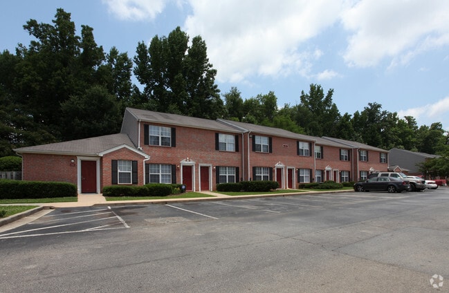
9170 Dorsey Rd
05-0236D-00A-006
Sunamerica Hsng Fund 291 Green
Welfaresocialservicelowincomehousingexempt
Clayton
AE
Georgia
13063C0069F
16.26 AC
2025
Clayton County
2025
Atlanta
040518
Atlanta-Sandy Springs-Roswell, GA
130 SF
DEMOGRAPHICS near 9170 Dorsey Rd
1 Mile
3 Mile
5 Mile
2024 Total Population
10,242
59,024
143,714
2029 Population
10,193
58,865
144,442
Pop Growth 2024-2029
(0.48%)
(0.27%)
+ 0.51%
Average Age
35
36
37
2024 Total Households
3,390
20,494
51,162
HH Growth 2024-2029
(0.50%)
(0.31%)
+ 0.53%
Median Household Inc
$51,816
$54,872
$58,508
Avg Household Size
3.00
2.80
2.70
2024 Avg HH Vehicles
2.00
2.00
2.00
Median Home Value
$166,449
$181,973
$193,389
Median Year Built
1985
1986
1987
Nearby Places
Map Layers
Map Styles
 Street
 Aerial
- Restaurants
- Banks
- Shops
- Fitness
- Groceries
PUBLIC TRANSPORTATION
AIRPORT
Hartsfield - Jackson Atlanta International
DRIVE
WALK
Distance
Hartsfield - Jackson Atlanta International
25 min
12.2 mi
Freight Ports
Georgia Ports - Savannah
DRIVE
WALK
Distance
Georgia Ports - Savannah
273 min
237.6 mi
Nearby Properties
Address
Land Use
TOTAL SIZE
Lot Size
Zoning
Address
Land Use
TOTAL SIZE
Lot Size
Zoning
231,046 SF
97.58 AC
C
Address
Land Use
TOTAL SIZE
Lot Size
Zoning
7,851 SF
94.84 AC
RS180
Address
Land Use
TOTAL SIZE
Lot Size
Zoning
324 SF
49.49 AC
RM
Address
Land Use
TOTAL SIZE
Lot Size
Zoning
123,000 SF
48 AC
RS110
Address
Land Use
TOTAL SIZE
Lot Size
Zoning
424 SF
54.79 AC
RM
Address
Land Use
TOTAL SIZE
Lot Size
Zoning
270 SF
28.02 AC
RM
Address
Land Use
TOTAL SIZE
Lot Size
Zoning
316 SF
34.30 AC
RG75
Address
Land Use
TOTAL SIZE
Lot Size
Zoning
500,415 SF
26.99 AC
HI
Address
Land Use
TOTAL SIZE
Lot Size
Zoning
224 SF
25 AC
C
Address
Land Use
TOTAL SIZE
Lot Size
Zoning
256 SF
25 AC
PUD
Address
Land Use
TOTAL SIZE
Lot Size
Zoning
14,230 AC
C
Address
Land Use
TOTAL SIZE
Lot Size
Zoning
220 SF
26.84 AC
RM
Address
Land Use
TOTAL SIZE
Lot Size
Zoning
65,798 SF
7.41 AC
C
Address
Land Use
TOTAL SIZE
Lot Size
Zoning
57.05 AC
GB
Address
Land Use
TOTAL SIZE
Lot Size
Zoning
160 SF
19.95 AC
RM
Address
Land Use
TOTAL SIZE
Lot Size
Zoning
176 SF
17.67 AC
RM
Address
Land Use
TOTAL SIZE
Lot Size
Zoning
155,204 SF
21.37 AC
I
Address
Land Use
TOTAL SIZE
Lot Size
Zoning
200 SF
13.12 AC
RM
Address
Land Use
TOTAL SIZE
Lot Size
Zoning
141,792 SF
18.50 AC
RS110
Address
Land Use
TOTAL SIZE
Lot Size
Zoning
96,022 SF
5.04 AC
C
Address
Land Use
TOTAL SIZE
Lot Size
Zoning
81,986 SF
15 AC
RS180
Address
Land Use
TOTAL SIZE
Lot Size
Zoning
116,822 SF
4.10 AC
RS180
Address
Land Use
TOTAL SIZE
Lot Size
Zoning
184 SF
16.89 AC
C
Address
Land Use
TOTAL SIZE
Lot Size
Zoning
63,256 SF
27.07 AC
I
Address
Land Use
TOTAL SIZE
Lot Size
Zoning
132 SF
12.70 AC
C
Address
Land Use
TOTAL SIZE
Lot Size
Zoning
199,132 SF
19.59 AC
C PUD
Address
Land Use
TOTAL SIZE
Lot Size
Zoning
2,193 SF
8.49 AC
C
Address
Land Use
TOTAL SIZE
Lot Size
Zoning
196 SF
6.19 AC
C
Address
Land Use
TOTAL SIZE
Lot Size
Zoning
57,441 SF
15.20 AC
RS110
Address
Land Use
TOTAL SIZE
Lot Size
Zoning
33,619 SF
3.18 AC
C
The World's #1 Commercial Real Estate Marketplace
Connect with us
© 2026 CoStar Group
The information above has been obtained from sources believed reliable. While we do not doubt its accuracy we have not verified it and make no guarantee, warranty or representation about it. It is your responsibility to independently confirm its accuracy and completeness. Any projections, opinions, assumptions, or estimates used are for example only and do not represent the current or future performance of the property. The value of this transaction to you depends on tax and other factors which should be evaluated by your tax, financial, and legal advisors. You and your advisors should conduct a careful, independent investigation of the property to determine to your satisfaction the suitability of the property for your needs.