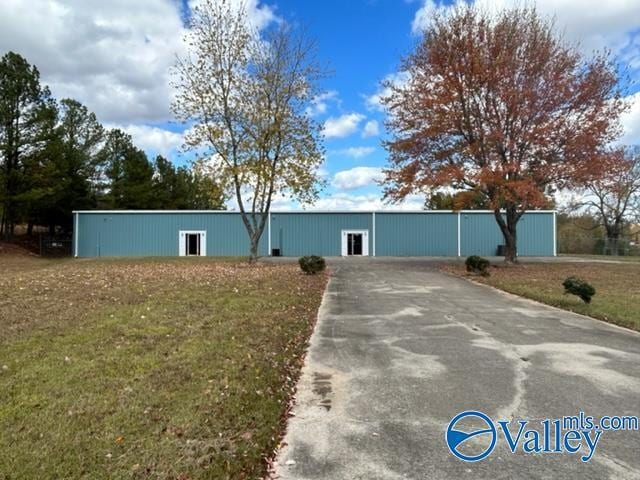
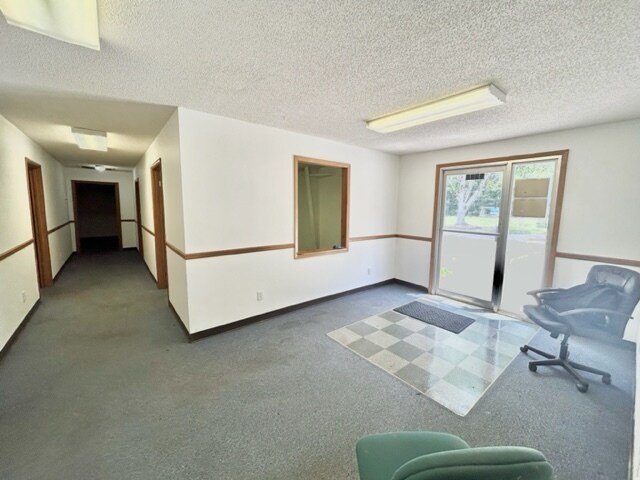
Property Record
9172 Highway 36 E, Laceys Spring, AL 35754

Property Detail
9172 Highway 36 E
09-02-09-0-000-001.001
COM AT NW COR OF NE1/4 SEC 9, T6S, R1W, TH E 1320.04', TH SO 1385.39' TO TPOB, TH CONT SO 406.66' TO HWY #36, TH SE ALG SD HW
Publicstorage
Morgan
B and X Area of moderate flood hazard, usually the area between the limits of the 100-year and 500-year floods.
Alabama
2025
8 AC
2024
Alabama North Area
005704
Other Market Areas
11,250 SF
Decatur, AL
NEARBY LISTINGS FOR SALE OR LEASE
-
-
View all Laceys Spring listings for sale on LoopNet.com
DEMOGRAPHICS near 9172 Highway 36 E
1 mile
3 mile
5 mile
2025 Total Population
420
3,260
6,490
2030 Population
436
3,390
6,737
Pop Growth 2025-2030
+ 3.81%
+ 3.99%
+ 3.81%
Average Age
43
42
43
2025 Total Households
169
1,322
2,647
HH Growth 2025-2030
+ 4.14%
+ 4.01%
+ 3.85%
Median Household Inc
$83,654
$92,702
$89,679
Avg Household Size
2.50
2.50
2.40
2025 Avg HH Vehicles
2.00
3.00
3.00
Median Home Value
$191,071
$199,771
$214,170
Median Year Built
1987
1988
1988
Nearby Places
Map Layers
Map Styles
 Street
 Aerial
Layers
 Traffic
 Biking
Places
Listings with unknown addresses are not visible on the map
- Restaurants
- Banks
- Shops
- Fitness
- Groceries
PUBLIC TRANSPORTATION
AIRPORT
Huntsville International-Carl T Jones Field
Drive
Walk
Distance
Huntsville International-Carl T Jones Field
44 min
29.7 mi
Freight Ports
Port of Mobile
Drive
Walk
Distance
Port of Mobile
391 min
349.7 mi
SALE & LEASE HISTORY
LISTING DATE
SALE/LEASE

Nov 03, 2023
For Sale
Nearby Properties
Address
Land Use
TOTAL SIZE
Lot Size
Zoning
Address
Land Use
TOTAL SIZE
Lot Size
Zoning
11,209 SF
2 AC
Address
Land Use
TOTAL SIZE
Lot Size
Zoning
32,000 SF
4.50 AC
Address
Land Use
TOTAL SIZE
Lot Size
Zoning
1,728 SF
1.10 AC
Address
Land Use
TOTAL SIZE
Lot Size
Zoning
2,360 SF
2.10 AC
Address
Land Use
TOTAL SIZE
Lot Size
Zoning
13,200 SF
6.70 AC
Address
Land Use
TOTAL SIZE
Lot Size
Zoning
4,800 SF
1.70 AC
Address
Land Use
TOTAL SIZE
Lot Size
Zoning
1,500 SF
2.70 AC
Address
Land Use
TOTAL SIZE
Lot Size
Zoning
Address
Land Use
TOTAL SIZE
Lot Size
Zoning
3,508 SF
35 AC
Address
Land Use
TOTAL SIZE
Lot Size
Zoning
Address
Land Use
TOTAL SIZE
Lot Size
Zoning
3,904 SF
4 AC
Address
Land Use
TOTAL SIZE
Lot Size
Zoning
11,250 SF
4.80 AC
Address
Land Use
TOTAL SIZE
Lot Size
Zoning
8,000 SF
1.30 AC
Address
Land Use
TOTAL SIZE
Lot Size
Zoning
2,501 SF
3.10 AC
Address
Land Use
TOTAL SIZE
Lot Size
Zoning
Address
Land Use
TOTAL SIZE
Lot Size
Zoning
Address
Land Use
TOTAL SIZE
Lot Size
Zoning
9,000 SF
1.20 AC
Address
Land Use
TOTAL SIZE
Lot Size
Zoning
640 SF
24 AC
Address
Land Use
TOTAL SIZE
Lot Size
Zoning
4,512 SF
1.20 AC
Address
Land Use
TOTAL SIZE
Lot Size
Zoning
2,664 SF
1.70 AC
Address
Land Use
TOTAL SIZE
Lot Size
Zoning
3,108 SF
1.40 AC
Address
Land Use
TOTAL SIZE
Lot Size
Zoning
9,900 SF
0.40 AC
Address
Land Use
TOTAL SIZE
Lot Size
Zoning
Address
Land Use
TOTAL SIZE
Lot Size
Zoning
225 SF
5.30 AC
Address
Land Use
TOTAL SIZE
Lot Size
Zoning
9,304 SF
1.90 AC
Address
Land Use
TOTAL SIZE
Lot Size
Zoning
6,000 SF
0.99 AC
Address
Land Use
TOTAL SIZE
Lot Size
Zoning
10,000 SF
1.01 AC
Address
Land Use
TOTAL SIZE
Lot Size
Zoning
3,469 SF
1.90 AC
Address
Land Use
TOTAL SIZE
Lot Size
Zoning
The World's #1 Commercial Real Estate Marketplace
Connect with us
© 2026 CoStar Group
The information above has been obtained from sources believed reliable. While we do not doubt its accuracy we have not verified it and make no guarantee, warranty or representation about it. It is your responsibility to independently confirm its accuracy and completeness. Any projections, opinions, assumptions, or estimates used are for example only and do not represent the current or future performance of the property. The value of this transaction to you depends on tax and other factors which should be evaluated by your tax, financial, and legal advisors. You and your advisors should conduct a careful, independent investigation of the property to determine to your satisfaction the suitability of the property for your needs.