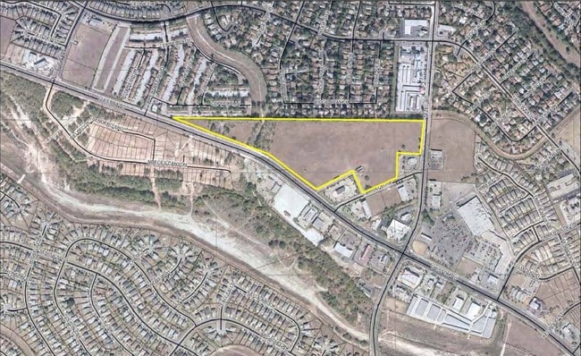
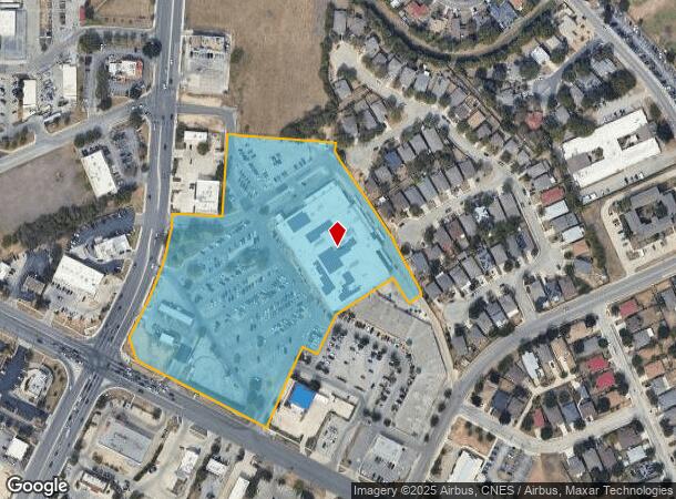
Property Record
9255 Grissom Rd, San Antonio, TX 78251
NEARBY LISTINGS FOR SALE OR LEASE
Property Detail
9255 Grissom Rd
San Antonio-New Braunfels, TX
Conv A/S Code
18792-092-0123
NCB 18792 BLK 92 LOT 12
Supermarket
Bexar
X
Texas
48029C0360G
123
2024
9.75 AC
2025
Northwest
181712
San Antonio
95,250 SF
DEMOGRAPHICS near 9255 Grissom Rd
1 Mile
3 Mile
5 Mile
2024 Total Population
15,676
121,188
340,352
2029 Population
16,438
127,684
360,850
Pop Growth 2024-2029
+ 4.86%
+ 5.36%
+ 6.02%
Average Age
38
37
36
2024 Total Households
5,422
44,532
123,819
HH Growth 2024-2029
+ 5.02%
+ 5.56%
+ 6.18%
Median Household Inc
$79,492
$72,383
$73,997
Avg Household Size
2.80
2.70
2.70
2024 Avg HH Vehicles
2.00
2.00
2.00
Median Home Value
$185,095
$201,787
$221,016
Median Year Built
1988
1992
1996
Nearby Places
Map Layers
Map Styles
 Street
 Aerial
- Restaurants
- Banks
- Shops
- Fitness
- Groceries
PUBLIC TRANSPORTATION
AIRPORT
San Antonio International
DRIVE
WALK
Distance
San Antonio International
20 min
13.7 mi
SALE & LEASE HISTORY
LISTING DATE
SALE/LEASE

Sep 24, 2016
For Sale
Nearby Properties
Address
Land Use
TOTAL SIZE
Lot Size
Zoning
Address
Land Use
TOTAL SIZE
Lot Size
Zoning
754,713 SF
33.44 AC
Address
Land Use
TOTAL SIZE
Lot Size
Zoning
486,228 SF
50.05 AC
Address
Land Use
TOTAL SIZE
Lot Size
Zoning
339,795 SF
24.27 AC
Address
Land Use
TOTAL SIZE
Lot Size
Zoning
315,000 SF
24.20 AC
Address
Land Use
TOTAL SIZE
Lot Size
Zoning
1,963,350 SF
36.24 AC
Address
Land Use
TOTAL SIZE
Lot Size
Zoning
738,286 SF
44 SF
Address
Land Use
TOTAL SIZE
Lot Size
Zoning
469,808 SF
36 AC
Address
Land Use
TOTAL SIZE
Lot Size
Zoning
443,726 SF
25.01 AC
Address
Land Use
TOTAL SIZE
Lot Size
Zoning
321,368 SF
48.21 AC
Address
Land Use
TOTAL SIZE
Lot Size
Zoning
593,760 SF
69.28 AC
Address
Land Use
TOTAL SIZE
Lot Size
Zoning
411,503 SF
48.90 AC
Address
Land Use
TOTAL SIZE
Lot Size
Zoning
236,594 SF
25.35 AC
Address
Land Use
TOTAL SIZE
Lot Size
Zoning
185,751 SF
21.60 AC
Address
Land Use
TOTAL SIZE
Lot Size
Zoning
171,142 SF
21.60 AC
Address
Land Use
TOTAL SIZE
Lot Size
Zoning
260,384 SF
33.56 AC
Address
Land Use
TOTAL SIZE
Lot Size
Zoning
370,870 SF
27.27 AC
Address
Land Use
TOTAL SIZE
Lot Size
Zoning
541,776 SF
22.15 AC
Address
Land Use
TOTAL SIZE
Lot Size
Zoning
352,500 SF
31.03 AC
Address
Land Use
TOTAL SIZE
Lot Size
Zoning
815,030 SF
111.97 AC
Address
Land Use
TOTAL SIZE
Lot Size
Zoning
123,595 SF
21.60 AC
Address
Land Use
TOTAL SIZE
Lot Size
Zoning
361,708 SF
17.83 AC
Address
Land Use
TOTAL SIZE
Lot Size
Zoning
109,425 SF
30.63 AC
Address
Land Use
TOTAL SIZE
Lot Size
Zoning
316,842 SF
19.61 AC
Address
Land Use
TOTAL SIZE
Lot Size
Zoning
532,921 SF
21.80 AC
Address
Land Use
TOTAL SIZE
Lot Size
Zoning
50,135 SF
10.96 AC
Address
Land Use
TOTAL SIZE
Lot Size
Zoning
368,012 SF
22.27 AC
Address
Land Use
TOTAL SIZE
Lot Size
Zoning
275,270 SF
11.97 AC
Address
Land Use
TOTAL SIZE
Lot Size
Zoning
202,122 SF
20.56 AC
Address
Land Use
TOTAL SIZE
Lot Size
Zoning
608,644 SF
88.50 AC
Address
Land Use
TOTAL SIZE
Lot Size
Zoning
360,108 SF
24 AC
The World's #1 Commercial Real Estate Marketplace
Connect with us
© 2026 CoStar Group
The information above has been obtained from sources believed reliable. While we do not doubt its accuracy we have not verified it and make no guarantee, warranty or representation about it. It is your responsibility to independently confirm its accuracy and completeness. Any projections, opinions, assumptions, or estimates used are for example only and do not represent the current or future performance of the property. The value of this transaction to you depends on tax and other factors which should be evaluated by your tax, financial, and legal advisors. You and your advisors should conduct a careful, independent investigation of the property to determine to your satisfaction the suitability of the property for your needs.