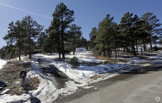
Property Record
918 Nob Hill Rd, Evergreen, CO 80439

Property Detail
918 Nob Hill Rd
41-164-05-007
SECTION 16 TOWNSHIP 04 RANGE 71 QTR SE SUBDIVISIONCD 276400 SUBDIVISIONNAME GENESEE PARK STATE BLOCK 008 LOT SIZE: 65776 TRACT 00E VALUE: 1.510
Industrialgeneral
Jefferson
MR1
Colorado
B and X Area of moderate flood hazard, usually the area between the limits of the 100-year and 500-year floods.
1.51 AC
2025
West Denver
2025
Denver
009846
Denver-Aurora-Centennial, CO
53,739 SF
NEARBY LISTINGS FOR SALE OR LEASE
DEMOGRAPHICS near 918 Nob Hill Rd
1 mile
3 mile
5 mile
2025 Total Population
937
9,087
20,125
2030 Population
946
9,084
20,056
Pop Growth 2025-2030
+ 0.96%
(0.03%)
(0.34%)
Average Age
46
46
47
2025 Total Households
356
3,598
8,138
HH Growth 2025-2030
+ 0.84%
(0.14%)
(0.44%)
Median Household Inc
$172,500
$167,567
$169,909
Avg Household Size
2.60
2.50
2.40
2025 Avg HH Vehicles
2.00
2.00
2.00
Median Home Value
$1,084,163
$1,029,344
$982,772
Median Year Built
1993
1986
1984
Nearby Places
Map Layers
Map Styles
 Street
 Aerial
Layers
 Traffic
 Biking
Places
Listings with unknown addresses are not visible on the map
- Restaurants
- Banks
- Shops
- Fitness
- Groceries
Nearby Properties
Address
Land Use
TOTAL SIZE
Lot Size
Zoning
Address
Land Use
TOTAL SIZE
Lot Size
Zoning
59,012 SF
2.40 AC
PD
Address
Land Use
TOTAL SIZE
Lot Size
Zoning
57,775 SF
4.47 AC
Address
Land Use
TOTAL SIZE
Lot Size
Zoning
35,890 SF
1.84 AC
PD
Address
Land Use
TOTAL SIZE
Lot Size
Zoning
4,655 SF
566.76 AC
CO
Address
Land Use
TOTAL SIZE
Lot Size
Zoning
160,578 SF
15.07 AC
C1
Address
Land Use
TOTAL SIZE
Lot Size
Zoning
46,955 SF
7.84 AC
PD
Address
Land Use
TOTAL SIZE
Lot Size
Zoning
73,516 SF
7.55 AC
C1
Address
Land Use
TOTAL SIZE
Lot Size
Zoning
47,651 SF
5 AC
C1
Address
Land Use
TOTAL SIZE
Lot Size
Zoning
82,457 SF
9.38 AC
C1
Address
Land Use
TOTAL SIZE
Lot Size
Zoning
89,485 SF
20.01 AC
A2
Address
Land Use
TOTAL SIZE
Lot Size
Zoning
51,200 SF
3.80 AC
PD
Address
Land Use
TOTAL SIZE
Lot Size
Zoning
75,008 SF
2.17 AC
PD
Address
Land Use
TOTAL SIZE
Lot Size
Zoning
41,505 SF
30.15 AC
Address
Land Use
TOTAL SIZE
Lot Size
Zoning
23,349 SF
2.90 AC
Address
Land Use
TOTAL SIZE
Lot Size
Zoning
44,100 SF
4.86 AC
PD
Address
Land Use
TOTAL SIZE
Lot Size
Zoning
39,303 SF
3.17 AC
PD
Address
Land Use
TOTAL SIZE
Lot Size
Zoning
27,303 SF
6.99 AC
PD
Address
Land Use
TOTAL SIZE
Lot Size
Zoning
35,631 SF
169.48 AC
PD
Address
Land Use
TOTAL SIZE
Lot Size
Zoning
60,497 SF
5.18 AC
PD
Address
Land Use
TOTAL SIZE
Lot Size
Zoning
47,190 SF
5.22 AC
A1
Address
Land Use
TOTAL SIZE
Lot Size
Zoning
73,388 SF
9.37 AC
PD
Address
Land Use
TOTAL SIZE
Lot Size
Zoning
28,828 SF
2.73 AC
PD
Address
Land Use
TOTAL SIZE
Lot Size
Zoning
36,402 SF
5.64 AC
PD
Address
Land Use
TOTAL SIZE
Lot Size
Zoning
29,748 SF
257.77 AC
Address
Land Use
TOTAL SIZE
Lot Size
Zoning
53,106 SF
3.19 AC
C1
Address
Land Use
TOTAL SIZE
Lot Size
Zoning
23,124 SF
5 AC
A2
Address
Land Use
TOTAL SIZE
Lot Size
Zoning
39,265 SF
6.07 AC
PD
Address
Land Use
TOTAL SIZE
Lot Size
Zoning
999.86 AC
Address
Land Use
TOTAL SIZE
Lot Size
Zoning
69.37 AC
MR1
The World's #1 Commercial Real Estate Marketplace
Connect with us
© 2026 CoStar Group
The information above has been obtained from sources believed reliable. While we do not doubt its accuracy we have not verified it and make no guarantee, warranty or representation about it. It is your responsibility to independently confirm its accuracy and completeness. Any projections, opinions, assumptions, or estimates used are for example only and do not represent the current or future performance of the property. The value of this transaction to you depends on tax and other factors which should be evaluated by your tax, financial, and legal advisors. You and your advisors should conduct a careful, independent investigation of the property to determine to your satisfaction the suitability of the property for your needs.