Property Record
918 S Main St, Middletown, OH 45044
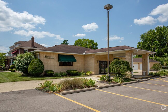

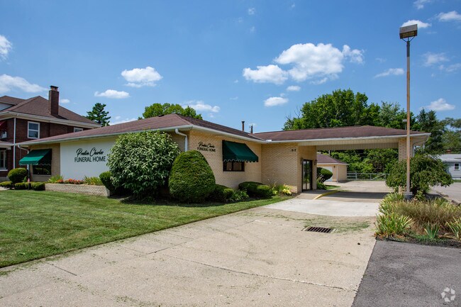
Property Detail
918 S Main St
Cincinnati, OH-KY-IN
1478 ENT
Q6521-030-000-013
Butler
Funeralhome
Ohio
B and X Area of moderate flood hazard, usually the area between the limits of the 100-year and 500-year floods.
1478
2024
0.20 AC
2025
Butler County
013000
Cincinnati/Dayton
6,740 SF
NEARBY LISTINGS FOR SALE OR LEASE
DEMOGRAPHICS near 918 S Main St
1 mile
3 mile
5 mile
2025 Total Population
6,092
44,458
86,832
2030 Population
6,326
45,974
89,581
Pop Growth 2025-2030
+ 3.84%
+ 3.41%
+ 3.17%
Average Age
36
38
39
2025 Total Households
2,375
17,786
34,245
HH Growth 2025-2030
+ 3.92%
+ 3.46%
+ 3.23%
Median Household Inc
$39,090
$49,941
$63,403
Avg Household Size
2.40
2.40
2.50
2025 Avg HH Vehicles
1.00
2.00
2.00
Median Home Value
$89,534
$157,640
$205,547
Median Year Built
1951
1957
1968
Nearby Places
Map Layers
Map Styles
 Street
 Aerial
Layers
 Traffic
 Biking
Places
Listings with unknown addresses are not visible on the map
- Restaurants
- Banks
- Shops
- Fitness
- Groceries
PUBLIC TRANSPORTATION
AIRPORT
James M Cox Dayton International
Drive
Walk
Distance
James M Cox Dayton International
55 min
38.1 mi
Cincinnati/Northern Kentucky International
Drive
Walk
Distance
Cincinnati/Northern Kentucky International
71 min
45.2 mi
SALE & LEASE HISTORY
LISTING DATE
SALE/LEASE

Feb 07, 2017
For Sale
Nearby Properties
Address
Land Use
TOTAL SIZE
Lot Size
Zoning
Address
Land Use
TOTAL SIZE
Lot Size
Zoning
14,558 SF
26.81 AC
Address
Land Use
TOTAL SIZE
Lot Size
Zoning
7.19 AC
Address
Land Use
TOTAL SIZE
Lot Size
Zoning
27.87 AC
Address
Land Use
TOTAL SIZE
Lot Size
Zoning
189,571 SF
10.79 AC
ADV
Address
Land Use
TOTAL SIZE
Lot Size
Zoning
84,352 SF
0.30 AC
Address
Land Use
TOTAL SIZE
Lot Size
Zoning
86.47 AC
ADV
Address
Land Use
TOTAL SIZE
Lot Size
Zoning
54,005 SF
0.33 AC
Address
Land Use
TOTAL SIZE
Lot Size
Zoning
57,248 SF
224.87 AC
Address
Land Use
TOTAL SIZE
Lot Size
Zoning
Address
Land Use
TOTAL SIZE
Lot Size
Zoning
33,362 SF
0.73 AC
Address
Land Use
TOTAL SIZE
Lot Size
Zoning
371,743 SF
24.58 AC
ADV
Address
Land Use
TOTAL SIZE
Lot Size
Zoning
9,069 SF
115.70 AC
Address
Land Use
TOTAL SIZE
Lot Size
Zoning
118,671 SF
5.46 AC
ADV
Address
Land Use
TOTAL SIZE
Lot Size
Zoning
166 AC
ADV
Address
Land Use
TOTAL SIZE
Lot Size
Zoning
16,779 SF
2.19 AC
Address
Land Use
TOTAL SIZE
Lot Size
Zoning
Address
Land Use
TOTAL SIZE
Lot Size
Zoning
499,497 SF
20.30 AC
ADV
Address
Land Use
TOTAL SIZE
Lot Size
Zoning
19,168 SF
7.69 AC
Address
Land Use
TOTAL SIZE
Lot Size
Zoning
151,839 SF
1.68 AC
Address
Land Use
TOTAL SIZE
Lot Size
Zoning
236,670 SF
17.78 AC
Address
Land Use
TOTAL SIZE
Lot Size
Zoning
20,160 SF
0.10 AC
Address
Land Use
TOTAL SIZE
Lot Size
Zoning
34,090 SF
2.14 AC
Address
Land Use
TOTAL SIZE
Lot Size
Zoning
2.92 AC
ADV
Address
Land Use
TOTAL SIZE
Lot Size
Zoning
3.14 AC
Address
Land Use
TOTAL SIZE
Lot Size
Zoning
71,649 SF
26.15 AC
ADV
Address
Land Use
TOTAL SIZE
Lot Size
Zoning
522,237 SF
11.14 AC
ADV
Address
Land Use
TOTAL SIZE
Lot Size
Zoning
0.09 AC
Address
Land Use
TOTAL SIZE
Lot Size
Zoning
17.27 AC
Address
Land Use
TOTAL SIZE
Lot Size
Zoning
242,587 SF
18.99 AC
Address
Land Use
TOTAL SIZE
Lot Size
Zoning
40,076 SF
5.91 AC
The World's #1 Commercial Real Estate Marketplace
Connect with us
© 2026 CoStar Group
The information above has been obtained from sources believed reliable. While we do not doubt its accuracy we have not verified it and make no guarantee, warranty or representation about it. It is your responsibility to independently confirm its accuracy and completeness. Any projections, opinions, assumptions, or estimates used are for example only and do not represent the current or future performance of the property. The value of this transaction to you depends on tax and other factors which should be evaluated by your tax, financial, and legal advisors. You and your advisors should conduct a careful, independent investigation of the property to determine to your satisfaction the suitability of the property for your needs.