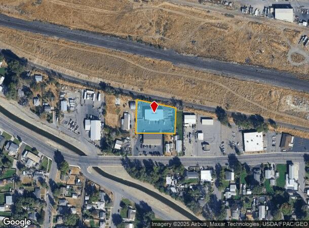
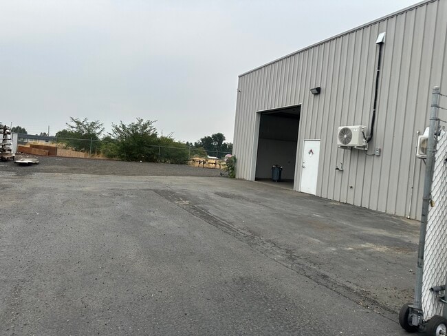
Property Record
918 W Canal Dr, Kennewick, WA 99336
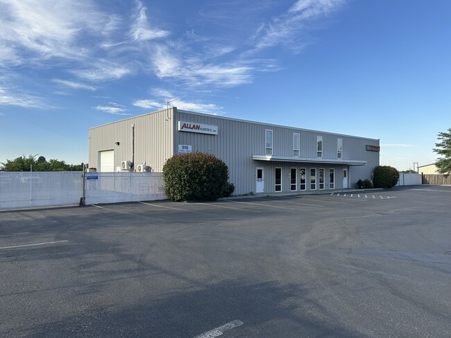
This Property Is For Sale
NEARBY LISTINGS FOR SALE OR LEASE
Property Detail
918 W Canal Dr
Other Market Areas
Short Plat #3035
Kennewick-Richland, WA
SECTION 1 TOWNSHIP 8 RANGE 29 QUARTER NW SHORT PLAT #3035 LOT 1 RECORDED 8242007 UNDER AUDITORS FILE NO. 2007-028100. RECORDED IN VOLUME 1 OF SHORT PLATS PAGE 3035 RECORDS OF BENTON COUNTY WASHINGTON.
101892013035001
Benton
Commercialnec
Washington
2024
1
2024
0.68 AC
011300
Yakima/Kennewick
5,500 SF
DEMOGRAPHICS near 918 W Canal Dr
1 Mile
3 Mile
5 Mile
2024 Total Population
13,045
90,330
155,385
2029 Population
13,642
93,736
161,791
Pop Growth 2024-2029
+ 4.58%
+ 3.77%
+ 4.12%
Average Age
34
36
36
2024 Total Households
4,621
30,863
52,523
HH Growth 2024-2029
+ 4.61%
+ 3.90%
+ 4.22%
Median Household Inc
$37,422
$63,083
$74,853
Avg Household Size
2.70
2.80
2.90
2024 Avg HH Vehicles
2.00
2.00
2.00
Median Home Value
$260,456
$343,856
$380,103
Median Year Built
1967
1973
1980
Nearby Places
- Restaurants
- Banks
- Shops
- Fitness
- Groceries
PUBLIC TRANSPORTATION
COMMUTER RAIL
Pasco Amtrak Station (Empire Builder - Amtrak)
DRIVE
WALK
Distance
Pasco Amtrak Station (Empire Builder - Amtrak)
8 min
3.7 mi
AIRPORT
Tri-Cities
DRIVE
WALK
Distance
Tri-Cities
9 min
5.0 mi
Freight Ports
Port of Tacoma
DRIVE
WALK
Distance
Port of Tacoma
272 min
237.3 mi
Nearby Properties
Address
Land Use
TOTAL SIZE
Lot Size
Zoning
Address
Land Use
TOTAL SIZE
Lot Size
Zoning
2,863,808 SF
28.33 AC
Address
Land Use
TOTAL SIZE
Lot Size
Zoning
232,463 SF
31.54 AC
Address
Land Use
TOTAL SIZE
Lot Size
Zoning
294,855 SF
35.04 AC
KENNEWICK
Address
Land Use
TOTAL SIZE
Lot Size
Zoning
377,541 SF
24.58 AC
Address
Land Use
TOTAL SIZE
Lot Size
Zoning
153,320 SF
7.37 AC
Address
Land Use
TOTAL SIZE
Lot Size
Zoning
113,585 SF
15.43 AC
Address
Land Use
TOTAL SIZE
Lot Size
Zoning
213,921 SF
22.78 AC
Address
Land Use
TOTAL SIZE
Lot Size
Zoning
114,673 SF
6.58 AC
Address
Land Use
TOTAL SIZE
Lot Size
Zoning
84,951 SF
4.39 AC
Address
Land Use
TOTAL SIZE
Lot Size
Zoning
172,573 SF
15.30 AC
Address
Land Use
TOTAL SIZE
Lot Size
Zoning
84,680 SF
3 AC
Address
Land Use
TOTAL SIZE
Lot Size
Zoning
61,400 SF
11.50 AC
Address
Land Use
TOTAL SIZE
Lot Size
Zoning
164,172 SF
9.37 AC
35
Address
Land Use
TOTAL SIZE
Lot Size
Zoning
132,060 SF
6.74 AC
35
Address
Land Use
TOTAL SIZE
Lot Size
Zoning
67,635 SF
5.95 AC
Address
Land Use
TOTAL SIZE
Lot Size
Zoning
55,841 SF
12.30 AC
Address
Land Use
TOTAL SIZE
Lot Size
Zoning
86,190 SF
30.10 AC
Address
Land Use
TOTAL SIZE
Lot Size
Zoning
149,281 SF
10.79 AC
Address
Land Use
TOTAL SIZE
Lot Size
Zoning
67,748 SF
3.87 AC
Address
Land Use
TOTAL SIZE
Lot Size
Zoning
241,912 SF
12.99 AC
Address
Land Use
TOTAL SIZE
Lot Size
Zoning
110,740 SF
18.15 AC
Address
Land Use
TOTAL SIZE
Lot Size
Zoning
55,809 SF
10.79 AC
Address
Land Use
TOTAL SIZE
Lot Size
Zoning
20,919 SF
58.49 AC
KENNEWICK
Address
Land Use
TOTAL SIZE
Lot Size
Zoning
103,115 SF
8.38 AC
Address
Land Use
TOTAL SIZE
Lot Size
Zoning
47,064 SF
13.70 AC
KENNEWICK
Address
Land Use
TOTAL SIZE
Lot Size
Zoning
57,794 SF
14.38 AC
Address
Land Use
TOTAL SIZE
Lot Size
Zoning
138,738 SF
8.70 AC
33
Address
Land Use
TOTAL SIZE
Lot Size
Zoning
108,754 SF
7.51 AC
33
Address
Land Use
TOTAL SIZE
Lot Size
Zoning
80,604 SF
4.30 AC
Address
Land Use
TOTAL SIZE
Lot Size
Zoning
75,542 SF
6.36 AC
The World's #1 Commercial Real Estate Marketplace
Connect with us
© 2025 CoStar Group
The information above has been obtained from sources believed reliable. While we do not doubt its accuracy we have not verified it and make no guarantee, warranty or representation about it. It is your responsibility to independently confirm its accuracy and completeness. Any projections, opinions, assumptions, or estimates used are for example only and do not represent the current or future performance of the property. The value of this transaction to you depends on tax and other factors which should be evaluated by your tax, financial, and legal advisors. You and your advisors should conduct a careful, independent investigation of the property to determine to your satisfaction the suitability of the property for your needs.