Property Record
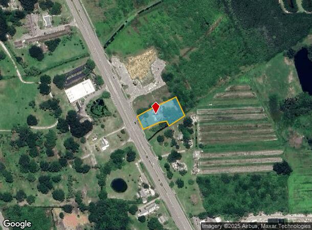
9180 Us Highway 1, Sebastian, FL 32976


NEARBY LISTINGS FOR SALE OR LEASE
-
-
View all Sebastian listings for sale on LoopNet.com
Property Detail
9180 Us Highway 1
31-39-28-00000-3000-00004.0
Null
Officebuilding
SEC 28 TWP 31 RNG 39 BEING A PARC SITUATED IN THE NE QTR OF THE NW QTR OF SEC 28 AND MORE PART DESC AS FOLL COM AT THE NE COR OF THE NW QTR OF SEC 28 AND RUN S1-38-06E AL THE QTR SEC LINE A DIS OF 195.31 FT TO A POINT TH RUN S56-38-34W A DIS OF 815.9
AE
Indian River
12061C0114J
Florida
2025
0.85 AC
2025
Fort Pierce/Port St Lucie
065239
Other Market Areas
2,608 SF
Sebastian-Vero Beach, FL
DEMOGRAPHICS near 9180 Us Highway 1
1 Mile
3 Mile
5 Mile
2024 Total Population
1,794
18,185
42,146
2029 Population
1,996
20,380
47,081
Pop Growth 2024-2029
+ 11.26%
+ 12.07%
+ 11.71%
Average Age
59
55
54
2024 Total Households
929
8,362
18,924
HH Growth 2024-2029
+ 10.76%
+ 11.66%
+ 11.28%
Median Household Inc
$47,575
$63,515
$66,247
Avg Household Size
1.90
2.10
2.20
2024 Avg HH Vehicles
2.00
2.00
2.00
Median Home Value
$180,333
$317,747
$309,034
Median Year Built
1988
1994
1996
Nearby Places
Map Layers
Map Styles
 Street
 Aerial
- Restaurants
- Banks
- Shops
- Fitness
- Groceries
PUBLIC TRANSPORTATION
AIRPORT
Melbourne Orlando International
DRIVE
WALK
Distance
Melbourne Orlando International
48 min
28.1 mi
Freight Ports
Port Canaveral
DRIVE
WALK
Distance
Port Canaveral
85 min
68.3 mi
Nearby Properties
Address
Land Use
TOTAL SIZE
Lot Size
Zoning
Address
Land Use
TOTAL SIZE
Lot Size
Zoning
88,643 SF
19.01 AC
PDTND
Address
Land Use
TOTAL SIZE
Lot Size
Zoning
868 SF
20.80 AC
RS-3
Address
Land Use
TOTAL SIZE
Lot Size
Zoning
103,664 SF
7.39 AC
CL
Address
Land Use
TOTAL SIZE
Lot Size
Zoning
1,530 SF
4.50 AC
RS-3
Address
Land Use
TOTAL SIZE
Lot Size
Zoning
4,256 SF
45 AC
PD
Address
Land Use
TOTAL SIZE
Lot Size
Zoning
1,771 SF
99.92 AC
CON-1
Address
Land Use
TOTAL SIZE
Lot Size
Zoning
69.45 AC
Address
Land Use
TOTAL SIZE
Lot Size
Zoning
2,142 SF
3.27 AC
RS-3
Address
Land Use
TOTAL SIZE
Lot Size
Zoning
61,088 SF
9.92 AC
CG
Address
Land Use
TOTAL SIZE
Lot Size
Zoning
3,922 SF
309.08 AC
PD
Address
Land Use
TOTAL SIZE
Lot Size
Zoning
25,938 SF
350.65 AC
A-1
Address
Land Use
TOTAL SIZE
Lot Size
Zoning
49,817 SF
18.57 AC
A-1
Address
Land Use
TOTAL SIZE
Lot Size
Zoning
1.17 AC
RS-3
Address
Land Use
TOTAL SIZE
Lot Size
Zoning
65,936 SF
32.77 AC
PS
Address
Land Use
TOTAL SIZE
Lot Size
Zoning
900 SF
6.23 AC
RS-3
Address
Land Use
TOTAL SIZE
Lot Size
Zoning
26,157 SF
9.77 AC
RS-3
Address
Land Use
TOTAL SIZE
Lot Size
Zoning
0.83 AC
RS-3
Address
Land Use
TOTAL SIZE
Lot Size
Zoning
20,576 SF
139.18 AC
A-1
Address
Land Use
TOTAL SIZE
Lot Size
Zoning
19.60 AC
RS-3
Address
Land Use
TOTAL SIZE
Lot Size
Zoning
1,656 SF
6.31 AC
RS-3
Address
Land Use
TOTAL SIZE
Lot Size
Zoning
3,530 SF
50.26 AC
RS-1
Address
Land Use
TOTAL SIZE
Lot Size
Zoning
0.80 AC
RS-3
Address
Land Use
TOTAL SIZE
Lot Size
Zoning
1,722 SF
196.63 AC
RM-6
Address
Land Use
TOTAL SIZE
Lot Size
Zoning
9,168 SF
0.10 AC
CG
Address
Land Use
TOTAL SIZE
Lot Size
Zoning
4,696 SF
84.52 AC
A-1
Address
Land Use
TOTAL SIZE
Lot Size
Zoning
300 SF
10.72 AC
IL
Address
Land Use
TOTAL SIZE
Lot Size
Zoning
23,805 SF
40.17 AC
A-1
Address
Land Use
TOTAL SIZE
Lot Size
Zoning
916 SF
171.72 AC
RS-3
Address
Land Use
TOTAL SIZE
Lot Size
Zoning
23 AC
RM-6
Address
Land Use
TOTAL SIZE
Lot Size
Zoning
1.80 AC
RS-3
The World's #1 Commercial Real Estate Marketplace
Connect with us
© 2025 CoStar Group
The information above has been obtained from sources believed reliable. While we do not doubt its accuracy we have not verified it and make no guarantee, warranty or representation about it. It is your responsibility to independently confirm its accuracy and completeness. Any projections, opinions, assumptions, or estimates used are for example only and do not represent the current or future performance of the property. The value of this transaction to you depends on tax and other factors which should be evaluated by your tax, financial, and legal advisors. You and your advisors should conduct a careful, independent investigation of the property to determine to your satisfaction the suitability of the property for your needs.