Property Record
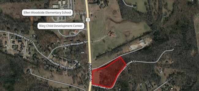
9185 Augusta Rd, Pelzer, SC 29669
Property Detail
9185 Augusta Rd
Greenville-Anderson-Greer, SC
MAP 0596.06; 1
0596.03-01-023.02
GREENVILLE
Officebuilding
South Carolina
S1
001.00
B and X Area of moderate flood hazard, usually the area between the limits of the 100-year and 500-year floods.
2.90 AC
2025
Western Greenville County
2025
Greenville/Spartanburg
003203
NEARBY LISTINGS FOR SALE OR LEASE
DEMOGRAPHICS near 9185 Augusta Rd
1 mile
3 mile
5 mile
2025 Total Population
991
6,423
20,912
2030 Population
1,081
7,008
22,781
Pop Growth 2025-2030
+ 9.08%
+ 9.11%
+ 8.94%
Average Age
44
44
42
2025 Total Households
325
2,238
7,768
HH Growth 2025-2030
+ 9.85%
+ 9.61%
+ 9.28%
Median Household Inc
$81,818
$72,654
$66,138
Avg Household Size
2.60
2.50
2.50
2025 Avg HH Vehicles
2.00
2.00
2.00
Median Home Value
$343,478
$331,228
$232,595
Median Year Built
1994
1989
1989
Nearby Places
Map Layers
Map Styles
 Street
 Aerial
Transit
 Traffic
 Biking
Places
Listings with unknown addresses are not visible on the map
- Restaurants
- Banks
- Shops
- Fitness
- Groceries
PUBLIC TRANSPORTATION
AIRPORT
Greenville Spartanburg International
Drive
Walk
Distance
Greenville Spartanburg International
35 min
25.5 mi
Freight Ports
North Charleston Terminal
Drive
Walk
Distance
North Charleston Terminal
225 min
197.4 mi
SALE & LEASE HISTORY
LISTING DATE
SALE/LEASE

Mar 14, 2024
For Sale
Jan 16, 2019
For Sale
Feb 19, 2019
For Lease
Nearby Properties
Address
Land Use
TOTAL SIZE
Lot Size
Zoning
Address
Land Use
TOTAL SIZE
Lot Size
Zoning
18.53 AC
UNZONED
Address
Land Use
TOTAL SIZE
Lot Size
Zoning
1,078 SF
19.29 AC
RR1
Address
Land Use
TOTAL SIZE
Lot Size
Zoning
1,032 SF
11.82 AC
UNZONED
Address
Land Use
TOTAL SIZE
Lot Size
Zoning
2,243 SF
9.40 AC
RR1
Address
Land Use
TOTAL SIZE
Lot Size
Zoning
17.80 AC
RR3
Address
Land Use
TOTAL SIZE
Lot Size
Zoning
2,730 SF
2.93 AC
UNZONED
Address
Land Use
TOTAL SIZE
Lot Size
Zoning
13.84 AC
UNZONED
Address
Land Use
TOTAL SIZE
Lot Size
Zoning
10.80 AC
UNZONED
Address
Land Use
TOTAL SIZE
Lot Size
Zoning
14 AC
RR1
Address
Land Use
TOTAL SIZE
Lot Size
Zoning
10.30 AC
UNZONED
Address
Land Use
TOTAL SIZE
Lot Size
Zoning
9.50 AC
UNZONED
Address
Land Use
TOTAL SIZE
Lot Size
Zoning
9.40 AC
RR1
Address
Land Use
TOTAL SIZE
Lot Size
Zoning
9.77 AC
UNZONED
Address
Land Use
TOTAL SIZE
Lot Size
Zoning
8.48 AC
UNZONED
Address
Land Use
TOTAL SIZE
Lot Size
Zoning
1,560 SF
7.94 AC
UNZONED
Address
Land Use
TOTAL SIZE
Lot Size
Zoning
2.60 AC
UNZONED
Address
Land Use
TOTAL SIZE
Lot Size
Zoning
1,302 SF
35.66 AC
RR3
Address
Land Use
TOTAL SIZE
Lot Size
Zoning
5.47 AC
RR3
Address
Land Use
TOTAL SIZE
Lot Size
Zoning
2.99 AC
C3
Address
Land Use
TOTAL SIZE
Lot Size
Zoning
6.44 AC
UNZONED
Address
Land Use
TOTAL SIZE
Lot Size
Zoning
6.20 AC
UNZONED
Address
Land Use
TOTAL SIZE
Lot Size
Zoning
2.26 AC
Address
Land Use
TOTAL SIZE
Lot Size
Zoning
6 AC
UNZONED
Address
Land Use
TOTAL SIZE
Lot Size
Zoning
1.70 AC
R20
Address
Land Use
TOTAL SIZE
Lot Size
Zoning
5.30 AC
UNZONED
Address
Land Use
TOTAL SIZE
Lot Size
Zoning
7 AC
UNZONED
Address
Land Use
TOTAL SIZE
Lot Size
Zoning
5.10 AC
UNZONED
Address
Land Use
TOTAL SIZE
Lot Size
Zoning
1.24 AC
C3
Address
Land Use
TOTAL SIZE
Lot Size
Zoning
1.71 AC
RR1
Address
Land Use
TOTAL SIZE
Lot Size
Zoning
2.60 AC
RR1
The World's #1 Commercial Real Estate Marketplace
Connect with us
© 2026 CoStar Group
The information above has been obtained from sources believed reliable. While we do not doubt its accuracy we have not verified it and make no guarantee, warranty or representation about it. It is your responsibility to independently confirm its accuracy and completeness. Any projections, opinions, assumptions, or estimates used are for example only and do not represent the current or future performance of the property. The value of this transaction to you depends on tax and other factors which should be evaluated by your tax, financial, and legal advisors. You and your advisors should conduct a careful, independent investigation of the property to determine to your satisfaction the suitability of the property for your needs.