Property Record
919 Debuel Rd, Lutz, FL 33549


NEARBY LISTINGS FOR SALE OR LEASE
-
-
View all Lutz listings for sale on LoopNet.com
Property Detail
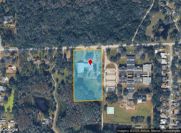
919 Debuel Rd
Tampa-St. Petersburg-Clearwater, FL
Unplatted
U-19-27-19-ZZZ-000001-19360.0
TRACT BEG 86.84 FT S & 10.01 FT W OF NE COR OF W 5/8 OF NW 1/4 OF NW 1/4 RUN S 594 FT W 330 FT N 594 FT E 330 FT TO BEG
Religious
Hillsborough
AE
Florida
12101C0415F
19360
2024
4.48 AC
2024
Northeast Tampa
011007
Tampa/St Petersburg
13,740 SF
DEMOGRAPHICS near 919 Debuel Rd
1 Mile
3 Mile
5 Mile
2024 Total Population
3,991
31,517
175,768
2029 Population
4,331
34,706
194,356
Pop Growth 2024-2029
+ 8.52%
+ 10.12%
+ 10.58%
Average Age
43
42
38
2024 Total Households
1,501
11,768
70,167
HH Growth 2024-2029
+ 8.79%
+ 10.39%
+ 10.71%
Median Household Inc
$84,166
$89,297
$63,747
Avg Household Size
2.60
2.50
2.40
2024 Avg HH Vehicles
2.00
2.00
2.00
Median Home Value
$309,672
$407,936
$358,904
Median Year Built
1979
1987
1989
Nearby Places
Map Layers
Map Styles
 Street
 Aerial
- Restaurants
- Banks
- Shops
- Fitness
- Groceries
PUBLIC TRANSPORTATION
AIRPORT
Tampa International
DRIVE
WALK
Distance
Tampa International
33 min
21.3 mi
St Pete-Clearwater International
DRIVE
WALK
Distance
St Pete-Clearwater International
44 min
29.8 mi
Freight Ports
Port of Tampa Bay
DRIVE
WALK
Distance
Port of Tampa Bay
30 min
16.9 mi
Nearby Properties
Address
Land Use
TOTAL SIZE
Lot Size
Zoning
Address
Land Use
TOTAL SIZE
Lot Size
Zoning
444,470 SF
147.09 AC
AR
Address
Land Use
TOTAL SIZE
Lot Size
Zoning
456,074 SF
41.06 AC
RMC-12
Address
Land Use
TOTAL SIZE
Lot Size
Zoning
326,968 SF
24.02 AC
RMC-16
Address
Land Use
TOTAL SIZE
Lot Size
Zoning
206,674 SF
38.31 AC
RSC-2
Address
Land Use
TOTAL SIZE
Lot Size
Zoning
126,672 SF
16.33 AC
RMC-12
Address
Land Use
TOTAL SIZE
Lot Size
Zoning
2,850 SF
68.38 AC
PD
Address
Land Use
TOTAL SIZE
Lot Size
Zoning
45,032 SF
35.30 AC
PD
Address
Land Use
TOTAL SIZE
Lot Size
Zoning
192,120 SF
21.04 AC
PD
Address
Land Use
TOTAL SIZE
Lot Size
Zoning
156,891 SF
19.68 AC
CI
Address
Land Use
TOTAL SIZE
Lot Size
Zoning
62,050 SF
11.17 AC
PD
Address
Land Use
TOTAL SIZE
Lot Size
Zoning
99,007 SF
18.46 AC
PD
Address
Land Use
TOTAL SIZE
Lot Size
Zoning
74,366 SF
22.46 AC
PD
Address
Land Use
TOTAL SIZE
Lot Size
Zoning
80,719 SF
8.14 AC
PD
Address
Land Use
TOTAL SIZE
Lot Size
Zoning
133,367 SF
11.98 AC
CG
Address
Land Use
TOTAL SIZE
Lot Size
Zoning
104,406 SF
16.81 AC
PD
Address
Land Use
TOTAL SIZE
Lot Size
Zoning
65,365 SF
8.68 AC
PD
Address
Land Use
TOTAL SIZE
Lot Size
Zoning
75,630 SF
8.17 AC
PD
Address
Land Use
TOTAL SIZE
Lot Size
Zoning
70,716 SF
7.73 AC
CG
Address
Land Use
TOTAL SIZE
Lot Size
Zoning
85,626 SF
14.47 AC
PD
Address
Land Use
TOTAL SIZE
Lot Size
Zoning
41,224 SF
26.17 AC
ASC-1
Address
Land Use
TOTAL SIZE
Lot Size
Zoning
24,133 SF
9.12 AC
PD
Address
Land Use
TOTAL SIZE
Lot Size
Zoning
34,020 SF
76.51 AC
PD
Address
Land Use
TOTAL SIZE
Lot Size
Zoning
119,492 SF
19.22 AC
ASC-1
Address
Land Use
TOTAL SIZE
Lot Size
Zoning
95,769 SF
12.96 AC
RSC-6
Address
Land Use
TOTAL SIZE
Lot Size
Zoning
85,065 SF
5.26 AC
PD
Address
Land Use
TOTAL SIZE
Lot Size
Zoning
73,783 SF
11.59 AC
CN
Address
Land Use
TOTAL SIZE
Lot Size
Zoning
56,232 SF
192.93 AC
PD
Address
Land Use
TOTAL SIZE
Lot Size
Zoning
72,832 SF
5 AC
PD
Address
Land Use
TOTAL SIZE
Lot Size
Zoning
30,058 SF
14.18 AC
PD
Address
Land Use
TOTAL SIZE
Lot Size
Zoning
83,870 SF
7.95 AC
M
The World's #1 Commercial Real Estate Marketplace
Connect with us
© 2026 CoStar Group
The information above has been obtained from sources believed reliable. While we do not doubt its accuracy we have not verified it and make no guarantee, warranty or representation about it. It is your responsibility to independently confirm its accuracy and completeness. Any projections, opinions, assumptions, or estimates used are for example only and do not represent the current or future performance of the property. The value of this transaction to you depends on tax and other factors which should be evaluated by your tax, financial, and legal advisors. You and your advisors should conduct a careful, independent investigation of the property to determine to your satisfaction the suitability of the property for your needs.