Property Record
900 E 19Th St, Kansas City, MO 64108

Current Lease Availabilities
NEARBY LISTINGS FOR SALE OR LEASE
Property Detail
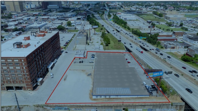
900 E 19Th St
Kansas City, MO-KS
Wirthmans Partition
29-510-18-04-00-0-00-000
WIRTHMANS PARTITION---LOTS A-L BLK 9 & E 135 OF LOTS 1-7 & ALL LOT 8 VINEYARDS ADD & VAC ALLEYS (EX PT IN ST)
Wholesaleoutletdiscountstore
Jackson
X
Missouri
29095C0254G
8
2024
2.76 AC
2025
Downtown KC
015800
Kansas City
54,878 SF
DEMOGRAPHICS near 900 E 19Th St
1 Mile
3 Mile
5 Mile
2024 Total Population
14,698
116,420
243,684
2029 Population
15,117
119,356
247,366
Pop Growth 2024-2029
+ 2.85%
+ 2.52%
+ 1.51%
Average Age
37
36
37
2024 Total Households
7,336
53,927
106,481
HH Growth 2024-2029
+ 3.27%
+ 2.56%
+ 1.66%
Median Household Inc
$71,502
$50,306
$49,856
Avg Household Size
1.70
2.00
2.10
2024 Avg HH Vehicles
1.00
1.00
1.00
Median Home Value
$290,388
$166,350
$160,906
Median Year Built
1973
1952
1952
Nearby Places
Map Layers
Map Styles
 Street
 Aerial
- Restaurants
- Banks
- Shops
- Fitness
- Groceries
PUBLIC TRANSPORTATION
COMMUTER RAIL
DRIVE
WALK
Distance
4 min
20 min
1.0 mi
DRIVE
WALK
Distance
17 min
8.7 mi
AIRPORT
Kansas City International
DRIVE
WALK
Distance
Kansas City International
30 min
21.4 mi
Nearby Properties
Address
Land Use
TOTAL SIZE
Lot Size
Zoning
Address
Land Use
TOTAL SIZE
Lot Size
Zoning
91,485 SF
10.11 AC
Address
Land Use
TOTAL SIZE
Lot Size
Zoning
172,810 SF
Address
Land Use
TOTAL SIZE
Lot Size
Zoning
568,235 SF
9.59 AC
Address
Land Use
TOTAL SIZE
Lot Size
Zoning
488,351 SF
8.34 AC
Address
Land Use
TOTAL SIZE
Lot Size
Zoning
1,825,083 SF
25.77 AC
Address
Land Use
TOTAL SIZE
Lot Size
Zoning
63,748 SF
3.92 AC
Address
Land Use
TOTAL SIZE
Lot Size
Zoning
404,524 SF
5.51 AC
Address
Land Use
TOTAL SIZE
Lot Size
Zoning
711,196 SF
15.58 AC
Address
Land Use
TOTAL SIZE
Lot Size
Zoning
277,042 SF
0.40 AC
Address
Land Use
TOTAL SIZE
Lot Size
Zoning
257,647 SF
3.63 AC
Address
Land Use
TOTAL SIZE
Lot Size
Zoning
44,491 SF
1.96 AC
C3A2
Address
Land Use
TOTAL SIZE
Lot Size
Zoning
81,578 SF
1.63 AC
Address
Land Use
TOTAL SIZE
Lot Size
Zoning
124,492 SF
4.24 AC
Address
Land Use
TOTAL SIZE
Lot Size
Zoning
115,627 SF
1.56 AC
Address
Land Use
TOTAL SIZE
Lot Size
Zoning
261,570 SF
1.82 AC
Address
Land Use
TOTAL SIZE
Lot Size
Zoning
157,488 SF
1.60 AC
Address
Land Use
TOTAL SIZE
Lot Size
Zoning
87,294 SF
0.70 AC
Address
Land Use
TOTAL SIZE
Lot Size
Zoning
803,812 SF
5.85 AC
Address
Land Use
TOTAL SIZE
Lot Size
Zoning
384,543 SF
5.40 AC
Address
Land Use
TOTAL SIZE
Lot Size
Zoning
614,978 SF
31.56 AC
Address
Land Use
TOTAL SIZE
Lot Size
Zoning
274,622 SF
1.35 AC
Address
Land Use
TOTAL SIZE
Lot Size
Zoning
342,989 SF
1.84 AC
Address
Land Use
TOTAL SIZE
Lot Size
Zoning
238,003 SF
1.74 AC
Address
Land Use
TOTAL SIZE
Lot Size
Zoning
349,977 SF
2.21 AC
Address
Land Use
TOTAL SIZE
Lot Size
Zoning
191,753 SF
0.79 AC
M1
Address
Land Use
TOTAL SIZE
Lot Size
Zoning
27,292 SF
10.75 AC
Address
Land Use
TOTAL SIZE
Lot Size
Zoning
250,410 SF
3.74 AC
Address
Land Use
TOTAL SIZE
Lot Size
Zoning
131,115 SF
2.80 AC
Address
Land Use
TOTAL SIZE
Lot Size
Zoning
50,504 SF
0.39 AC
Address
Land Use
TOTAL SIZE
Lot Size
Zoning
90,023 SF
1.18 AC
The World's #1 Commercial Real Estate Marketplace
Connect with us
© 2026 CoStar Group
The information above has been obtained from sources believed reliable. While we do not doubt its accuracy we have not verified it and make no guarantee, warranty or representation about it. It is your responsibility to independently confirm its accuracy and completeness. Any projections, opinions, assumptions, or estimates used are for example only and do not represent the current or future performance of the property. The value of this transaction to you depends on tax and other factors which should be evaluated by your tax, financial, and legal advisors. You and your advisors should conduct a careful, independent investigation of the property to determine to your satisfaction the suitability of the property for your needs.