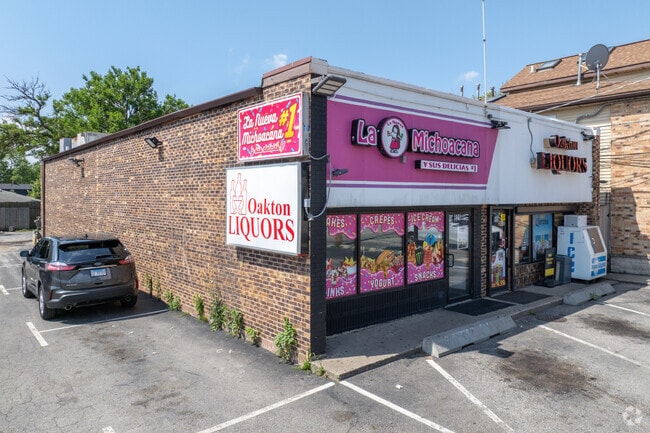
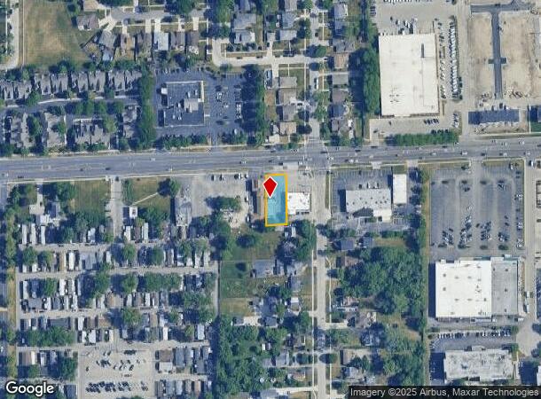
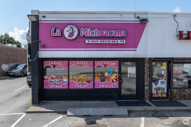
Property Record
919 E Oakton St, Des Plaines, IL 60018
NEARBY LISTINGS FOR SALE OR LEASE
Property Detail
919 E Oakton St
Chicago-Naperville-Elgin, IL-IN-WI
Oakton Gardens
09-29-100-080-0000
(OAKTON)(GARDENS) SUB EH WH NW SEC 29-41-12
Commercialbuilding
Cook
X
Illinois
17031C0219J
4,5
2023
0.25 AC
2024
O'Hare
770602
Chicago
3,000 SF
DEMOGRAPHICS near 919 E Oakton St
1 Mile
3 Mile
5 Mile
2024 Total Population
13,933
104,526
297,977
2029 Population
13,547
101,380
289,261
Pop Growth 2024-2029
(2.77%)
(3.01%)
(2.93%)
Average Age
42
42
42
2024 Total Households
4,715
39,806
113,564
HH Growth 2024-2029
(3.10%)
(3.27%)
(3.23%)
Median Household Inc
$79,494
$77,637
$83,630
Avg Household Size
2.80
2.50
2.50
2024 Avg HH Vehicles
2.00
2.00
2.00
Median Home Value
$281,584
$302,691
$339,682
Median Year Built
1958
1968
1966
Nearby Places
Map Layers
Map Styles
 Street
 Aerial
- Restaurants
- Banks
- Shops
- Fitness
- Groceries
PUBLIC TRANSPORTATION
COMMUTER RAIL
Des Plaines Station (Union Pacific Northwest Line - Northeast Illinois Regional Commuter Railroad (Metra))
DRIVE
WALK
Distance
Des Plaines Station (Union Pacific Northwest Line - Northeast Illinois Regional Commuter Railroad (Metra))
5 min
1.7 mi
Cumberland Station (Union Pacific Northwest Line - Northeast Illinois Regional Commuter Railroad (Metra))
DRIVE
WALK
Distance
Cumberland Station (Union Pacific Northwest Line - Northeast Illinois Regional Commuter Railroad (Metra))
7 min
2.7 mi
AIRPORT
Chicago O'Hare International
DRIVE
WALK
Distance
Chicago O'Hare International
12 min
5.2 mi
Chicago Midway International
DRIVE
WALK
Distance
Chicago Midway International
41 min
28.9 mi
Freight Ports
Port of Baltimore
DRIVE
WALK
Distance
Port of Baltimore
1 min
622.1 mi
Nearby Properties
Address
Land Use
TOTAL SIZE
Lot Size
Zoning
Address
Land Use
TOTAL SIZE
Lot Size
Zoning
1,127,595 SF
Address
Land Use
TOTAL SIZE
Lot Size
Zoning
380,895 SF
5.36 AC
Address
Land Use
TOTAL SIZE
Lot Size
Zoning
Address
Land Use
TOTAL SIZE
Lot Size
Zoning
132,699 SF
6.74 AC
Address
Land Use
TOTAL SIZE
Lot Size
Zoning
413,338 SF
23.92 AC
Address
Land Use
TOTAL SIZE
Lot Size
Zoning
Address
Land Use
TOTAL SIZE
Lot Size
Zoning
533,629 SF
24.19 AC
Address
Land Use
TOTAL SIZE
Lot Size
Zoning
508,246 SF
32.81 AC
Address
Land Use
TOTAL SIZE
Lot Size
Zoning
1.23 AC
Address
Land Use
TOTAL SIZE
Lot Size
Zoning
270,512 SF
2.26 AC
Address
Land Use
TOTAL SIZE
Lot Size
Zoning
160,000 SF
2.14 AC
Address
Land Use
TOTAL SIZE
Lot Size
Zoning
378,525 SF
0.11 AC
Address
Land Use
TOTAL SIZE
Lot Size
Zoning
667,821 SF
20.55 AC
Address
Land Use
TOTAL SIZE
Lot Size
Zoning
279,103 SF
7.09 AC
Address
Land Use
TOTAL SIZE
Lot Size
Zoning
207,560 SF
4.42 AC
Address
Land Use
TOTAL SIZE
Lot Size
Zoning
6.28 AC
Address
Land Use
TOTAL SIZE
Lot Size
Zoning
282,366 SF
2.48 AC
Address
Land Use
TOTAL SIZE
Lot Size
Zoning
132,574 SF
5.91 AC
Address
Land Use
TOTAL SIZE
Lot Size
Zoning
489,538 SF
5.94 AC
Address
Land Use
TOTAL SIZE
Lot Size
Zoning
59,013 SF
1.90 AC
Address
Land Use
TOTAL SIZE
Lot Size
Zoning
Address
Land Use
TOTAL SIZE
Lot Size
Zoning
134,170 SF
2.15 AC
Address
Land Use
TOTAL SIZE
Lot Size
Zoning
214,200 SF
16.97 AC
Address
Land Use
TOTAL SIZE
Lot Size
Zoning
405,484 SF
Address
Land Use
TOTAL SIZE
Lot Size
Zoning
179,178 SF
2.16 AC
Address
Land Use
TOTAL SIZE
Lot Size
Zoning
291,226 SF
3.57 AC
Address
Land Use
TOTAL SIZE
Lot Size
Zoning
131,687 SF
2.89 AC
Address
Land Use
TOTAL SIZE
Lot Size
Zoning
85,014 SF
2.38 AC
Address
Land Use
TOTAL SIZE
Lot Size
Zoning
154,560 SF
3.87 AC
Address
Land Use
TOTAL SIZE
Lot Size
Zoning
23.45 AC
The World's #1 Commercial Real Estate Marketplace
Connect with us
© 2025 CoStar Group
The information above has been obtained from sources believed reliable. While we do not doubt its accuracy we have not verified it and make no guarantee, warranty or representation about it. It is your responsibility to independently confirm its accuracy and completeness. Any projections, opinions, assumptions, or estimates used are for example only and do not represent the current or future performance of the property. The value of this transaction to you depends on tax and other factors which should be evaluated by your tax, financial, and legal advisors. You and your advisors should conduct a careful, independent investigation of the property to determine to your satisfaction the suitability of the property for your needs.