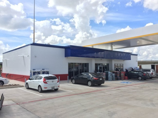
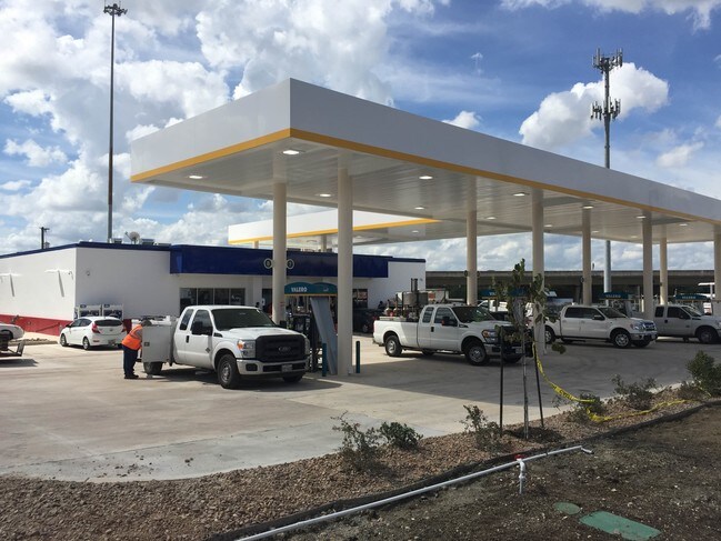
Property Record
919 Fredericksburg Rd, San Antonio, TX 78201

NEARBY LISTINGS FOR SALE OR LEASE
Property Detail
919 Fredericksburg Rd
San Antonio-New Braunfels, TX
Ncb 1968 (Bailey Cat)
01968-002-0150
NCB 1968 (BAILEY CAT), BLOCK 2 LOT 15 2017-NEW ACCT CREATED PER PLAT 9704/30-33 FILED 7-22-16. LR/GIS/8-26-16.
Servicestation
Bexar
X
Texas
48029C0384H
15
2024
1.89 AC
2025
North Central
190100
San Antonio
44,700 SF
DEMOGRAPHICS near 919 Fredericksburg Rd
1 Mile
3 Mile
5 Mile
2024 Total Population
16,330
148,186
382,981
2029 Population
17,304
157,790
408,104
Pop Growth 2024-2029
+ 5.96%
+ 6.48%
+ 6.56%
Average Age
41
39
38
2024 Total Households
6,662
56,790
143,914
HH Growth 2024-2029
+ 6.11%
+ 7.07%
+ 6.96%
Median Household Inc
$44,499
$42,341
$43,707
Avg Household Size
2.40
2.40
2.50
2024 Avg HH Vehicles
2.00
2.00
2.00
Median Home Value
$181,610
$160,655
$164,480
Median Year Built
1946
1955
1960
Nearby Places
Map Layers
Map Styles
 Street
 Aerial
- Restaurants
- Banks
- Shops
- Fitness
- Groceries
PUBLIC TRANSPORTATION
COMMUTER RAIL
San Antonio Amtrak Station (Sunset Limited - Amtrak, Texas Eagle - Amtrak)
DRIVE
WALK
Distance
San Antonio Amtrak Station (Sunset Limited - Amtrak, Texas Eagle - Amtrak)
7 min
3.7 mi
AIRPORT
San Antonio International
DRIVE
WALK
Distance
San Antonio International
12 min
7.6 mi
Freight Ports
Calhoun Port
DRIVE
WALK
Distance
Calhoun Port
184 min
151.0 mi
SALE & LEASE HISTORY
LISTING DATE
SALE/LEASE

Sep 28, 2016
For Sale
Sep 24, 2016
For Sale
Mar 30, 2017
For Sale
Nearby Properties
Address
Land Use
TOTAL SIZE
Lot Size
Zoning
Address
Land Use
TOTAL SIZE
Lot Size
Zoning
26.51 AC
Address
Land Use
TOTAL SIZE
Lot Size
Zoning
443,000 SF
4.16 AC
Address
Land Use
TOTAL SIZE
Lot Size
Zoning
738,650 SF
2.93 AC
Address
Land Use
TOTAL SIZE
Lot Size
Zoning
1,049,861 SF
1.50 AC
Address
Land Use
TOTAL SIZE
Lot Size
Zoning
339,590 SF
3.12 AC
Address
Land Use
TOTAL SIZE
Lot Size
Zoning
922,468 SF
10.78 AC
Address
Land Use
TOTAL SIZE
Lot Size
Zoning
443,560 SF
2.77 AC
Address
Land Use
TOTAL SIZE
Lot Size
Zoning
400,228 SF
0.78 AC
Address
Land Use
TOTAL SIZE
Lot Size
Zoning
290,794 SF
0.62 AC
Address
Land Use
TOTAL SIZE
Lot Size
Zoning
8.10 AC
Address
Land Use
TOTAL SIZE
Lot Size
Zoning
5,106 SF
2.30 AC
Address
Land Use
TOTAL SIZE
Lot Size
Zoning
387,443 SF
0.89 AC
Address
Land Use
TOTAL SIZE
Lot Size
Zoning
43,834 SF
3.11 AC
Address
Land Use
TOTAL SIZE
Lot Size
Zoning
178,534 SF
1.32 AC
Address
Land Use
TOTAL SIZE
Lot Size
Zoning
254,108 SF
2.40 AC
Address
Land Use
TOTAL SIZE
Lot Size
Zoning
103,425 SF
4.76 AC
Address
Land Use
TOTAL SIZE
Lot Size
Zoning
521,935 SF
2.17 AC
Address
Land Use
TOTAL SIZE
Lot Size
Zoning
495,840 SF
1.20 AC
Address
Land Use
TOTAL SIZE
Lot Size
Zoning
308,878 SF
1.23 AC
Address
Land Use
TOTAL SIZE
Lot Size
Zoning
11,915 SF
4.06 AC
Address
Land Use
TOTAL SIZE
Lot Size
Zoning
254,908 SF
1.92 AC
Address
Land Use
TOTAL SIZE
Lot Size
Zoning
173,422 SF
5.85 AC
Address
Land Use
TOTAL SIZE
Lot Size
Zoning
15,468 SF
4.18 AC
Address
Land Use
TOTAL SIZE
Lot Size
Zoning
221,865 SF
3.12 AC
Address
Land Use
TOTAL SIZE
Lot Size
Zoning
262,082 SF
1.60 AC
Address
Land Use
TOTAL SIZE
Lot Size
Zoning
7,018 SF
3.24 AC
Address
Land Use
TOTAL SIZE
Lot Size
Zoning
163,858 SF
0.62 AC
Address
Land Use
TOTAL SIZE
Lot Size
Zoning
481,589 SF
5.29 AC
Address
Land Use
TOTAL SIZE
Lot Size
Zoning
31,334 SF
14.11 AC
Address
Land Use
TOTAL SIZE
Lot Size
Zoning
399,007 SF
22.03 AC
The World's #1 Commercial Real Estate Marketplace
Connect with us
© 2025 CoStar Group
The information above has been obtained from sources believed reliable. While we do not doubt its accuracy we have not verified it and make no guarantee, warranty or representation about it. It is your responsibility to independently confirm its accuracy and completeness. Any projections, opinions, assumptions, or estimates used are for example only and do not represent the current or future performance of the property. The value of this transaction to you depends on tax and other factors which should be evaluated by your tax, financial, and legal advisors. You and your advisors should conduct a careful, independent investigation of the property to determine to your satisfaction the suitability of the property for your needs.