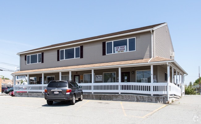
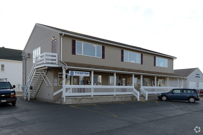
Property Record
92 Main Rd, Tiverton, RI 02878
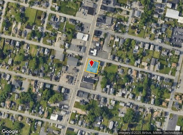
NEARBY LISTINGS FOR SALE OR LEASE
Property Detail
92 Main Rd
Commercialbuilding
Newport
X
Rhode Island
25005C0341G
0.32 AC
2025
Newport County
2025
Providence
041601
Providence-Warwick, RI-MA
4,148 SF
TIVE-000102-000000-000179
DEMOGRAPHICS near 92 Main Rd
1 Mile
3 Mile
5 Mile
2024 Total Population
9,893
64,633
141,595
2029 Population
9,639
64,006
140,329
Pop Growth 2024-2029
(2.57%)
(0.97%)
(0.89%)
Average Age
42
40
42
2024 Total Households
4,343
28,318
60,346
HH Growth 2024-2029
(2.67%)
(1.00%)
(0.93%)
Median Household Inc
$51,250
$47,386
$59,791
Avg Household Size
2.20
2.20
2.20
2024 Avg HH Vehicles
2.00
1.00
2.00
Median Home Value
$335,148
$347,596
$360,932
Median Year Built
1950
1948
1950
Nearby Places
Map Layers
Map Styles
 Street
 Aerial
- Restaurants
- Banks
- Shops
- Fitness
- Groceries
PUBLIC TRANSPORTATION
AIRPORT
Rhode Island Tf Green International
DRIVE
WALK
Distance
Rhode Island Tf Green International
40 min
26.3 mi
Freight Ports
Port of Davisville, RI
DRIVE
WALK
Distance
Port of Davisville, RI
56 min
38.6 mi
Nearby Properties
Address
Land Use
TOTAL SIZE
Lot Size
Zoning
Address
Land Use
TOTAL SIZE
Lot Size
Zoning
11.26 AC
IND
Address
Land Use
TOTAL SIZE
Lot Size
Zoning
27.66 AC
I
Address
Land Use
TOTAL SIZE
Lot Size
Zoning
73,957 SF
46.62 AC
CO
Address
Land Use
TOTAL SIZE
Lot Size
Zoning
183,732 SF
5.50 AC
IND
Address
Land Use
TOTAL SIZE
Lot Size
Zoning
6.16 AC
B-L
Address
Land Use
TOTAL SIZE
Lot Size
Zoning
132,666 SF
18.97 AC
IND
Address
Land Use
TOTAL SIZE
Lot Size
Zoning
16.08 AC
N/A
Address
Land Use
TOTAL SIZE
Lot Size
Zoning
107,441 SF
2.10 AC
N/A
Address
Land Use
TOTAL SIZE
Lot Size
Zoning
113,643 SF
4.95 AC
R-4
Address
Land Use
TOTAL SIZE
Lot Size
Zoning
559.70 AC
S
Address
Land Use
TOTAL SIZE
Lot Size
Zoning
116,036 SF
2.43 AC
R-4
Address
Land Use
TOTAL SIZE
Lot Size
Zoning
78,883 SF
40.99 AC
N/A
Address
Land Use
TOTAL SIZE
Lot Size
Zoning
150,156 SF
8.77 AC
R40
Address
Land Use
TOTAL SIZE
Lot Size
Zoning
126,146 SF
1.18 AC
A-2
Address
Land Use
TOTAL SIZE
Lot Size
Zoning
9.44 AC
A-2
Address
Land Use
TOTAL SIZE
Lot Size
Zoning
177,051 SF
3.13 AC
CBD
Address
Land Use
TOTAL SIZE
Lot Size
Zoning
194,181 SF
3.40 AC
Address
Land Use
TOTAL SIZE
Lot Size
Zoning
178,538 SF
17.27 AC
I
Address
Land Use
TOTAL SIZE
Lot Size
Zoning
160,234 SF
2.98 AC
CBD
Address
Land Use
TOTAL SIZE
Lot Size
Zoning
11.17 AC
MBD
Address
Land Use
TOTAL SIZE
Lot Size
Zoning
153,134 SF
14.57 AC
IND
Address
Land Use
TOTAL SIZE
Lot Size
Zoning
75,736 SF
1.39 AC
B-L
Address
Land Use
TOTAL SIZE
Lot Size
Zoning
22.36 AC
B-N
Address
Land Use
TOTAL SIZE
Lot Size
Zoning
131,086 SF
2.29 AC
CBD
Address
Land Use
TOTAL SIZE
Lot Size
Zoning
142,842 SF
2.45 AC
IND
Address
Land Use
TOTAL SIZE
Lot Size
Zoning
112,515 SF
1.83 AC
CBD
Address
Land Use
TOTAL SIZE
Lot Size
Zoning
111,722 SF
1.60 AC
IND
Address
Land Use
TOTAL SIZE
Lot Size
Zoning
99,066 SF
3.05 AC
IND
Address
Land Use
TOTAL SIZE
Lot Size
Zoning
4 AC
M
Address
Land Use
TOTAL SIZE
Lot Size
Zoning
106,293 SF
1.32 AC
CBD
The World's #1 Commercial Real Estate Marketplace
Connect with us
© 2026 CoStar Group
The information above has been obtained from sources believed reliable. While we do not doubt its accuracy we have not verified it and make no guarantee, warranty or representation about it. It is your responsibility to independently confirm its accuracy and completeness. Any projections, opinions, assumptions, or estimates used are for example only and do not represent the current or future performance of the property. The value of this transaction to you depends on tax and other factors which should be evaluated by your tax, financial, and legal advisors. You and your advisors should conduct a careful, independent investigation of the property to determine to your satisfaction the suitability of the property for your needs.