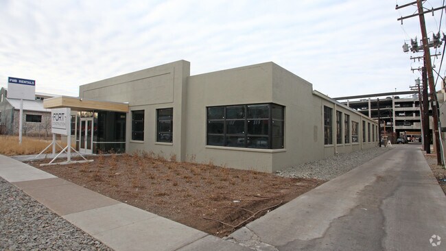
Property Record
920 Foch St, Fort Worth, TX 76107


NEARBY LISTINGS FOR SALE OR LEASE
Property Detail
920 Foch St
Dallas-Fort Worth-Arlington, TX
Van Zandt Park Addition
03252973
VAN ZANDT PARK ADDITION BLOCK 8 LOT 11 THRU 14
Commercialnec
Tarrant
X
Texas
48439C0305L
11-14
2024
0.60 AC
2025
N Central Ft Worth
102000
Dallas/Ft Worth
9,028 SF
DEMOGRAPHICS near 920 Foch St
1 Mile
3 Mile
5 Mile
2024 Total Population
11,420
102,172
286,846
2029 Population
12,265
109,826
305,405
Pop Growth 2024-2029
+ 7.40%
+ 7.49%
+ 6.47%
Average Age
39
38
36
2024 Total Households
7,316
43,592
104,793
HH Growth 2024-2029
+ 7.45%
+ 7.93%
+ 6.93%
Median Household Inc
$75,146
$65,951
$57,293
Avg Household Size
1.50
2.20
2.50
2024 Avg HH Vehicles
1.00
2.00
2.00
Median Home Value
$496,855
$347,081
$226,449
Median Year Built
2008
1980
1967
Nearby Places
Map Layers
Map Styles
 Street
 Aerial
- Restaurants
- Banks
- Shops
- Fitness
- Groceries
PUBLIC TRANSPORTATION
COMMUTER RAIL
Texas And Pacific (T&P) (Trinity Railway Express - Dallas Area Rapid Transit (DART))
DRIVE
WALK
Distance
Texas And Pacific (T&P) (Trinity Railway Express - Dallas Area Rapid Transit (DART))
6 min
2.3 mi
Fort Worth (Heartland Flyer - Amtrak, Texas Eagle - Amtrak)
DRIVE
WALK
Distance
Fort Worth (Heartland Flyer - Amtrak, Texas Eagle - Amtrak)
6 min
2.7 mi
AIRPORT
Dallas-Fort Worth International
DRIVE
WALK
Distance
Dallas-Fort Worth International
37 min
26.6 mi
Freight Ports
Port of Shreveport
DRIVE
WALK
Distance
Port of Shreveport
253 min
230.1 mi
Nearby Properties
Address
Land Use
TOTAL SIZE
Lot Size
Zoning
Address
Land Use
TOTAL SIZE
Lot Size
Zoning
802,865 SF
17.38 AC
Address
Land Use
TOTAL SIZE
Lot Size
Zoning
1,135,360 SF
7.30 AC
Address
Land Use
TOTAL SIZE
Lot Size
Zoning
2,168,050 SF
16.28 AC
Address
Land Use
TOTAL SIZE
Lot Size
Zoning
1,545,212 SF
8.90 AC
Address
Land Use
TOTAL SIZE
Lot Size
Zoning
133,700 SF
6.29 AC
Address
Land Use
TOTAL SIZE
Lot Size
Zoning
738,487 SF
2.11 AC
Address
Land Use
TOTAL SIZE
Lot Size
Zoning
1,009,233 SF
0.92 AC
Address
Land Use
TOTAL SIZE
Lot Size
Zoning
616,686 SF
2.82 AC
Address
Land Use
TOTAL SIZE
Lot Size
Zoning
773,033 SF
2.11 AC
Address
Land Use
TOTAL SIZE
Lot Size
Zoning
1,281,000 SF
1.15 AC
Address
Land Use
TOTAL SIZE
Lot Size
Zoning
551,198 SF
3.12 AC
Address
Land Use
TOTAL SIZE
Lot Size
Zoning
508,378 SF
6.02 AC
Address
Land Use
TOTAL SIZE
Lot Size
Zoning
650,744 SF
15.68 AC
Address
Land Use
TOTAL SIZE
Lot Size
Zoning
884,928 SF
1.01 AC
Address
Land Use
TOTAL SIZE
Lot Size
Zoning
205,807 SF
3.19 AC
Address
Land Use
TOTAL SIZE
Lot Size
Zoning
928,562 SF
17.47 AC
Address
Land Use
TOTAL SIZE
Lot Size
Zoning
1,024,627 SF
0.83 AC
Address
Land Use
TOTAL SIZE
Lot Size
Zoning
764,691 SF
0.92 AC
Address
Land Use
TOTAL SIZE
Lot Size
Zoning
914,300 SF
3.46 AC
Address
Land Use
TOTAL SIZE
Lot Size
Zoning
774,327 SF
11.86 AC
Address
Land Use
TOTAL SIZE
Lot Size
Zoning
1,719,136 SF
18.18 AC
Address
Land Use
TOTAL SIZE
Lot Size
Zoning
1,259,660 SF
52.13 AC
Address
Land Use
TOTAL SIZE
Lot Size
Zoning
482,938 SF
22.22 AC
Address
Land Use
TOTAL SIZE
Lot Size
Zoning
407,056 SF
17.20 AC
Address
Land Use
TOTAL SIZE
Lot Size
Zoning
509,560 SF
3.06 AC
Address
Land Use
TOTAL SIZE
Lot Size
Zoning
433,672 SF
6.37 AC
Address
Land Use
TOTAL SIZE
Lot Size
Zoning
1,054,538 SF
6.23 AC
Address
Land Use
TOTAL SIZE
Lot Size
Zoning
537,395 SF
2.82 AC
Address
Land Use
TOTAL SIZE
Lot Size
Zoning
788,621 SF
6.39 AC
Address
Land Use
TOTAL SIZE
Lot Size
Zoning
498,381 SF
5.26 AC
The World's #1 Commercial Real Estate Marketplace
Connect with us
© 2026 CoStar Group
The information above has been obtained from sources believed reliable. While we do not doubt its accuracy we have not verified it and make no guarantee, warranty or representation about it. It is your responsibility to independently confirm its accuracy and completeness. Any projections, opinions, assumptions, or estimates used are for example only and do not represent the current or future performance of the property. The value of this transaction to you depends on tax and other factors which should be evaluated by your tax, financial, and legal advisors. You and your advisors should conduct a careful, independent investigation of the property to determine to your satisfaction the suitability of the property for your needs.