Property Record
920 N 7Th Ave, Greeley, CO 80631


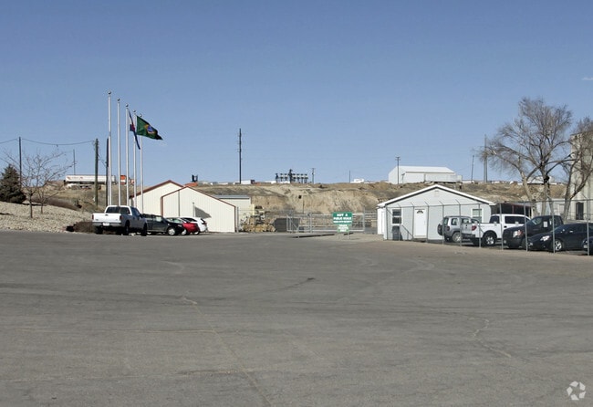

Property Detail
920 N 7Th Ave
Greeley, CO
GR 13862 PT 32-6-65 ALL L4 SE4NW4 & PT L1 NE4SW4 LYING W OF C/L FREE CHURCH LATERAL & PT L4 NE4SW4 LYING W OF C/L FREE CHURCH LATERAL & N OF 6TH AVE EXC RR R/W (MONFORT LAMB PLANT ANNX)
R0029690
Weld
Industrialgeneral
Colorado
AE The base floodplain where base flood elevations are provided. AE Zones are now used on new format FIRMs instead of A1-A30 Zones.
4,1
2024
17.36 AC
2025
Weld County
000701
Denver
80,893 SF
NEARBY LISTINGS FOR SALE OR LEASE
DEMOGRAPHICS near 920 N 7Th Ave
1 mile
3 mile
5 mile
2025 Total Population
1,774
52,394
115,773
2030 Population
1,908
58,310
127,462
Pop Growth 2025-2030
+ 7.55%
+ 11.29%
+ 10.10%
Average Age
38
35
36
2025 Total Households
363
18,433
41,375
HH Growth 2025-2030
+ 10.19%
+ 12.29%
+ 10.80%
Median Household Inc
$45,875
$50,835
$61,884
Avg Household Size
2.70
2.60
2.60
2025 Avg HH Vehicles
2.00
2.00
2.00
Median Home Value
$317,857
$326,585
$365,838
Median Year Built
1975
1975
1982
Nearby Places
Map Layers
Map Styles
 Street
 Aerial
Transit
 Traffic
 Biking
Places
Listings with unknown addresses are not visible on the map
- Restaurants
- Banks
- Shops
- Fitness
- Groceries
Nearby Properties
Address
Land Use
TOTAL SIZE
Lot Size
Zoning
Address
Land Use
TOTAL SIZE
Lot Size
Zoning
1,181,203 SF
23.26 AC
Address
Land Use
TOTAL SIZE
Lot Size
Zoning
689,580 SF
65.15 AC
Address
Land Use
TOTAL SIZE
Lot Size
Zoning
393,166 SF
4.53 AC
Address
Land Use
TOTAL SIZE
Lot Size
Zoning
536,281 SF
33.91 AC
Address
Land Use
TOTAL SIZE
Lot Size
Zoning
237,575 SF
10.77 AC
Address
Land Use
TOTAL SIZE
Lot Size
Zoning
113,715 SF
9.42 AC
Address
Land Use
TOTAL SIZE
Lot Size
Zoning
83,032 SF
9.23 AC
Address
Land Use
TOTAL SIZE
Lot Size
Zoning
99,348 SF
5.85 AC
Address
Land Use
TOTAL SIZE
Lot Size
Zoning
34,697 SF
55.28 AC
Address
Land Use
TOTAL SIZE
Lot Size
Zoning
700,277 SF
16.35 AC
Address
Land Use
TOTAL SIZE
Lot Size
Zoning
79,313 SF
23.46 AC
Address
Land Use
TOTAL SIZE
Lot Size
Zoning
63,960 SF
3.67 AC
Address
Land Use
TOTAL SIZE
Lot Size
Zoning
239,925 SF
6.06 AC
Address
Land Use
TOTAL SIZE
Lot Size
Zoning
127,822 SF
1.38 AC
Address
Land Use
TOTAL SIZE
Lot Size
Zoning
132,968 SF
1.24 AC
Address
Land Use
TOTAL SIZE
Lot Size
Zoning
82,759 SF
2.05 AC
Address
Land Use
TOTAL SIZE
Lot Size
Zoning
145,184 SF
19 AC
Address
Land Use
TOTAL SIZE
Lot Size
Zoning
198,845 SF
16.02 AC
Address
Land Use
TOTAL SIZE
Lot Size
Zoning
88,620 SF
5.11 AC
Address
Land Use
TOTAL SIZE
Lot Size
Zoning
128,054 SF
Address
Land Use
TOTAL SIZE
Lot Size
Zoning
178,873 SF
4.13 AC
Address
Land Use
TOTAL SIZE
Lot Size
Zoning
114,879 SF
27.73 AC
Address
Land Use
TOTAL SIZE
Lot Size
Zoning
52,041 SF
4.36 AC
Address
Land Use
TOTAL SIZE
Lot Size
Zoning
253,204 SF
25.82 AC
Address
Land Use
TOTAL SIZE
Lot Size
Zoning
87,504 SF
8.13 AC
Address
Land Use
TOTAL SIZE
Lot Size
Zoning
227,794 SF
1.65 AC
Address
Land Use
TOTAL SIZE
Lot Size
Zoning
30,104 SF
2.83 AC
Address
Land Use
TOTAL SIZE
Lot Size
Zoning
4,457 SF
76.48 AC
Address
Land Use
TOTAL SIZE
Lot Size
Zoning
95,845 SF
3.66 AC
Address
Land Use
TOTAL SIZE
Lot Size
Zoning
33,973 SF
4.63 AC
The World's #1 Commercial Real Estate Marketplace
Connect with us
© 2026 CoStar Group
The information above has been obtained from sources believed reliable. While we do not doubt its accuracy we have not verified it and make no guarantee, warranty or representation about it. It is your responsibility to independently confirm its accuracy and completeness. Any projections, opinions, assumptions, or estimates used are for example only and do not represent the current or future performance of the property. The value of this transaction to you depends on tax and other factors which should be evaluated by your tax, financial, and legal advisors. You and your advisors should conduct a careful, independent investigation of the property to determine to your satisfaction the suitability of the property for your needs.