Property Record
920 N State Rd, Davison, MI 48423
NEARBY LISTINGS FOR SALE OR LEASE
Property Detail
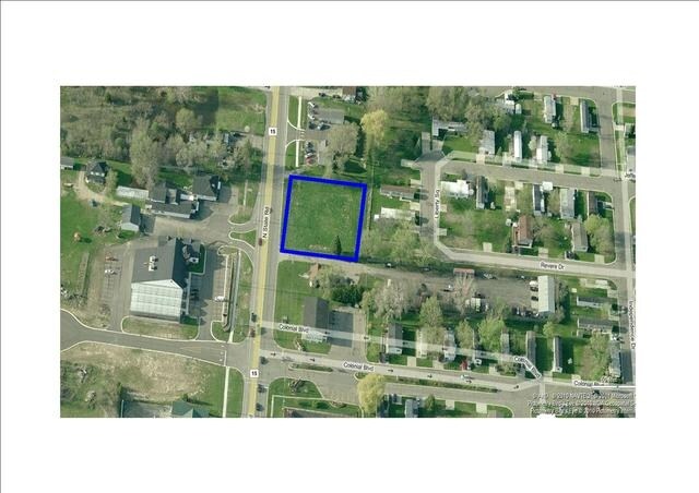
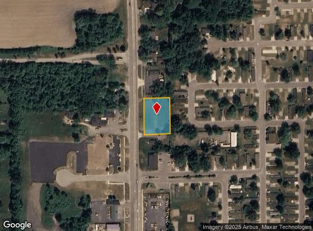
920 N State Rd
52-03-300-019
PROPERTY EXEMPT FROM AD VALOREM TAXES AND ASSESSED ON THE SPECIAL ACT ROLL PURSUANT TO PA 261 OF 2003 EXPIRING 12/30/2018. A
Commercialacreage
Genesee
X
Michigan
26049C0217D
0.61 AC
2024
Flint
2025
Detroit
011710
Flint, MI
DEMOGRAPHICS near 920 N State Rd
1 Mile
3 Mile
5 Mile
2024 Total Population
4,471
22,298
42,361
2029 Population
4,376
21,830
41,319
Pop Growth 2024-2029
(2.12%)
(2.10%)
(2.46%)
Average Age
41
42
42
2024 Total Households
2,026
10,092
17,884
HH Growth 2024-2029
(2.12%)
(2.12%)
(2.44%)
Median Household Inc
$54,225
$56,221
$62,608
Avg Household Size
2.20
2.20
2.30
2024 Avg HH Vehicles
1.00
2.00
2.00
Median Home Value
$164,985
$174,959
$176,452
Median Year Built
1970
1979
1975
Nearby Places
Map Layers
Map Styles
 Street
 Aerial
- Restaurants
- Banks
- Shops
- Fitness
- Groceries
PUBLIC TRANSPORTATION
COMMUTER RAIL
DRIVE
WALK
Distance
13 min
9.4 mi
AIRPORT
Bishop International
DRIVE
WALK
Distance
Bishop International
31 min
18.8 mi
SALE & LEASE HISTORY
LISTING DATE
SALE/LEASE

Sep 24, 2016
For Sale
Jan 13, 2017
For Sale
Nearby Properties
Address
Land Use
TOTAL SIZE
Lot Size
Zoning
Address
Land Use
TOTAL SIZE
Lot Size
Zoning
217,010 SF
18.08 AC
Address
Land Use
TOTAL SIZE
Lot Size
Zoning
51.59 AC
NOT AVAILA
Address
Land Use
TOTAL SIZE
Lot Size
Zoning
46.83 AC
NOT AVAILA
Address
Land Use
TOTAL SIZE
Lot Size
Zoning
34,652 SF
208.43 AC
SRA
Address
Land Use
TOTAL SIZE
Lot Size
Zoning
302,862 SF
27.14 AC
NOT AVAILA
Address
Land Use
TOTAL SIZE
Lot Size
Zoning
157,741 SF
33.61 AC
Address
Land Use
TOTAL SIZE
Lot Size
Zoning
156,996 SF
NOT AVAILA
Address
Land Use
TOTAL SIZE
Lot Size
Zoning
Address
Land Use
TOTAL SIZE
Lot Size
Zoning
19.05 AC
NOT AVAILA
Address
Land Use
TOTAL SIZE
Lot Size
Zoning
159,560 SF
9.96 AC
NOT AVAILA
Address
Land Use
TOTAL SIZE
Lot Size
Zoning
6,449 SF
90.81 AC
MH
Address
Land Use
TOTAL SIZE
Lot Size
Zoning
42,397 SF
15.14 AC
NOT AVAILA
Address
Land Use
TOTAL SIZE
Lot Size
Zoning
56,966 SF
1.81 AC
NOT AVAILA
Address
Land Use
TOTAL SIZE
Lot Size
Zoning
59,276 SF
3.40 AC
NOT AVAILA
Address
Land Use
TOTAL SIZE
Lot Size
Zoning
72,603 SF
4 AC
NOT AVAILA
Address
Land Use
TOTAL SIZE
Lot Size
Zoning
34,096 SF
131.93 AC
Address
Land Use
TOTAL SIZE
Lot Size
Zoning
12.16 AC
NOT AVAILA
Address
Land Use
TOTAL SIZE
Lot Size
Zoning
44,280 SF
5.48 AC
C-3
Address
Land Use
TOTAL SIZE
Lot Size
Zoning
60,692 SF
64.65 AC
NOT AVAILA
Address
Land Use
TOTAL SIZE
Lot Size
Zoning
46,464 SF
9.69 AC
NOT AVAILA
Address
Land Use
TOTAL SIZE
Lot Size
Zoning
38,881 SF
3.70 AC
NOT AVAILA
Address
Land Use
TOTAL SIZE
Lot Size
Zoning
25.50 AC
NOT AVAILA
Address
Land Use
TOTAL SIZE
Lot Size
Zoning
79,677 SF
13.79 AC
B-1
Address
Land Use
TOTAL SIZE
Lot Size
Zoning
101,648 SF
18.65 AC
I
Address
Land Use
TOTAL SIZE
Lot Size
Zoning
59,420 SF
5.25 AC
C-3
Address
Land Use
TOTAL SIZE
Lot Size
Zoning
98,410 SF
4.34 AC
C-3
Address
Land Use
TOTAL SIZE
Lot Size
Zoning
1,438 SF
40.80 AC
NOT AVAILA
Address
Land Use
TOTAL SIZE
Lot Size
Zoning
49,688 SF
8.79 AC
NOT AVAILA
Address
Land Use
TOTAL SIZE
Lot Size
Zoning
10,806 SF
6.52 AC
NOT AVAILA
Address
Land Use
TOTAL SIZE
Lot Size
Zoning
10.05 AC
NOT AVAILA
The World's #1 Commercial Real Estate Marketplace
Connect with us
© 2026 CoStar Group
The information above has been obtained from sources believed reliable. While we do not doubt its accuracy we have not verified it and make no guarantee, warranty or representation about it. It is your responsibility to independently confirm its accuracy and completeness. Any projections, opinions, assumptions, or estimates used are for example only and do not represent the current or future performance of the property. The value of this transaction to you depends on tax and other factors which should be evaluated by your tax, financial, and legal advisors. You and your advisors should conduct a careful, independent investigation of the property to determine to your satisfaction the suitability of the property for your needs.