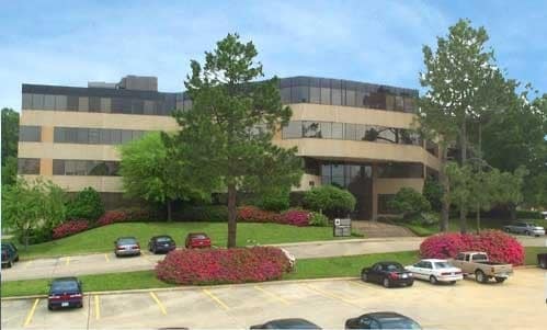
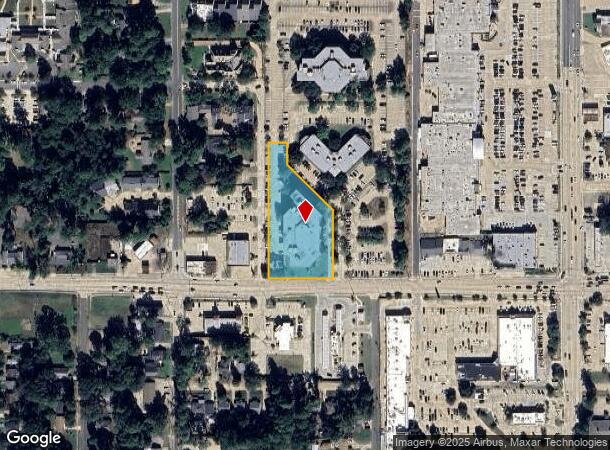
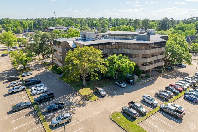
Property Record
920 Pierremont Rd, Shreveport, LA 71106

Current Lease Availabilities
NEARBY LISTINGS FOR SALE OR LEASE
-
-
-
-
-
-
-
No Photo
-
-
-
View all Shreveport listings for lease on LoopNet.com
Property Detail
920 Pierremont Rd
Shreveport-Bossier City, LA
Currie Land Subn
171413-049-0152-00
1.678 ACS M/L - A TRACT OF LAND IN LOTS 47, 54 & 57, CURRIE LAND PER ASSR PLAT, 171413-49-152
Commercialnec
Caddo
X
Louisiana
22017C0478H
58
2024
1.68 AC
2024
Central
022600
Shreveport/Bossier City
85,500 SF
DEMOGRAPHICS near 920 Pierremont Rd
1 Mile
3 Mile
5 Mile
2024 Total Population
6,854
69,518
144,714
2029 Population
6,603
66,802
140,010
Pop Growth 2024-2029
(3.66%)
(3.91%)
(3.25%)
Average Age
41
39
40
2024 Total Households
2,830
29,439
62,021
HH Growth 2024-2029
(3.75%)
(3.99%)
(3.29%)
Median Household Inc
$61,154
$41,930
$40,809
Avg Household Size
2.30
2.20
2.20
2024 Avg HH Vehicles
2.00
1.00
1.00
Median Home Value
$304,271
$162,558
$155,246
Median Year Built
1957
1964
1969
Nearby Places
Map Layers
Map Styles
 Street
 Aerial
- Restaurants
- Banks
- Shops
- Fitness
- Groceries
PUBLIC TRANSPORTATION
AIRPORT
Shreveport Regional
DRIVE
WALK
Distance
Shreveport Regional
11 min
5.5 mi
Freight Ports
Port of Shreveport
DRIVE
WALK
Distance
Port of Shreveport
1 min
9.8 mi
Nearby Properties
Address
Land Use
TOTAL SIZE
Lot Size
Zoning
Address
Land Use
TOTAL SIZE
Lot Size
Zoning
76,032 SF
23.59 AC
Address
Land Use
TOTAL SIZE
Lot Size
Zoning
367,005 SF
25.66 AC
Address
Land Use
TOTAL SIZE
Lot Size
Zoning
425,691 SF
9.33 AC
Address
Land Use
TOTAL SIZE
Lot Size
Zoning
292,198 SF
9.54 AC
Address
Land Use
TOTAL SIZE
Lot Size
Zoning
157,947 SF
Address
Land Use
TOTAL SIZE
Lot Size
Zoning
771,314 SF
108.03 AC
Address
Land Use
TOTAL SIZE
Lot Size
Zoning
179,907 SF
7.71 AC
Address
Land Use
TOTAL SIZE
Lot Size
Zoning
354,052 SF
55.80 AC
Address
Land Use
TOTAL SIZE
Lot Size
Zoning
347,639 SF
0.74 AC
Address
Land Use
TOTAL SIZE
Lot Size
Zoning
359,699 SF
18.80 AC
Address
Land Use
TOTAL SIZE
Lot Size
Zoning
217,083 SF
3.08 AC
Address
Land Use
TOTAL SIZE
Lot Size
Zoning
353,716 SF
46.75 AC
Address
Land Use
TOTAL SIZE
Lot Size
Zoning
410,560 SF
20 AC
Address
Land Use
TOTAL SIZE
Lot Size
Zoning
290,640 SF
24.42 AC
Address
Land Use
TOTAL SIZE
Lot Size
Zoning
112,672 SF
21.13 AC
Address
Land Use
TOTAL SIZE
Lot Size
Zoning
148,178 SF
4.19 AC
Address
Land Use
TOTAL SIZE
Lot Size
Zoning
292,829 SF
10.91 AC
Address
Land Use
TOTAL SIZE
Lot Size
Zoning
108,886 SF
4.78 AC
Address
Land Use
TOTAL SIZE
Lot Size
Zoning
157,412 SF
6.23 AC
Address
Land Use
TOTAL SIZE
Lot Size
Zoning
33,000 SF
2.46 AC
Address
Land Use
TOTAL SIZE
Lot Size
Zoning
130,896 SF
15.04 AC
Address
Land Use
TOTAL SIZE
Lot Size
Zoning
189,581 SF
6.52 AC
Address
Land Use
TOTAL SIZE
Lot Size
Zoning
152,646 SF
18.68 AC
Address
Land Use
TOTAL SIZE
Lot Size
Zoning
47,482 SF
6.17 AC
Address
Land Use
TOTAL SIZE
Lot Size
Zoning
205,007 SF
6.69 AC
Address
Land Use
TOTAL SIZE
Lot Size
Zoning
80,132 SF
0.16 AC
Address
Land Use
TOTAL SIZE
Lot Size
Zoning
111,591 SF
9.62 AC
Address
Land Use
TOTAL SIZE
Lot Size
Zoning
29,260 SF
3.63 AC
Address
Land Use
TOTAL SIZE
Lot Size
Zoning
308,181 SF
35.84 AC
Address
Land Use
TOTAL SIZE
Lot Size
Zoning
181,000 SF
2.18 AC
The World's #1 Commercial Real Estate Marketplace
Connect with us
© 2025 CoStar Group
The information above has been obtained from sources believed reliable. While we do not doubt its accuracy we have not verified it and make no guarantee, warranty or representation about it. It is your responsibility to independently confirm its accuracy and completeness. Any projections, opinions, assumptions, or estimates used are for example only and do not represent the current or future performance of the property. The value of this transaction to you depends on tax and other factors which should be evaluated by your tax, financial, and legal advisors. You and your advisors should conduct a careful, independent investigation of the property to determine to your satisfaction the suitability of the property for your needs.