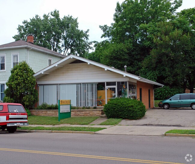
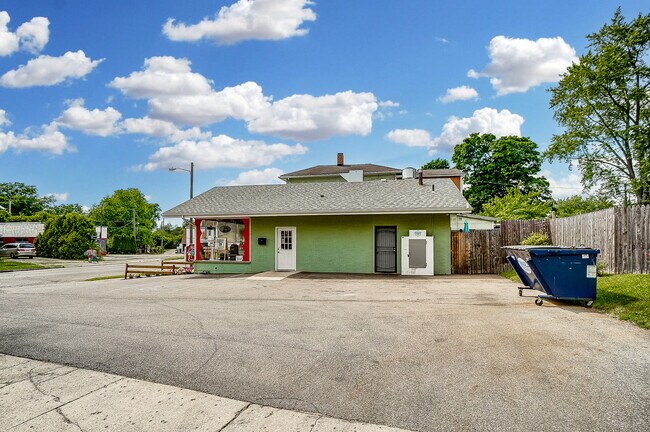
Property Record
920 Selma Rd, Springfield, OH 45505
NEARBY LISTINGS FOR SALE OR LEASE
Property Detail
920 Selma Rd
34-00700-02830-8046
W SI ELDER 100 N OF SELMA RD
Commercialnec
Clark
X
Ohio
39023C0191E
46
2024
0.20 AC
2025
Northeast Dayton
001300
Cincinnati/Dayton
1,200 SF
Springfield, OH
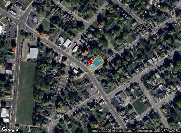
DEMOGRAPHICS near 920 Selma Rd
1 mile
3 mile
5 mile
2024 Total Population
13,167
59,792
79,469
2029 Population
13,359
59,956
79,418
Pop Growth 2024-2029
+ 1.46%
+ 0.27%
(0.06%)
Average Age
36
39
40
2024 Total Households
5,224
24,038
32,821
HH Growth 2024-2029
+ 1.28%
+ 0.21%
(0.15%)
Median Household Inc
$34,314
$45,529
$49,714
Avg Household Size
2.30
2.30
2.30
2024 Avg HH Vehicles
2.00
2.00
2.00
Median Home Value
$64,469
$97,023
$128,729
Median Year Built
1947
1949
1955
Nearby Places
Map Layers
Map Styles
 Street
 Aerial
Transit
 Traffic
 Biking
Places
Listings with unknown addresses are not visible on the map
- Restaurants
- Banks
- Shops
- Fitness
- Groceries
PUBLIC TRANSPORTATION
AIRPORT
James M Cox Dayton International
Drive
Walk
Distance
James M Cox Dayton International
36 min
28.0 mi
Freight Ports
Port of Toledo
Drive
Walk
Distance
Port of Toledo
190 min
131.9 mi
SALE & LEASE HISTORY
LISTING DATE
SALE/LEASE

Jun 21, 2023
For Sale
Nearby Properties
Address
Land Use
TOTAL SIZE
Lot Size
Zoning
Address
Land Use
TOTAL SIZE
Lot Size
Zoning
1.20 AC
Address
Land Use
TOTAL SIZE
Lot Size
Zoning
479,515 SF
1.69 AC
Address
Land Use
TOTAL SIZE
Lot Size
Zoning
399,308 SF
11.06 AC
Address
Land Use
TOTAL SIZE
Lot Size
Zoning
32.89 AC
Address
Land Use
TOTAL SIZE
Lot Size
Zoning
107.87 AC
Address
Land Use
TOTAL SIZE
Lot Size
Zoning
17,280 SF
14.32 AC
Address
Land Use
TOTAL SIZE
Lot Size
Zoning
Address
Land Use
TOTAL SIZE
Lot Size
Zoning
44.85 AC
Address
Land Use
TOTAL SIZE
Lot Size
Zoning
103,458 SF
5.51 AC
Address
Land Use
TOTAL SIZE
Lot Size
Zoning
12,657 SF
8.17 AC
Address
Land Use
TOTAL SIZE
Lot Size
Zoning
399,308 SF
11.06 AC
Address
Land Use
TOTAL SIZE
Lot Size
Zoning
61,376 SF
3.95 AC
Address
Land Use
TOTAL SIZE
Lot Size
Zoning
8,316 SF
34.41 AC
R-1
Address
Land Use
TOTAL SIZE
Lot Size
Zoning
25.44 AC
Address
Land Use
TOTAL SIZE
Lot Size
Zoning
47,929 SF
2.77 AC
Address
Land Use
TOTAL SIZE
Lot Size
Zoning
Address
Land Use
TOTAL SIZE
Lot Size
Zoning
225,335 SF
22.73 AC
Address
Land Use
TOTAL SIZE
Lot Size
Zoning
56,381 SF
2.37 AC
Address
Land Use
TOTAL SIZE
Lot Size
Zoning
Address
Land Use
TOTAL SIZE
Lot Size
Zoning
Address
Land Use
TOTAL SIZE
Lot Size
Zoning
Address
Land Use
TOTAL SIZE
Lot Size
Zoning
32,566 SF
1.90 AC
Address
Land Use
TOTAL SIZE
Lot Size
Zoning
217,626 SF
17.85 AC
Address
Land Use
TOTAL SIZE
Lot Size
Zoning
Address
Land Use
TOTAL SIZE
Lot Size
Zoning
399,308 SF
31.78 AC
Address
Land Use
TOTAL SIZE
Lot Size
Zoning
1.05 AC
Address
Land Use
TOTAL SIZE
Lot Size
Zoning
194,184 SF
24.01 AC
Address
Land Use
TOTAL SIZE
Lot Size
Zoning
Address
Land Use
TOTAL SIZE
Lot Size
Zoning
Address
Land Use
TOTAL SIZE
Lot Size
Zoning
77,006 SF
1.39 AC
The World's #1 Commercial Real Estate Marketplace
Connect with us
© 2026 CoStar Group
The information above has been obtained from sources believed reliable. While we do not doubt its accuracy we have not verified it and make no guarantee, warranty or representation about it. It is your responsibility to independently confirm its accuracy and completeness. Any projections, opinions, assumptions, or estimates used are for example only and do not represent the current or future performance of the property. The value of this transaction to you depends on tax and other factors which should be evaluated by your tax, financial, and legal advisors. You and your advisors should conduct a careful, independent investigation of the property to determine to your satisfaction the suitability of the property for your needs.