Property Record
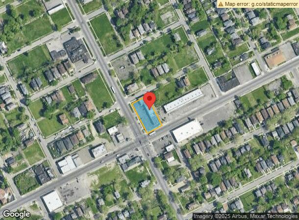
9200 Dexter Ave, Detroit, MI 48206


Current Lease Availabilities
NEARBY LISTINGS FOR SALE OR LEASE
Property Detail
9200 Dexter Ave
Detroit-Warren-Dearborn, MI
Wagers
12-0104569
E DEXTER LOTS 164 THRU 160 WAGERS SUB L35 P7 PLATS, WCR 12/190 196 X 100 [2003 COMBINATION ITEMS 010456-8, 010459] 2-20-03
Stripcommercialcenter
Wayne
X
Michigan
26163C0280E
164
2025
0.45 AC
2025
Detroit W of Woodward
531100
Detroit
6,870 SF
DEMOGRAPHICS near 9200 Dexter Ave
1 Mile
3 Mile
5 Mile
2024 Total Population
21,716
156,041
417,818
2029 Population
22,712
158,220
414,285
Pop Growth 2024-2029
+ 4.59%
+ 1.40%
(0.85%)
Average Age
40
38
37
2024 Total Households
9,117
63,415
160,650
HH Growth 2024-2029
+ 4.69%
+ 1.56%
(0.53%)
Median Household Inc
$30,619
$31,691
$35,720
Avg Household Size
2.30
2.30
2.50
2024 Avg HH Vehicles
1.00
1.00
1.00
Median Home Value
$72,866
$84,696
$90,552
Median Year Built
1946
1947
1948
Nearby Places
Map Layers
Map Styles
 Street
 Aerial
- Restaurants
- Banks
- Shops
- Fitness
- Groceries
PUBLIC TRANSPORTATION
COMMUTER RAIL
DRIVE
WALK
Distance
9 min
3.2 mi
DRIVE
WALK
Distance
19 min
9.2 mi
AIRPORT
Windsor International
DRIVE
WALK
Distance
Windsor International
32 min
15.5 mi
Detroit Metro Wayne County
DRIVE
WALK
Distance
Detroit Metro Wayne County
33 min
20.7 mi
Freight Ports
DRIVE
WALK
Distance
78 min
62.1 mi
Nearby Properties
Address
Land Use
TOTAL SIZE
Lot Size
Zoning
Address
Land Use
TOTAL SIZE
Lot Size
Zoning
334,904 SF
B5
Address
Land Use
TOTAL SIZE
Lot Size
Zoning
506,450 SF
3.84 AC
B5
Address
Land Use
TOTAL SIZE
Lot Size
Zoning
266,016 SF
7.76 AC
PD
Address
Land Use
TOTAL SIZE
Lot Size
Zoning
152,232 SF
SD2
Address
Land Use
TOTAL SIZE
Lot Size
Zoning
531,360 SF
1.44 AC
B5
Address
Land Use
TOTAL SIZE
Lot Size
Zoning
678,539 SF
3.52 AC
B5
Address
Land Use
TOTAL SIZE
Lot Size
Zoning
158,535 SF
B4
Address
Land Use
TOTAL SIZE
Lot Size
Zoning
164,797 SF
2.03 AC
Address
Land Use
TOTAL SIZE
Lot Size
Zoning
449,083 SF
2.39 AC
B2
Address
Land Use
TOTAL SIZE
Lot Size
Zoning
171,665 SF
3.73 AC
R5
Address
Land Use
TOTAL SIZE
Lot Size
Zoning
76,986 SF
2.73 AC
B4
Address
Land Use
TOTAL SIZE
Lot Size
Zoning
274,900 SF
M2
Address
Land Use
TOTAL SIZE
Lot Size
Zoning
331,559 SF
11.42 AC
M4
Address
Land Use
TOTAL SIZE
Lot Size
Zoning
520,522 SF
51.78 AC
M4
Address
Land Use
TOTAL SIZE
Lot Size
Zoning
135,296 SF
1.09 AC
R5
Address
Land Use
TOTAL SIZE
Lot Size
Zoning
263,240 SF
1.21 AC
B4
Address
Land Use
TOTAL SIZE
Lot Size
Zoning
185,944 SF
B2
Address
Land Use
TOTAL SIZE
Lot Size
Zoning
590,652 SF
21.79 AC
TM
Address
Land Use
TOTAL SIZE
Lot Size
Zoning
446,500 SF
27.90 AC
Address
Land Use
TOTAL SIZE
Lot Size
Zoning
224,410 SF
2.11 AC
M3
Address
Land Use
TOTAL SIZE
Lot Size
Zoning
115,560 SF
1 AC
B4
Address
Land Use
TOTAL SIZE
Lot Size
Zoning
48,568 SF
0.28 AC
SD2
Address
Land Use
TOTAL SIZE
Lot Size
Zoning
138,649 SF
Address
Land Use
TOTAL SIZE
Lot Size
Zoning
214,306 SF
3.76 AC
R3
Address
Land Use
TOTAL SIZE
Lot Size
Zoning
65,140 SF
1.22 AC
B4
Address
Land Use
TOTAL SIZE
Lot Size
Zoning
Address
Land Use
TOTAL SIZE
Lot Size
Zoning
61,576 SF
Address
Land Use
TOTAL SIZE
Lot Size
Zoning
113,740 SF
2.79 AC
M4
Address
Land Use
TOTAL SIZE
Lot Size
Zoning
60,868 SF
0.45 AC
B4
Address
Land Use
TOTAL SIZE
Lot Size
Zoning
46,723 SF
B2
The World's #1 Commercial Real Estate Marketplace
Connect with us
© 2026 CoStar Group
The information above has been obtained from sources believed reliable. While we do not doubt its accuracy we have not verified it and make no guarantee, warranty or representation about it. It is your responsibility to independently confirm its accuracy and completeness. Any projections, opinions, assumptions, or estimates used are for example only and do not represent the current or future performance of the property. The value of this transaction to you depends on tax and other factors which should be evaluated by your tax, financial, and legal advisors. You and your advisors should conduct a careful, independent investigation of the property to determine to your satisfaction the suitability of the property for your needs.