Property Record
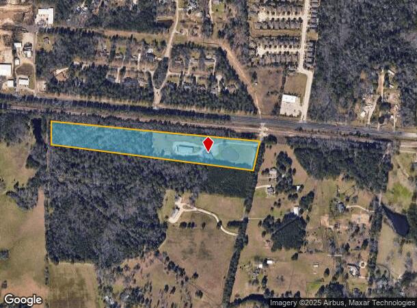
9200 Leonidas Horton Rd, Conroe, TX 77304

NEARBY LISTINGS FOR SALE OR LEASE
Property Detail
9200 Leonidas Horton Rd
0009-00-05801
Corner Mary
Commercialnec
A0009 - CORNER MARY, TRACT 58, 58-A, ACRES 12.439
X
Montgomery
48339C0360G
Texas
2024
12.44 AC
2025
Outlying Montgomery Cnty
694503
Houston
9,600 SF
Houston-The Woodlands-Sugar Land, TX
DEMOGRAPHICS near 9200 Leonidas Horton Rd
1 Mile
3 Mile
5 Mile
2024 Total Population
1,307
25,048
80,259
2029 Population
1,610
31,227
99,417
Pop Growth 2024-2029
+ 23.18%
+ 24.67%
+ 23.87%
Average Age
39
39
39
2024 Total Households
498
9,305
30,538
HH Growth 2024-2029
+ 23.49%
+ 24.73%
+ 23.96%
Median Household Inc
$70,081
$99,155
$80,653
Avg Household Size
2.60
2.70
2.60
2024 Avg HH Vehicles
2.00
2.00
2.00
Median Home Value
$261,841
$373,868
$334,907
Median Year Built
2010
2011
2008
Nearby Places
Map Layers
Map Styles
 Street
 Aerial
- Restaurants
- Banks
- Shops
- Fitness
- Groceries
PUBLIC TRANSPORTATION
AIRPORT
George Bush Intcntl/Houston
DRIVE
WALK
Distance
George Bush Intcntl/Houston
45 min
35.6 mi
Freight Ports
Port of Houston
DRIVE
WALK
Distance
Port of Houston
67 min
51.4 mi
Nearby Properties
Address
Land Use
TOTAL SIZE
Lot Size
Zoning
Address
Land Use
TOTAL SIZE
Lot Size
Zoning
296,593 SF
13.03 AC
Address
Land Use
TOTAL SIZE
Lot Size
Zoning
294,336 SF
20.39 AC
Address
Land Use
TOTAL SIZE
Lot Size
Zoning
204,716 SF
15.51 AC
Address
Land Use
TOTAL SIZE
Lot Size
Zoning
229,345 SF
12.36 AC
1
Address
Land Use
TOTAL SIZE
Lot Size
Zoning
134,935 SF
10.50 AC
1
Address
Land Use
TOTAL SIZE
Lot Size
Zoning
250,716 SF
11.17 AC
1
Address
Land Use
TOTAL SIZE
Lot Size
Zoning
134,621 SF
26.37 AC
Address
Land Use
TOTAL SIZE
Lot Size
Zoning
313,974 SF
25.03 AC
1
Address
Land Use
TOTAL SIZE
Lot Size
Zoning
228,088 SF
16.16 AC
Address
Land Use
TOTAL SIZE
Lot Size
Zoning
157,996 SF
9 AC
Address
Land Use
TOTAL SIZE
Lot Size
Zoning
125,042 SF
7.39 AC
Address
Land Use
TOTAL SIZE
Lot Size
Zoning
239,104 SF
65.54 AC
1
Address
Land Use
TOTAL SIZE
Lot Size
Zoning
114,547 SF
57.94 AC
1
Address
Land Use
TOTAL SIZE
Lot Size
Zoning
17,544 SF
24.25 AC
1
Address
Land Use
TOTAL SIZE
Lot Size
Zoning
109,998 SF
13.20 AC
Address
Land Use
TOTAL SIZE
Lot Size
Zoning
42,750 SF
4.75 AC
Address
Land Use
TOTAL SIZE
Lot Size
Zoning
190,000 SF
7.54 AC
Address
Land Use
TOTAL SIZE
Lot Size
Zoning
50,464 SF
7.95 AC
Address
Land Use
TOTAL SIZE
Lot Size
Zoning
81,011 SF
21.53 AC
Address
Land Use
TOTAL SIZE
Lot Size
Zoning
170,050 SF
10.80 AC
Address
Land Use
TOTAL SIZE
Lot Size
Zoning
45,301 SF
13.18 AC
1
Address
Land Use
TOTAL SIZE
Lot Size
Zoning
68,576 SF
26.39 AC
Address
Land Use
TOTAL SIZE
Lot Size
Zoning
74,395 SF
8.44 AC
Address
Land Use
TOTAL SIZE
Lot Size
Zoning
46,374 SF
3.76 AC
Address
Land Use
TOTAL SIZE
Lot Size
Zoning
104,735 SF
29.96 AC
1
Address
Land Use
TOTAL SIZE
Lot Size
Zoning
26,278 SF
9.39 AC
Address
Land Use
TOTAL SIZE
Lot Size
Zoning
14,957 SF
2.10 AC
1
Address
Land Use
TOTAL SIZE
Lot Size
Zoning
19,474 SF
12.76 AC
Address
Land Use
TOTAL SIZE
Lot Size
Zoning
54,511 SF
14.42 AC
1
The World's #1 Commercial Real Estate Marketplace
Connect with us
© 2025 CoStar Group
The information above has been obtained from sources believed reliable. While we do not doubt its accuracy we have not verified it and make no guarantee, warranty or representation about it. It is your responsibility to independently confirm its accuracy and completeness. Any projections, opinions, assumptions, or estimates used are for example only and do not represent the current or future performance of the property. The value of this transaction to you depends on tax and other factors which should be evaluated by your tax, financial, and legal advisors. You and your advisors should conduct a careful, independent investigation of the property to determine to your satisfaction the suitability of the property for your needs.