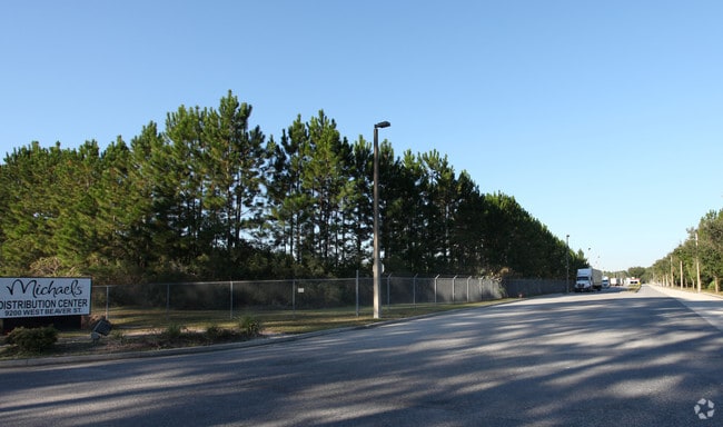
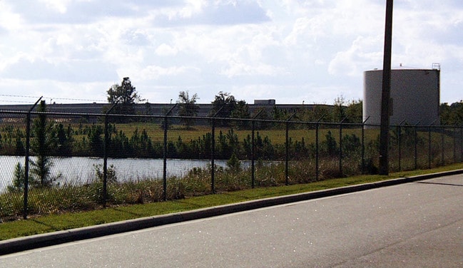
Property Record
9200 W Beaver St, Jacksonville, FL 32220


NEARBY LISTINGS FOR SALE OR LEASE
Property Detail
9200 W Beaver St
006862-0000
Jax Heights Sec
Warehouse
5-93 21-2S-25E 94.599 JACKSONVILLE HEIGHTS PT TRACTS 3-6,8-14,TRACT 9 BLK 1, PT TRACTS 2,13,14,16,TRACT 15 BLK 2, PT CL ST RECD O/R 10020-2204 BEING PARCEL A
X
Duval
12031C0333H
Florida
2024
94.71 AC
2025
Riverside
011901
Jacksonville (Florida)
505,748 SF
Jacksonville, FL
DEMOGRAPHICS near 9200 W Beaver St
1 Mile
3 Mile
5 Mile
2024 Total Population
3,095
35,213
104,356
2029 Population
3,208
36,789
109,652
Pop Growth 2024-2029
+ 3.65%
+ 4.48%
+ 5.07%
Average Age
40
39
38
2024 Total Households
1,136
12,785
38,896
HH Growth 2024-2029
+ 3.70%
+ 4.55%
+ 5.16%
Median Household Inc
$69,919
$65,758
$55,908
Avg Household Size
2.60
2.70
2.60
2024 Avg HH Vehicles
2.00
2.00
2.00
Median Home Value
$168,514
$192,856
$186,755
Median Year Built
1991
1990
1984
Nearby Places
Map Layers
Map Styles
 Street
 Aerial
- Restaurants
- Banks
- Shops
- Fitness
- Groceries
PUBLIC TRANSPORTATION
COMMUTER RAIL
Jacksonville (Silver Meteor - Amtrak, Silver Star - Amtrak)
DRIVE
WALK
Distance
Jacksonville (Silver Meteor - Amtrak, Silver Star - Amtrak)
19 min
8.5 mi
AIRPORT
Jacksonville International
DRIVE
WALK
Distance
Jacksonville International
33 min
20.3 mi
Freight Ports
Jacksonville Port
DRIVE
WALK
Distance
Jacksonville Port
25 min
14.1 mi
Nearby Properties
Address
Land Use
TOTAL SIZE
Lot Size
Zoning
Address
Land Use
TOTAL SIZE
Lot Size
Zoning
506,876 SF
39.32 AC
IBP
Address
Land Use
TOTAL SIZE
Lot Size
Zoning
185,662 SF
1,416.80 AC
PBF-3
Address
Land Use
TOTAL SIZE
Lot Size
Zoning
874,178 SF
46.91 AC
PBF-2
Address
Land Use
TOTAL SIZE
Lot Size
Zoning
321,547 SF
17.17 AC
PUD
Address
Land Use
TOTAL SIZE
Lot Size
Zoning
421,500 SF
43.21 AC
PUD
Address
Land Use
TOTAL SIZE
Lot Size
Zoning
509,686 SF
43.32 AC
IL
Address
Land Use
TOTAL SIZE
Lot Size
Zoning
139,435 SF
7.15 AC
CCG-2
Address
Land Use
TOTAL SIZE
Lot Size
Zoning
480,461 SF
43.54 AC
IL
Address
Land Use
TOTAL SIZE
Lot Size
Zoning
269,178 SF
129.93 AC
PBF-2
Address
Land Use
TOTAL SIZE
Lot Size
Zoning
167,854 SF
8.01 AC
IL
Address
Land Use
TOTAL SIZE
Lot Size
Zoning
48,720 SF
9.38 AC
PUD
Address
Land Use
TOTAL SIZE
Lot Size
Zoning
114,316 SF
20.57 AC
IL
Address
Land Use
TOTAL SIZE
Lot Size
Zoning
75,247 SF
14.90 AC
CCG-1
Address
Land Use
TOTAL SIZE
Lot Size
Zoning
30,789 SF
2.10 AC
PUD
Address
Land Use
TOTAL SIZE
Lot Size
Zoning
131,247 SF
5.68 AC
PBF-2
Address
Land Use
TOTAL SIZE
Lot Size
Zoning
153,549 SF
15.96 AC
PBF-1
Address
Land Use
TOTAL SIZE
Lot Size
Zoning
98,541 SF
8.68 AC
CCG-2
Address
Land Use
TOTAL SIZE
Lot Size
Zoning
160,970 SF
25.46 AC
IL
Address
Land Use
TOTAL SIZE
Lot Size
Zoning
171.06 AC
PUD
Address
Land Use
TOTAL SIZE
Lot Size
Zoning
111,570 SF
4.15 AC
IL
Address
Land Use
TOTAL SIZE
Lot Size
Zoning
29,022 SF
3.17 AC
PUD
Address
Land Use
TOTAL SIZE
Lot Size
Zoning
212,908 SF
11.10 AC
IL
Address
Land Use
TOTAL SIZE
Lot Size
Zoning
121,370 SF
88.61 AC
RMD-D
Address
Land Use
TOTAL SIZE
Lot Size
Zoning
204,682 SF
15.80 AC
PBF-1
Address
Land Use
TOTAL SIZE
Lot Size
Zoning
33,424 SF
2.97 AC
PUD
Address
Land Use
TOTAL SIZE
Lot Size
Zoning
89,759 SF
7.05 AC
RMD-D
Address
Land Use
TOTAL SIZE
Lot Size
Zoning
53,405 SF
6.04 AC
PUD
Address
Land Use
TOTAL SIZE
Lot Size
Zoning
84.65 AC
PUD
Address
Land Use
TOTAL SIZE
Lot Size
Zoning
76,718 SF
8.89 AC
RR-ACRE
The World's #1 Commercial Real Estate Marketplace
Connect with us
© 2025 CoStar Group
The information above has been obtained from sources believed reliable. While we do not doubt its accuracy we have not verified it and make no guarantee, warranty or representation about it. It is your responsibility to independently confirm its accuracy and completeness. Any projections, opinions, assumptions, or estimates used are for example only and do not represent the current or future performance of the property. The value of this transaction to you depends on tax and other factors which should be evaluated by your tax, financial, and legal advisors. You and your advisors should conduct a careful, independent investigation of the property to determine to your satisfaction the suitability of the property for your needs.