Property Record
9201 El Matador Dr, Gilroy, CA 95020

NEARBY LISTINGS FOR SALE OR LEASE
-
-
View all Gilroy listings for sale on LoopNet.com
Property Detail
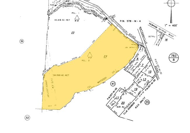
9201 El Matador Dr
San Jose-Sunnyvale-Santa Clara, CA
Map Of The Partiiton Of The Cordes Estat
756-30-024
EASTON MAP H7 956
Orchard
Santa Clara
D
California
06087C0300E
54.59 AC
2024
Outlying Santa Clara Cnty
2025
South Bay/San Jose
512200
DEMOGRAPHICS near 9201 El Matador Dr
1 Mile
3 Mile
5 Mile
2024 Total Population
386
6,341
44,103
2029 Population
362
6,059
42,164
Pop Growth 2024-2029
(6.22%)
(4.45%)
(4.40%)
Average Age
49
42
40
2024 Total Households
141
1,974
13,601
HH Growth 2024-2029
(6.38%)
(4.76%)
(4.66%)
Median Household Inc
$221,519
$191,264
$124,709
Avg Household Size
2.80
3.20
3.20
2024 Avg HH Vehicles
3.00
3.00
2.00
Median Home Value
$1,119,663
$1,076,571
$867,974
Median Year Built
1987
2001
1987
Nearby Places
Map Layers
Map Styles
 Street
 Aerial
- Restaurants
- Banks
- Shops
- Fitness
- Groceries
PUBLIC TRANSPORTATION
COMMUTER RAIL
San Martin (Caltrain - Caltrain (Caltrain), South Santa Clara County Connector - Caltrain (Caltrain))
DRIVE
WALK
Distance
San Martin (Caltrain - Caltrain (Caltrain), South Santa Clara County Connector - Caltrain (Caltrain))
14 min
7.9 mi
San Martin Caltrain Station Northbound (South Santa Clara County Connector - Caltrain (Caltrain))
DRIVE
WALK
Distance
San Martin Caltrain Station Northbound (South Santa Clara County Connector - Caltrain (Caltrain))
14 min
7.9 mi
AIRPORT
Norman Y Mineta San Jose International
DRIVE
WALK
Distance
Norman Y Mineta San Jose International
46 min
34.2 mi
Freight Ports
Port of Redwood City
DRIVE
WALK
Distance
Port of Redwood City
68 min
52.3 mi
Nearby Properties
Address
Land Use
TOTAL SIZE
Lot Size
Zoning
Address
Land Use
TOTAL SIZE
Lot Size
Zoning
50.84 AC
A-20A
Address
Land Use
TOTAL SIZE
Lot Size
Zoning
60.15 AC
AW
Address
Land Use
TOTAL SIZE
Lot Size
Zoning
14.25 AC
HS-SR
Address
Land Use
TOTAL SIZE
Lot Size
Zoning
48.27 AC
AW
Address
Land Use
TOTAL SIZE
Lot Size
Zoning
525.15 AC
HS
Address
Land Use
TOTAL SIZE
Lot Size
Zoning
9.57 AC
A-20A
Address
Land Use
TOTAL SIZE
Lot Size
Zoning
3,335 SF
8.26 AC
RR-5A
Address
Land Use
TOTAL SIZE
Lot Size
Zoning
22.70 AC
A-20A
Address
Land Use
TOTAL SIZE
Lot Size
Zoning
10.21 AC
AW
Address
Land Use
TOTAL SIZE
Lot Size
Zoning
15.29 AC
AW
Address
Land Use
TOTAL SIZE
Lot Size
Zoning
1,983 SF
75.52 AC
HS-SR
Address
Land Use
TOTAL SIZE
Lot Size
Zoning
6.70 AC
A-20A
Address
Land Use
TOTAL SIZE
Lot Size
Zoning
113.23 AC
A-20A
Address
Land Use
TOTAL SIZE
Lot Size
Zoning
31.72 AC
HS
Address
Land Use
TOTAL SIZE
Lot Size
Zoning
60.72 AC
HS-SR
Address
Land Use
TOTAL SIZE
Lot Size
Zoning
378.45 AC
AW
Address
Land Use
TOTAL SIZE
Lot Size
Zoning
118.04 AC
HS
Address
Land Use
TOTAL SIZE
Lot Size
Zoning
49.11 AC
HS
Address
Land Use
TOTAL SIZE
Lot Size
Zoning
41.55 AC
HS
Address
Land Use
TOTAL SIZE
Lot Size
Zoning
87.40 AC
A-20A
Address
Land Use
TOTAL SIZE
Lot Size
Zoning
2,549 SF
7.34 AC
A-20A
Address
Land Use
TOTAL SIZE
Lot Size
Zoning
2,555 SF
2.98 AC
RR
Address
Land Use
TOTAL SIZE
Lot Size
Zoning
11.68 AC
HS
Address
Land Use
TOTAL SIZE
Lot Size
Zoning
17.93 AC
HS
Address
Land Use
TOTAL SIZE
Lot Size
Zoning
3.45 AC
RR-5A
Address
Land Use
TOTAL SIZE
Lot Size
Zoning
124.13 AC
HS
Address
Land Use
TOTAL SIZE
Lot Size
Zoning
9.86 AC
RR
Address
Land Use
TOTAL SIZE
Lot Size
Zoning
16.55 AC
AW
Address
Land Use
TOTAL SIZE
Lot Size
Zoning
1 AC
R1
The World's #1 Commercial Real Estate Marketplace
Connect with us
© 2025 CoStar Group
The information above has been obtained from sources believed reliable. While we do not doubt its accuracy we have not verified it and make no guarantee, warranty or representation about it. It is your responsibility to independently confirm its accuracy and completeness. Any projections, opinions, assumptions, or estimates used are for example only and do not represent the current or future performance of the property. The value of this transaction to you depends on tax and other factors which should be evaluated by your tax, financial, and legal advisors. You and your advisors should conduct a careful, independent investigation of the property to determine to your satisfaction the suitability of the property for your needs.