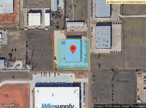
Property Record
9201 Polaris Dr, Oklahoma City, OK 73149


Current Lease Availabilities
Property Detail
9201 Polaris Dr
Oklahoma City, OK
OAK HOLLOW INDUSTRIAL PARK PHASE 2 (BEING A REPLT OF PRT BANASHS SUB) BEING ALL LT 4 & PRT OF LTS 3 & 5 BLK 3 BEG 47 S NE/C LT 3 S403 W431.71 N403 E431.71 POB
R0188900
CLEVELAND
Commercialnec
Oklahoma
B and X Area of moderate flood hazard, usually the area between the limits of the 100-year and 500-year floods.
4
2025
3.99 AC
2025
Moore
202002
Oklahoma City
NEARBY LISTINGS FOR SALE OR LEASE
DEMOGRAPHICS near 9201 Polaris Dr
1 mile
3 mile
5 mile
2025 Total Population
2,802
71,451
228,180
2030 Population
2,898
72,681
232,552
Pop Growth 2025-2030
+ 3.43%
+ 1.72%
+ 1.92%
Average Age
36
38
37
2025 Total Households
1,253
27,984
85,781
HH Growth 2025-2030
+ 3.27%
+ 1.82%
+ 2.05%
Median Household Inc
$45,294
$62,090
$62,739
Avg Household Size
2.10
2.50
2.60
2025 Avg HH Vehicles
1.00
2.00
2.00
Median Home Value
$187,109
$183,684
$187,588
Median Year Built
1995
1979
1979
Nearby Places
Map Layers
Map Styles
 Street
 Aerial
Layers
 Traffic
 Biking
Places
Listings with unknown addresses are not visible on the map
- Restaurants
- Banks
- Shops
- Fitness
- Groceries
PUBLIC TRANSPORTATION
COMMUTER RAIL
Drive
Walk
Distance
13 min
7.9 mi
AIRPORT
Will Rogers World
Drive
Walk
Distance
Will Rogers World
21 min
9.9 mi
Nearby Properties
Address
Land Use
TOTAL SIZE
Lot Size
Zoning
Address
Land Use
TOTAL SIZE
Lot Size
Zoning
50.08 AC
Address
Land Use
TOTAL SIZE
Lot Size
Zoning
1,600 SF
25 AC
Address
Land Use
TOTAL SIZE
Lot Size
Zoning
Address
Land Use
TOTAL SIZE
Lot Size
Zoning
2,123 SF
53.41 AC
C3
Address
Land Use
TOTAL SIZE
Lot Size
Zoning
155.94 AC
Address
Land Use
TOTAL SIZE
Lot Size
Zoning
3,246 SF
10 AC
Address
Land Use
TOTAL SIZE
Lot Size
Zoning
11.36 AC
C4
Address
Land Use
TOTAL SIZE
Lot Size
Zoning
57,536 SF
66.21 AC
R4
Address
Land Use
TOTAL SIZE
Lot Size
Zoning
10.81 AC
Address
Land Use
TOTAL SIZE
Lot Size
Zoning
15.61 AC
C1
Address
Land Use
TOTAL SIZE
Lot Size
Zoning
10 AC
R2
Address
Land Use
TOTAL SIZE
Lot Size
Zoning
Address
Land Use
TOTAL SIZE
Lot Size
Zoning
Address
Land Use
TOTAL SIZE
Lot Size
Zoning
Address
Land Use
TOTAL SIZE
Lot Size
Zoning
347,050 SF
18.56 AC
Address
Land Use
TOTAL SIZE
Lot Size
Zoning
40.90 AC
Address
Land Use
TOTAL SIZE
Lot Size
Zoning
998,813 SF
167.96 AC
I-2
Address
Land Use
TOTAL SIZE
Lot Size
Zoning
70.01 AC
Address
Land Use
TOTAL SIZE
Lot Size
Zoning
104.87 AC
Address
Land Use
TOTAL SIZE
Lot Size
Zoning
29.38 AC
Address
Land Use
TOTAL SIZE
Lot Size
Zoning
58,503 SF
3.63 AC
C1
Address
Land Use
TOTAL SIZE
Lot Size
Zoning
1.85 AC
Address
Land Use
TOTAL SIZE
Lot Size
Zoning
14,714 SF
14.41 AC
Address
Land Use
TOTAL SIZE
Lot Size
Zoning
403,745 SF
26.03 AC
I-3
Address
Land Use
TOTAL SIZE
Lot Size
Zoning
0.77 AC
Address
Land Use
TOTAL SIZE
Lot Size
Zoning
1.86 AC
Address
Land Use
TOTAL SIZE
Lot Size
Zoning
18.41 AC
Address
Land Use
TOTAL SIZE
Lot Size
Zoning
14.27 AC
Address
Land Use
TOTAL SIZE
Lot Size
Zoning
0.64 AC
Address
Land Use
TOTAL SIZE
Lot Size
Zoning
1.40 AC
The World's #1 Commercial Real Estate Marketplace
Connect with us
© 2026 CoStar Group
The information above has been obtained from sources believed reliable. While we do not doubt its accuracy we have not verified it and make no guarantee, warranty or representation about it. It is your responsibility to independently confirm its accuracy and completeness. Any projections, opinions, assumptions, or estimates used are for example only and do not represent the current or future performance of the property. The value of this transaction to you depends on tax and other factors which should be evaluated by your tax, financial, and legal advisors. You and your advisors should conduct a careful, independent investigation of the property to determine to your satisfaction the suitability of the property for your needs.