Property Record
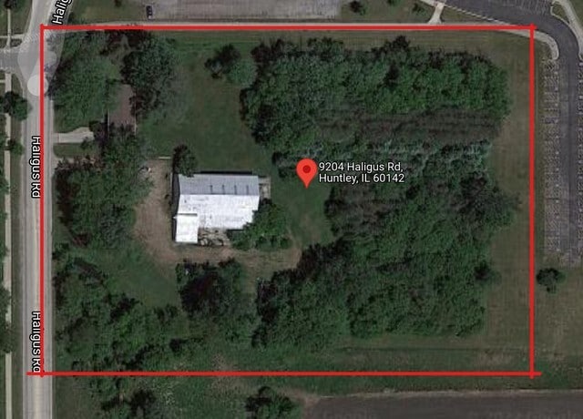
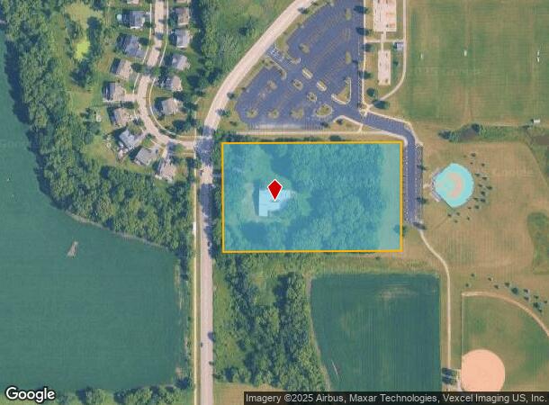
9204 Haligus Rd, Huntley, IL 60142

This Property Is For Sale
NEARBY LISTINGS FOR SALE OR LEASE
Property Detail
9204 Haligus Rd
18-22-200-004
DOC 2003R0155674 S 350FT N 853FT W 622.29FT NW1/4 NE1/4
Residentialnec
McHenry
AE
Illinois
17111C0309J
4.62 AC
2024
Far Northwest
2024
Chicago
871109
Chicago-Naperville-Elgin, IL-IN
3,032 SF
DEMOGRAPHICS near 9204 Haligus Rd
1 mile
3 mile
5 mile
2024 Total Population
10,285
53,381
106,202
2029 Population
10,222
53,392
106,276
Pop Growth 2024-2029
(0.61%)
+ 0.02%
+ 0.07%
Average Age
35
37
41
2024 Total Households
3,029
17,073
38,571
HH Growth 2024-2029
(0.63%)
+ 0.04%
+ 0.06%
Median Household Inc
$132,125
$124,599
$97,046
Avg Household Size
3.40
3.10
2.70
2024 Avg HH Vehicles
2.00
2.00
2.00
Median Home Value
$269,164
$288,537
$275,037
Median Year Built
2002
1998
1995
Nearby Places
Map Layers
Map Styles
 Street
 Aerial
Transit
 Traffic
 Biking
Places
Listings with unknown addresses are not visible on the map
- Restaurants
- Banks
- Shops
- Fitness
- Groceries
PUBLIC TRANSPORTATION
COMMUTER RAIL
Crystal Lake Station (Union Pacific Northwest Line - Northeast Illinois Regional Commuter Railroad (Metra))
Drive
Walk
Distance
Crystal Lake Station (Union Pacific Northwest Line - Northeast Illinois Regional Commuter Railroad (Metra))
17 min
7.8 mi
Pingree Road Station (Union Pacific Northwest Line - Northeast Illinois Regional Commuter Railroad (Metra))
Drive
Walk
Distance
Pingree Road Station (Union Pacific Northwest Line - Northeast Illinois Regional Commuter Railroad (Metra))
18 min
8.1 mi
AIRPORT
Chicago O'Hare International
Drive
Walk
Distance
Chicago O'Hare International
52 min
38.4 mi
Freight Ports
Port Milwaukee
Drive
Walk
Distance
Port Milwaukee
113 min
81.8 mi
Nearby Properties
Address
Land Use
TOTAL SIZE
Lot Size
Zoning
Address
Land Use
TOTAL SIZE
Lot Size
Zoning
7.26 AC
Address
Land Use
TOTAL SIZE
Lot Size
Zoning
11.86 AC
Address
Land Use
TOTAL SIZE
Lot Size
Zoning
3.50 AC
Address
Land Use
TOTAL SIZE
Lot Size
Zoning
Address
Land Use
TOTAL SIZE
Lot Size
Zoning
0.71 AC
Address
Land Use
TOTAL SIZE
Lot Size
Zoning
8.23 AC
Address
Land Use
TOTAL SIZE
Lot Size
Zoning
Address
Land Use
TOTAL SIZE
Lot Size
Zoning
92,850 SF
5 AC
Address
Land Use
TOTAL SIZE
Lot Size
Zoning
24,700 SF
3.08 AC
Address
Land Use
TOTAL SIZE
Lot Size
Zoning
3,144 SF
4.81 AC
Address
Land Use
TOTAL SIZE
Lot Size
Zoning
85,500 SF
7 AC
Address
Land Use
TOTAL SIZE
Lot Size
Zoning
2.55 AC
Address
Land Use
TOTAL SIZE
Lot Size
Zoning
0.27 AC
Address
Land Use
TOTAL SIZE
Lot Size
Zoning
24,157 SF
1.97 AC
Address
Land Use
TOTAL SIZE
Lot Size
Zoning
71,064 SF
7 AC
Address
Land Use
TOTAL SIZE
Lot Size
Zoning
65,235 SF
4.74 AC
Address
Land Use
TOTAL SIZE
Lot Size
Zoning
48,150 SF
3.42 AC
Address
Land Use
TOTAL SIZE
Lot Size
Zoning
22,100 SF
3 AC
Address
Land Use
TOTAL SIZE
Lot Size
Zoning
71,331 SF
8 AC
Address
Land Use
TOTAL SIZE
Lot Size
Zoning
Address
Land Use
TOTAL SIZE
Lot Size
Zoning
66,416 SF
3.04 AC
Address
Land Use
TOTAL SIZE
Lot Size
Zoning
45,000 SF
2.95 AC
Address
Land Use
TOTAL SIZE
Lot Size
Zoning
48,107 SF
2.21 AC
Address
Land Use
TOTAL SIZE
Lot Size
Zoning
8,934 SF
1.70 AC
Address
Land Use
TOTAL SIZE
Lot Size
Zoning
21,429 SF
1.31 AC
Address
Land Use
TOTAL SIZE
Lot Size
Zoning
35,100 SF
4.30 AC
Address
Land Use
TOTAL SIZE
Lot Size
Zoning
19,497 SF
3.52 AC
Address
Land Use
TOTAL SIZE
Lot Size
Zoning
16,560 SF
2.07 AC
Address
Land Use
TOTAL SIZE
Lot Size
Zoning
17,666 SF
2.24 AC
The World's #1 Commercial Real Estate Marketplace
Connect with us
© 2026 CoStar Group
The information above has been obtained from sources believed reliable. While we do not doubt its accuracy we have not verified it and make no guarantee, warranty or representation about it. It is your responsibility to independently confirm its accuracy and completeness. Any projections, opinions, assumptions, or estimates used are for example only and do not represent the current or future performance of the property. The value of this transaction to you depends on tax and other factors which should be evaluated by your tax, financial, and legal advisors. You and your advisors should conduct a careful, independent investigation of the property to determine to your satisfaction the suitability of the property for your needs.