Property Record
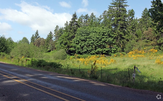
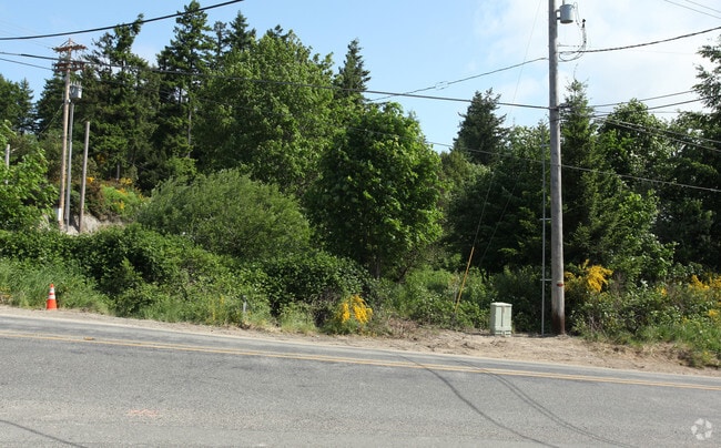
9209 Key Peninsula Hwy Nw, Longbranch, WA 98351

NEARBY LISTINGS FOR SALE OR LEASE
-
-
View all Longbranch listings for sale on LoopNet.com
Property Detail
9209 Key Peninsula Hwy Nw
002101-1044
SECTION 01 TOWNSHIP 21 RANGE 00 QUARTER 12 PARCEL B DBLR 2003-01-31-5001 DESC AS FOLL ALL THAT POR OF S 32.05 ACS OF NE OF NE LY WLY OF VAUGHN GLENCOVE CO RD TOG/W ALL THAT POR OF E 20 RODS OF NW OF NE LY NLY OF VAUGHN GLENCOVE RD & SLY OF LONGBRANCH
Commercialacreage
Pierce
X
Washington
53053C0125E
1.03 AC
2024
Gig Harbor/W Pierce Co
2025
Seattle/Puget Sound
072602
Seattle-Tacoma-Bellevue, WA
DEMOGRAPHICS near 9209 Key Peninsula Hwy Nw
1 Mile
3 Mile
5 Mile
2024 Total Population
585
6,383
18,580
2029 Population
604
6,582
19,343
Pop Growth 2024-2029
+ 3.25%
+ 3.12%
+ 4.11%
Average Age
44
43
44
2024 Total Households
221
2,391
7,090
HH Growth 2024-2029
+ 3.17%
+ 3.14%
+ 4.25%
Median Household Inc
$102,586
$115,438
$118,067
Avg Household Size
2.60
2.60
2.60
2024 Avg HH Vehicles
3.00
3.00
3.00
Median Home Value
$514,706
$513,771
$593,565
Median Year Built
1987
1990
1989
Nearby Places
Map Layers
Map Styles
 Street
 Aerial
- Restaurants
- Banks
- Shops
- Fitness
- Groceries
PUBLIC TRANSPORTATION
AIRPORT
Seattle-Tacoma International
DRIVE
WALK
Distance
Seattle-Tacoma International
67 min
44.5 mi
Freight Ports
Port of Tacoma
DRIVE
WALK
Distance
Port of Tacoma
39 min
26.1 mi
Nearby Properties
Address
Land Use
TOTAL SIZE
Lot Size
Zoning
Address
Land Use
TOTAL SIZE
Lot Size
Zoning
83,592 SF
76.45 AC
RSR
Address
Land Use
TOTAL SIZE
Lot Size
Zoning
58,516 SF
4.82 AC
R10
Address
Land Use
TOTAL SIZE
Lot Size
Zoning
34,375 SF
105.71 AC
PR
Address
Land Use
TOTAL SIZE
Lot Size
Zoning
21,939 SF
5 AC
RAC
Address
Land Use
TOTAL SIZE
Lot Size
Zoning
15,476 SF
2.77 AC
RNC
Address
Land Use
TOTAL SIZE
Lot Size
Zoning
19,755 SF
0.82 AC
RAC
Address
Land Use
TOTAL SIZE
Lot Size
Zoning
13,374 SF
8.17 AC
R10
Address
Land Use
TOTAL SIZE
Lot Size
Zoning
11,719 SF
4.32 AC
R10
Address
Land Use
TOTAL SIZE
Lot Size
Zoning
8,790 SF
1.34 AC
RNC
Address
Land Use
TOTAL SIZE
Lot Size
Zoning
7,162 SF
1.02 AC
RAC
Address
Land Use
TOTAL SIZE
Lot Size
Zoning
5,398 SF
19.68 AC
R10
Address
Land Use
TOTAL SIZE
Lot Size
Zoning
2,612 SF
25.32 AC
Address
Land Use
TOTAL SIZE
Lot Size
Zoning
Address
Land Use
TOTAL SIZE
Lot Size
Zoning
7,497 SF
16.79 AC
ARL
Address
Land Use
TOTAL SIZE
Lot Size
Zoning
13,580 SF
40.46 AC
RF
Address
Land Use
TOTAL SIZE
Lot Size
Zoning
3,456 SF
5.42 AC
RNC
Address
Land Use
TOTAL SIZE
Lot Size
Zoning
7,180 SF
20 AC
RSR
Address
Land Use
TOTAL SIZE
Lot Size
Zoning
5,232 SF
14.22 AC
R10
Address
Land Use
TOTAL SIZE
Lot Size
Zoning
3,968 SF
0.51 AC
RNC
Address
Land Use
TOTAL SIZE
Lot Size
Zoning
23,292 SF
10.06 AC
R10
Address
Land Use
TOTAL SIZE
Lot Size
Zoning
5,018 SF
8.02 AC
RAC
Address
Land Use
TOTAL SIZE
Lot Size
Zoning
616 SF
6.16 AC
R10
Address
Land Use
TOTAL SIZE
Lot Size
Zoning
7,136 SF
19.66 AC
RF
Address
Land Use
TOTAL SIZE
Lot Size
Zoning
614 SF
18.60 AC
R10
Address
Land Use
TOTAL SIZE
Lot Size
Zoning
2,772 SF
6.91 AC
R10
Address
Land Use
TOTAL SIZE
Lot Size
Zoning
160 AC
PR
Address
Land Use
TOTAL SIZE
Lot Size
Zoning
199.16 AC
R10
Address
Land Use
TOTAL SIZE
Lot Size
Zoning
506 SF
9.21 AC
R10
Address
Land Use
TOTAL SIZE
Lot Size
Zoning
2,636 SF
6.35 AC
Address
Land Use
TOTAL SIZE
Lot Size
Zoning
4,365 SF
20 AC
RF
The World's #1 Commercial Real Estate Marketplace
Connect with us
© 2025 CoStar Group
The information above has been obtained from sources believed reliable. While we do not doubt its accuracy we have not verified it and make no guarantee, warranty or representation about it. It is your responsibility to independently confirm its accuracy and completeness. Any projections, opinions, assumptions, or estimates used are for example only and do not represent the current or future performance of the property. The value of this transaction to you depends on tax and other factors which should be evaluated by your tax, financial, and legal advisors. You and your advisors should conduct a careful, independent investigation of the property to determine to your satisfaction the suitability of the property for your needs.