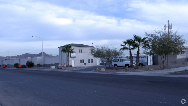
Property Record
921 Olsen St, Henderson, NV 89011


NEARBY LISTINGS FOR SALE OR LEASE
-
-
View all Henderson listings for sale on LoopNet.com
Property Detail
921 Olsen St
Las Vegas-Henderson-North Las Vegas, NV
Parcel Map File 32 Page 17
160-33-401-001
PARCEL MAP FILE 32 PAGE 17 LOT A-111
Publicstorage
Clark
X
Nevada
32003C2605F
a-111
2026
2.19 AC
2026
SE Las Vegas/Henderson
005437
Las Vegas
41,495 SF
DEMOGRAPHICS near 921 Olsen St
1 mile
3 mile
5 mile
2024 Total Population
9,737
47,781
127,114
2029 Population
10,815
52,592
137,706
Pop Growth 2024-2029
+ 11.07%
+ 10.07%
+ 8.33%
Average Age
44
42
41
2024 Total Households
3,732
18,114
48,737
HH Growth 2024-2029
+ 11.28%
+ 10.29%
+ 8.43%
Median Household Inc
$109,395
$79,150
$71,790
Avg Household Size
2.50
2.60
2.50
2024 Avg HH Vehicles
2.00
2.00
2.00
Median Home Value
$461,655
$413,236
$365,560
Median Year Built
2010
2004
1999
Nearby Places
Map Layers
Map Styles
 Street
 Aerial
Transit
 Traffic
 Biking
Places
Listings with unknown addresses are not visible on the map
- Restaurants
- Banks
- Shops
- Fitness
- Groceries
PUBLIC TRANSPORTATION
AIRPORT
Boulder City Municipal
Drive
Walk
Distance
Boulder City Municipal
23 min
13.8 mi
Harry Reid International
Drive
Walk
Distance
Harry Reid International
22 min
16.0 mi
Freight Ports
Port of Long Beach
Drive
Walk
Distance
Port of Long Beach
320 min
284.6 mi
Nearby Properties
Address
Land Use
TOTAL SIZE
Lot Size
Zoning
Address
Land Use
TOTAL SIZE
Lot Size
Zoning
31,463 SF
191.46 AC
PS
Address
Land Use
TOTAL SIZE
Lot Size
Zoning
9,493 SF
15.37 AC
Address
Land Use
TOTAL SIZE
Lot Size
Zoning
350.47 AC
PS
Address
Land Use
TOTAL SIZE
Lot Size
Zoning
10.50 AC
Address
Land Use
TOTAL SIZE
Lot Size
Zoning
81,485 SF
160.06 AC
PS
Address
Land Use
TOTAL SIZE
Lot Size
Zoning
1,635 SF
13.84 AC
CT
Address
Land Use
TOTAL SIZE
Lot Size
Zoning
387,990 SF
22.04 AC
Address
Land Use
TOTAL SIZE
Lot Size
Zoning
9,000 SF
96.81 AC
RE
Address
Land Use
TOTAL SIZE
Lot Size
Zoning
40,031 SF
21.25 AC
Address
Land Use
TOTAL SIZE
Lot Size
Zoning
19,753 SF
10.21 AC
DP
Address
Land Use
TOTAL SIZE
Lot Size
Zoning
3,664 SF
16.09 AC
RH20
Address
Land Use
TOTAL SIZE
Lot Size
Zoning
14,463 SF
19.48 AC
Address
Land Use
TOTAL SIZE
Lot Size
Zoning
136,465 SF
34.67 AC
Address
Land Use
TOTAL SIZE
Lot Size
Zoning
170,646 SF
18.16 AC
H:IG-RD
Address
Land Use
TOTAL SIZE
Lot Size
Zoning
3,085 SF
2.51 AC
Address
Land Use
TOTAL SIZE
Lot Size
Zoning
124,900 SF
5.45 AC
Address
Land Use
TOTAL SIZE
Lot Size
Zoning
83,313 SF
7.79 AC
Address
Land Use
TOTAL SIZE
Lot Size
Zoning
2,540 SF
3.82 AC
CT-G-MP
Address
Land Use
TOTAL SIZE
Lot Size
Zoning
45.08 AC
Address
Land Use
TOTAL SIZE
Lot Size
Zoning
16,240 SF
28.09 AC
Address
Land Use
TOTAL SIZE
Lot Size
Zoning
320 AC
DH
Address
Land Use
TOTAL SIZE
Lot Size
Zoning
123,673 SF
12.23 AC
Address
Land Use
TOTAL SIZE
Lot Size
Zoning
48,511 SF
13.98 AC
Address
Land Use
TOTAL SIZE
Lot Size
Zoning
254,758 SF
10.21 AC
RH36
Address
Land Use
TOTAL SIZE
Lot Size
Zoning
92,070 SF
6.51 AC
Address
Land Use
TOTAL SIZE
Lot Size
Zoning
89.77 AC
DH
Address
Land Use
TOTAL SIZE
Lot Size
Zoning
23.97 AC
Address
Land Use
TOTAL SIZE
Lot Size
Zoning
2,989 SF
4.98 AC
PS
The World's #1 Commercial Real Estate Marketplace
Connect with us
© 2026 CoStar Group
The information above has been obtained from sources believed reliable. While we do not doubt its accuracy we have not verified it and make no guarantee, warranty or representation about it. It is your responsibility to independently confirm its accuracy and completeness. Any projections, opinions, assumptions, or estimates used are for example only and do not represent the current or future performance of the property. The value of this transaction to you depends on tax and other factors which should be evaluated by your tax, financial, and legal advisors. You and your advisors should conduct a careful, independent investigation of the property to determine to your satisfaction the suitability of the property for your needs.