Property Record
9212 State Route 5 And 20, Bloomfield, NY 14469

NEARBY LISTINGS FOR SALE OR LEASE
-
-
View all Bloomfield listings for sale on LoopNet.com
Property Detail
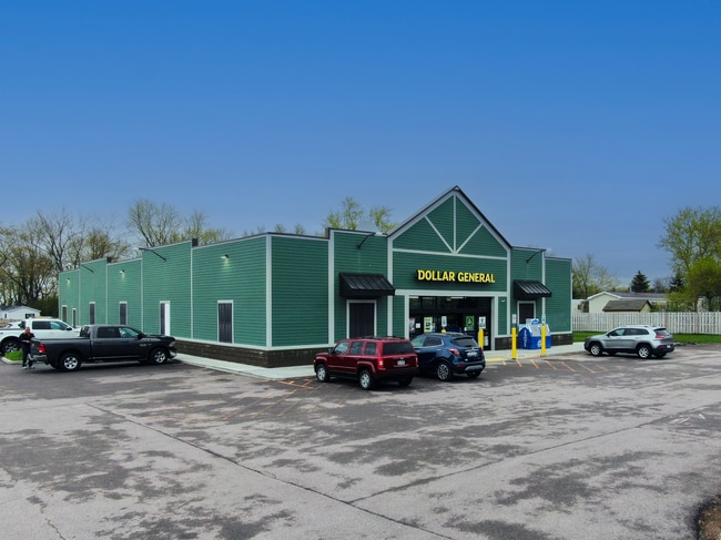
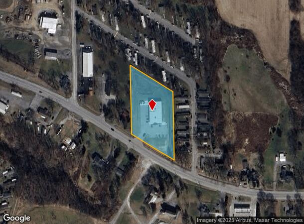
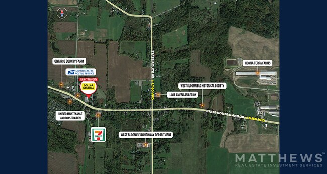
9212 State Route 5 And 20
Rochester, NY
3 ACRES
325000-065-009-0001-004-100
Ontario
Storebuilding
New York
2025
4.100
2024
2.70 AC
050502
Outlying Ontario County
9,100 SF
Rochester
DEMOGRAPHICS near 9212 State Route 5 And 20
1 Mile
3 Mile
5 Mile
2024 Total Population
815
2,497
11,322
2029 Population
787
2,432
11,167
Pop Growth 2024-2029
(3.44%)
(2.60%)
(1.37%)
Average Age
46
44
43
2024 Total Households
356
1,048
4,727
HH Growth 2024-2029
(3.65%)
(2.77%)
(1.40%)
Median Household Inc
$66,458
$75,840
$81,961
Avg Household Size
2.30
2.40
2.40
2024 Avg HH Vehicles
2.00
2.00
2.00
Median Home Value
$193,420
$205,059
$210,824
Median Year Built
1975
1974
1974
Nearby Places
- Restaurants
- Banks
- Shops
- Fitness
- Groceries
PUBLIC TRANSPORTATION
AIRPORT
Frederick Douglass/Greater Rochester International
DRIVE
WALK
Distance
Frederick Douglass/Greater Rochester International
38 min
25.8 mi
SALE & LEASE HISTORY
LISTING DATE
SALE/LEASE

May 12, 2022
For Sale
Apr 07, 2023
For Sale
Nearby Properties
Address
Land Use
TOTAL SIZE
Lot Size
Zoning
Address
Land Use
TOTAL SIZE
Lot Size
Zoning
Address
Land Use
TOTAL SIZE
Lot Size
Zoning
1,716 SF
59.30 AC
Address
Land Use
TOTAL SIZE
Lot Size
Zoning
Address
Land Use
TOTAL SIZE
Lot Size
Zoning
783 SF
8.01 AC
08 - GOVER
Address
Land Use
TOTAL SIZE
Lot Size
Zoning
720 SF
36.70 AC
Address
Land Use
TOTAL SIZE
Lot Size
Zoning
Address
Land Use
TOTAL SIZE
Lot Size
Zoning
426 AC
04 - FARM
Address
Land Use
TOTAL SIZE
Lot Size
Zoning
28,720 SF
12.60 AC
06 - INDUS
Address
Land Use
TOTAL SIZE
Lot Size
Zoning
226 AC
04 - FARM
Address
Land Use
TOTAL SIZE
Lot Size
Zoning
19.65 AC
06 - INDUS
Address
Land Use
TOTAL SIZE
Lot Size
Zoning
Address
Land Use
TOTAL SIZE
Lot Size
Zoning
54.90 AC
04 - FARM
Address
Land Use
TOTAL SIZE
Lot Size
Zoning
251 AC
04 - FARM
Address
Land Use
TOTAL SIZE
Lot Size
Zoning
138.60 AC
04 - FARM
Address
Land Use
TOTAL SIZE
Lot Size
Zoning
15.81 AC
04 - FARM
Address
Land Use
TOTAL SIZE
Lot Size
Zoning
189.40 AC
04 - FARM
Address
Land Use
TOTAL SIZE
Lot Size
Zoning
Address
Land Use
TOTAL SIZE
Lot Size
Zoning
194.10 AC
04 - FARM
Address
Land Use
TOTAL SIZE
Lot Size
Zoning
Address
Land Use
TOTAL SIZE
Lot Size
Zoning
2,808 SF
1 AC
Address
Land Use
TOTAL SIZE
Lot Size
Zoning
106.40 AC
04 - FARM
Address
Land Use
TOTAL SIZE
Lot Size
Zoning
350 SF
0.23 AC
Address
Land Use
TOTAL SIZE
Lot Size
Zoning
181.61 AC
04 - FARM
Address
Land Use
TOTAL SIZE
Lot Size
Zoning
4,698 SF
7.24 AC
01 - NOT Z
Address
Land Use
TOTAL SIZE
Lot Size
Zoning
1,822 SF
1.20 AC
01 - NOT Z
Address
Land Use
TOTAL SIZE
Lot Size
Zoning
150.90 AC
04 - FARM
Address
Land Use
TOTAL SIZE
Lot Size
Zoning
140.10 AC
04 - FARM
Address
Land Use
TOTAL SIZE
Lot Size
Zoning
4,240 SF
95.60 AC
04
Address
Land Use
TOTAL SIZE
Lot Size
Zoning
92.90 AC
04 - FARM
The World's #1 Commercial Real Estate Marketplace
Connect with us
© 2025 CoStar Group
The information above has been obtained from sources believed reliable. While we do not doubt its accuracy we have not verified it and make no guarantee, warranty or representation about it. It is your responsibility to independently confirm its accuracy and completeness. Any projections, opinions, assumptions, or estimates used are for example only and do not represent the current or future performance of the property. The value of this transaction to you depends on tax and other factors which should be evaluated by your tax, financial, and legal advisors. You and your advisors should conduct a careful, independent investigation of the property to determine to your satisfaction the suitability of the property for your needs.