Property Record
923 Dana Dr, Redding, CA 96003

Save to a Folder
{{folder.Name}}
{{folder.ListingIds.length}} Properties
{{folder.ListingIds.length}} Property
Create a New Folder
Property Detail
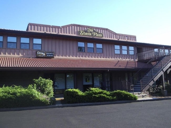
923 Dana Dr
Medicalbuilding
Shasta
B and X Area of moderate flood hazard, usually the area between the limits of the 100-year and 500-year floods.
California
2025
0.86 AC
2026
Other Market Areas
010300
Redding, CA
13,284 SF
107-290-007-000
NEARBY LISTINGS FOR SALE OR LEASE
DEMOGRAPHICS near 923 Dana Dr
1 mile
3 mile
5 mile
2025 Total Population
8,518
66,301
103,436
2030 Population
8,538
66,547
103,882
Pop Growth 2025-2030
+ 0.23%
+ 0.37%
+ 0.43%
Average Age
38
40
41
2025 Total Households
3,549
27,188
41,424
HH Growth 2025-2030
+ 0.17%
+ 0.38%
+ 0.44%
Median Household Inc
$71,036
$69,653
$77,046
Avg Household Size
2.30
2.30
2.40
2025 Avg HH Vehicles
2.00
2.00
2.00
Median Home Value
$376,414
$356,873
$382,090
Median Year Built
1985
1981
1983
Nearby Places
Map Layers
Map Styles
 Street
 Aerial
Layers
 Traffic
 Biking
Places
Listings with unknown addresses are not visible on the map
- Restaurants
- Banks
- Shops
- Fitness
- Groceries
PUBLIC TRANSPORTATION
COMMUTER RAIL
Drive
Walk
Distance
5 min
2.4 mi
AIRPORT
Redding Regional
Drive
Walk
Distance
Redding Regional
12 min
7.4 mi
SALE & LEASE HISTORY
LISTING DATE
SALE/LEASE

Jun 19, 2018
For Sale
Nearby Properties
Address
Land Use
TOTAL SIZE
Lot Size
Zoning
Address
Land Use
TOTAL SIZE
Lot Size
Zoning
15.20 AC
Address
Land Use
TOTAL SIZE
Lot Size
Zoning
2.60 AC
Address
Land Use
TOTAL SIZE
Lot Size
Zoning
208,310 SF
5.98 AC
Address
Land Use
TOTAL SIZE
Lot Size
Zoning
6.36 AC
Address
Land Use
TOTAL SIZE
Lot Size
Zoning
1,016 SF
14.35 AC
Address
Land Use
TOTAL SIZE
Lot Size
Zoning
Address
Land Use
TOTAL SIZE
Lot Size
Zoning
39.85 AC
Address
Land Use
TOTAL SIZE
Lot Size
Zoning
140.36 AC
Address
Land Use
TOTAL SIZE
Lot Size
Zoning
72,875 SF
3.93 AC
Address
Land Use
TOTAL SIZE
Lot Size
Zoning
31,365 SF
1.33 AC
Address
Land Use
TOTAL SIZE
Lot Size
Zoning
223,579 SF
19.65 AC
Address
Land Use
TOTAL SIZE
Lot Size
Zoning
4.10 AC
Address
Land Use
TOTAL SIZE
Lot Size
Zoning
89,098 SF
7.24 AC
Address
Land Use
TOTAL SIZE
Lot Size
Zoning
71,621 SF
8.22 AC
Address
Land Use
TOTAL SIZE
Lot Size
Zoning
21,089 SF
7 AC
Address
Land Use
TOTAL SIZE
Lot Size
Zoning
47,062 SF
4.80 AC
Address
Land Use
TOTAL SIZE
Lot Size
Zoning
73,000 SF
4.40 AC
Address
Land Use
TOTAL SIZE
Lot Size
Zoning
143,164 SF
13.90 AC
Address
Land Use
TOTAL SIZE
Lot Size
Zoning
54,720 SF
2.53 AC
Address
Land Use
TOTAL SIZE
Lot Size
Zoning
19,572 SF
5.94 AC
Address
Land Use
TOTAL SIZE
Lot Size
Zoning
31,526 SF
55.92 AC
Address
Land Use
TOTAL SIZE
Lot Size
Zoning
5.44 AC
Address
Land Use
TOTAL SIZE
Lot Size
Zoning
95,645 SF
9.55 AC
Address
Land Use
TOTAL SIZE
Lot Size
Zoning
61,754 SF
1.73 AC
Address
Land Use
TOTAL SIZE
Lot Size
Zoning
92,699 SF
5.91 AC
Address
Land Use
TOTAL SIZE
Lot Size
Zoning
1,500 SF
69.70 AC
Address
Land Use
TOTAL SIZE
Lot Size
Zoning
8,200 SF
55.72 AC
Address
Land Use
TOTAL SIZE
Lot Size
Zoning
10.27 AC
Address
Land Use
TOTAL SIZE
Lot Size
Zoning
104,740 SF
23.54 AC
Address
Land Use
TOTAL SIZE
Lot Size
Zoning
134,868 SF
0.57 AC
The World's #1 Commercial Real Estate Marketplace
Connect with us
© 2026 CoStar Group
The information above has been obtained from sources believed reliable. While we do not doubt its accuracy we have not verified it and make no guarantee, warranty or representation about it. It is your responsibility to independently confirm its accuracy and completeness. Any projections, opinions, assumptions, or estimates used are for example only and do not represent the current or future performance of the property. The value of this transaction to you depends on tax and other factors which should be evaluated by your tax, financial, and legal advisors. You and your advisors should conduct a careful, independent investigation of the property to determine to your satisfaction the suitability of the property for your needs.