Property Record
915 W State St, Trenton, OH 45067
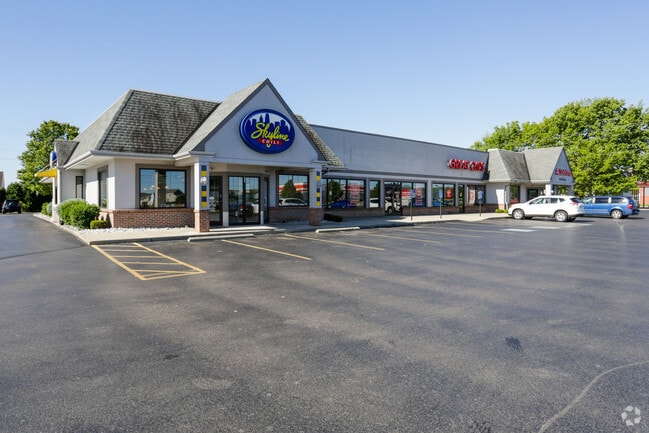

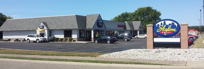
Property Detail
915 W State St
Cincinnati, OH-KY-IN
2002 ENT
R8000-031-000-001
BUTLER
Regionalshoppingcenterormallwithanchorstore
Ohio
B and X Area of moderate flood hazard, usually the area between the limits of the 100-year and 500-year floods.
2002
2024
1.46 AC
2025
Butler County
015100
Cincinnati/Dayton
11,469 SF
NEARBY LISTINGS FOR SALE OR LEASE
DEMOGRAPHICS near 915 W State St
1 mile
3 mile
5 mile
2025 Total Population
7,294
16,866
56,865
2030 Population
7,445
17,299
58,670
Pop Growth 2025-2030
+ 2.07%
+ 2.57%
+ 3.17%
Average Age
37
37
38
2025 Total Households
2,632
6,008
20,332
HH Growth 2025-2030
+ 2.09%
+ 2.60%
+ 3.18%
Median Household Inc
$96,025
$87,359
$78,320
Avg Household Size
2.80
2.80
2.70
2025 Avg HH Vehicles
2.00
2.00
2.00
Median Home Value
$235,945
$236,393
$259,863
Median Year Built
1989
1978
1975
Nearby Places
Map Layers
Map Styles
 Street
 Aerial
Layers
 Traffic
 Biking
Places
Listings with unknown addresses are not visible on the map
- Restaurants
- Banks
- Shops
- Fitness
- Groceries
PUBLIC TRANSPORTATION
AIRPORT
James M Cox Dayton International
Drive
Walk
Distance
James M Cox Dayton International
62 min
43.7 mi
Cincinnati/Northern Kentucky International
Drive
Walk
Distance
Cincinnati/Northern Kentucky International
77 min
48.0 mi
SALE & LEASE HISTORY
LISTING DATE
SALE/LEASE

Sep 26, 2016
For Lease
May 10, 2017
For Lease
Nearby Properties
Address
Land Use
TOTAL SIZE
Lot Size
Zoning
Address
Land Use
TOTAL SIZE
Lot Size
Zoning
14,558 SF
26.81 AC
Address
Land Use
TOTAL SIZE
Lot Size
Zoning
1,132,754 SF
443.17 AC
Address
Land Use
TOTAL SIZE
Lot Size
Zoning
342,520 SF
50.74 AC
Address
Land Use
TOTAL SIZE
Lot Size
Zoning
2,592 SF
49.96 AC
Address
Land Use
TOTAL SIZE
Lot Size
Zoning
119.02 AC
Address
Land Use
TOTAL SIZE
Lot Size
Zoning
342,520 SF
50.74 AC
Address
Land Use
TOTAL SIZE
Lot Size
Zoning
343,394 SF
4.51 AC
Address
Land Use
TOTAL SIZE
Lot Size
Zoning
15,160 SF
49.30 AC
Address
Land Use
TOTAL SIZE
Lot Size
Zoning
200,384 SF
119.02 AC
Address
Land Use
TOTAL SIZE
Lot Size
Zoning
192.22 AC
Address
Land Use
TOTAL SIZE
Lot Size
Zoning
23.03 AC
Address
Land Use
TOTAL SIZE
Lot Size
Zoning
151,839 SF
1.68 AC
Address
Land Use
TOTAL SIZE
Lot Size
Zoning
181.80 AC
Address
Land Use
TOTAL SIZE
Lot Size
Zoning
2,998 SF
98.96 AC
Address
Land Use
TOTAL SIZE
Lot Size
Zoning
78,720 SF
38.02 AC
Address
Land Use
TOTAL SIZE
Lot Size
Zoning
4,320 SF
19.95 AC
Address
Land Use
TOTAL SIZE
Lot Size
Zoning
67,159 SF
6.56 AC
Address
Land Use
TOTAL SIZE
Lot Size
Zoning
12.50 AC
Address
Land Use
TOTAL SIZE
Lot Size
Zoning
13,404 SF
2.11 AC
Address
Land Use
TOTAL SIZE
Lot Size
Zoning
42,000 SF
13.64 AC
Address
Land Use
TOTAL SIZE
Lot Size
Zoning
4,268 SF
2.90 AC
Address
Land Use
TOTAL SIZE
Lot Size
Zoning
24,000 SF
12.97 AC
Address
Land Use
TOTAL SIZE
Lot Size
Zoning
9,897 SF
4.72 AC
Address
Land Use
TOTAL SIZE
Lot Size
Zoning
33,826 SF
6 AC
Address
Land Use
TOTAL SIZE
Lot Size
Zoning
5,433 SF
49.20 AC
Address
Land Use
TOTAL SIZE
Lot Size
Zoning
13,404 SF
0.85 AC
Address
Land Use
TOTAL SIZE
Lot Size
Zoning
14,853 SF
2.22 AC
Address
Land Use
TOTAL SIZE
Lot Size
Zoning
6,590 SF
7.07 AC
Address
Land Use
TOTAL SIZE
Lot Size
Zoning
2.29 AC
ADV
Address
Land Use
TOTAL SIZE
Lot Size
Zoning
76.20 AC
The World's #1 Commercial Real Estate Marketplace
Connect with us
© 2026 CoStar Group
The information above has been obtained from sources believed reliable. While we do not doubt its accuracy we have not verified it and make no guarantee, warranty or representation about it. It is your responsibility to independently confirm its accuracy and completeness. Any projections, opinions, assumptions, or estimates used are for example only and do not represent the current or future performance of the property. The value of this transaction to you depends on tax and other factors which should be evaluated by your tax, financial, and legal advisors. You and your advisors should conduct a careful, independent investigation of the property to determine to your satisfaction the suitability of the property for your needs.