Property Record
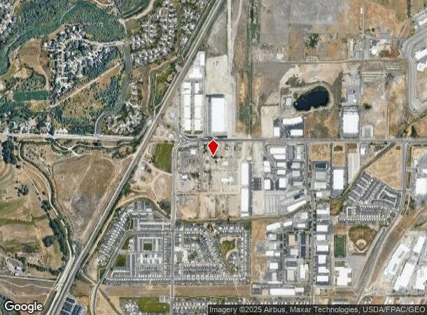
924 W 14600 S, Bluffdale, UT 84065

NEARBY LISTINGS FOR SALE OR LEASE
Property Detail
924 W 14600 S
33-11-200-036-0000
BEG N 8928 05 E 509.77 FT & N 0013 53 E 1178.56 FT FR THE CEN OF SEC 11, T4S, R1W, SLM; N 01352 E 579.99 FT TO RAILROAD; N 281944 E 1764.73 FT; S 01237 W 648.51 FT; S 895340 W 132.43 FT; S 10641 E 1327.29 FT; S 02007W 1158.33 FT; N 881629 W 168.93 FT
Industrialacreage
Salt Lake
X
Utah
49035C0581H
26.19 AC
2022
Draper
2022
Salt Lake City
112827
Salt Lake City, UT
DEMOGRAPHICS near 924 W 14600 S
1 Mile
3 Mile
5 Mile
2024 Total Population
8,321
60,184
172,290
2029 Population
8,670
62,315
181,133
Pop Growth 2024-2029
+ 4.19%
+ 3.54%
+ 5.13%
Average Age
28
34
34
2024 Total Households
2,388
17,378
50,500
HH Growth 2024-2029
+ 4.10%
+ 3.61%
+ 5.12%
Median Household Inc
$97,117
$109,725
$112,863
Avg Household Size
3.50
3.30
3.30
2024 Avg HH Vehicles
2.00
2.00
2.00
Median Home Value
$588,207
$633,850
$623,152
Median Year Built
2011
2007
2006
Nearby Places
Map Layers
Map Styles
 Street
 Aerial
- Restaurants
- Banks
- Shops
- Fitness
- Groceries
PUBLIC TRANSPORTATION
COMMUTER RAIL
Draper Station (FrontRunner - Utah Transit Authority (UTA))
DRIVE
WALK
Distance
Draper Station (FrontRunner - Utah Transit Authority (UTA))
9 min
4.2 mi
Lehi Station (FrontRunner - Utah Transit Authority (UTA))
DRIVE
WALK
Distance
Lehi Station (FrontRunner - Utah Transit Authority (UTA))
11 min
6.2 mi
AIRPORT
Salt Lake City International
DRIVE
WALK
Distance
Salt Lake City International
32 min
25.9 mi
Provo Municipal
DRIVE
WALK
Distance
Provo Municipal
37 min
26.9 mi
Freight Ports
Port of Stockton
DRIVE
WALK
Distance
Port of Stockton
732 min
716.3 mi
SALE & LEASE HISTORY
LISTING DATE
SALE/LEASE

Oct 26, 2021
For Lease
May 11, 2017
For Lease
Dec 05, 2024
For Lease
Nearby Properties
Address
Land Use
TOTAL SIZE
Lot Size
Zoning
Address
Land Use
TOTAL SIZE
Lot Size
Zoning
161,466 SF
624.79 AC
M-1
Address
Land Use
TOTAL SIZE
Lot Size
Zoning
40,495 SF
33.28 AC
RM-1
Address
Land Use
TOTAL SIZE
Lot Size
Zoning
774,515 SF
87.50 AC
M-1
Address
Land Use
TOTAL SIZE
Lot Size
Zoning
1,055,572 SF
8.31 AC
CR
Address
Land Use
TOTAL SIZE
Lot Size
Zoning
210,421 SF
6.87 AC
CR
Address
Land Use
TOTAL SIZE
Lot Size
Zoning
423,208 SF
8.07 AC
CSD-H
Address
Land Use
TOTAL SIZE
Lot Size
Zoning
359,628 SF
4.53 AC
TSD
Address
Land Use
TOTAL SIZE
Lot Size
Zoning
187,621 SF
3.64 AC
1103
Address
Land Use
TOTAL SIZE
Lot Size
Zoning
99,144 SF
6.23 AC
HC
Address
Land Use
TOTAL SIZE
Lot Size
Zoning
65,664 SF
16.47 AC
RM2
Address
Land Use
TOTAL SIZE
Lot Size
Zoning
391,078 SF
5.78 AC
IC
Address
Land Use
TOTAL SIZE
Lot Size
Zoning
416,562 SF
7.48 AC
CSDDPM
Address
Land Use
TOTAL SIZE
Lot Size
Zoning
81,925 SF
10.13 AC
MU
Address
Land Use
TOTAL SIZE
Lot Size
Zoning
115,637 SF
36.38 AC
TSD
Address
Land Use
TOTAL SIZE
Lot Size
Zoning
374,097 SF
6.87 AC
CSDDPM
Address
Land Use
TOTAL SIZE
Lot Size
Zoning
130,809 SF
16.13 AC
RM 1
Address
Land Use
TOTAL SIZE
Lot Size
Zoning
247,899 SF
9.20 AC
TSD
Address
Land Use
TOTAL SIZE
Lot Size
Zoning
296,237 SF
6.45 AC
TSD
Address
Land Use
TOTAL SIZE
Lot Size
Zoning
353,500 SF
29.38 AC
CR
Address
Land Use
TOTAL SIZE
Lot Size
Zoning
255,090 SF
17.91 AC
CSDDRC
Address
Land Use
TOTAL SIZE
Lot Size
Zoning
408,208 SF
5.20 AC
DC
Address
Land Use
TOTAL SIZE
Lot Size
Zoning
76,420 SF
14.22 AC
RM-2
Address
Land Use
TOTAL SIZE
Lot Size
Zoning
335,803 SF
8.63 AC
C-D
Address
Land Use
TOTAL SIZE
Lot Size
Zoning
249.04 AC
OS
Address
Land Use
TOTAL SIZE
Lot Size
Zoning
53,777 SF
229.36 AC
SF-1
Address
Land Use
TOTAL SIZE
Lot Size
Zoning
179,860 SF
11.50 AC
M-1
Address
Land Use
TOTAL SIZE
Lot Size
Zoning
193.06 AC
1115
Address
Land Use
TOTAL SIZE
Lot Size
Zoning
255,928 SF
14.90 AC
M-1
Address
Land Use
TOTAL SIZE
Lot Size
Zoning
207,380 SF
5.29 AC
CR
Address
Land Use
TOTAL SIZE
Lot Size
Zoning
186,398 SF
8.57 AC
CSD
The World's #1 Commercial Real Estate Marketplace
Connect with us
© 2025 CoStar Group
The information above has been obtained from sources believed reliable. While we do not doubt its accuracy we have not verified it and make no guarantee, warranty or representation about it. It is your responsibility to independently confirm its accuracy and completeness. Any projections, opinions, assumptions, or estimates used are for example only and do not represent the current or future performance of the property. The value of this transaction to you depends on tax and other factors which should be evaluated by your tax, financial, and legal advisors. You and your advisors should conduct a careful, independent investigation of the property to determine to your satisfaction the suitability of the property for your needs.