Property Record
909 3Rd St, Sacramento, CA 95814


NEARBY LISTINGS FOR SALE OR LEASE
-
-
View all Sacramento listings for sale on LoopNet.com
Property Detail
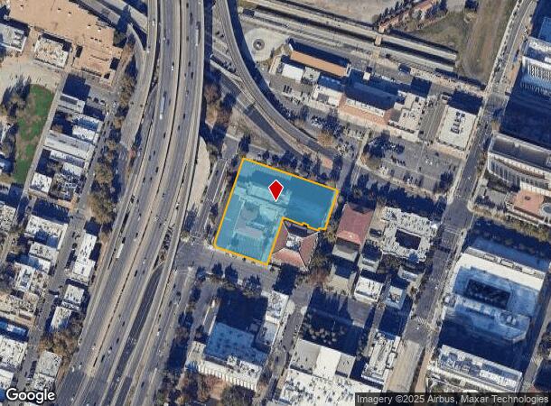
909 3Rd St
Sacramento-Roseville-Folsom, CA
Parcel Map
006-0024-053
PARCEL MAP, LOT A
Motel
Sacramento
X
California
06067C0160J
a
2024
1.86 AC
2025
Sacramento CBD
000700
Sacramento
41,338 SF
DEMOGRAPHICS near 909 3Rd St
1 mile
3 mile
5 mile
2024 Total Population
19,206
150,977
339,646
2029 Population
19,687
153,105
343,983
Pop Growth 2024-2029
+ 2.50%
+ 1.41%
+ 1.28%
Average Age
39
39
38
2024 Total Households
9,280
65,151
134,599
HH Growth 2024-2029
+ 2.96%
+ 1.64%
+ 1.39%
Median Household Inc
$52,202
$75,070
$72,521
Avg Household Size
1.70
2.10
2.40
2024 Avg HH Vehicles
1.00
2.00
2.00
Median Home Value
$514,683
$537,336
$482,652
Median Year Built
1976
1969
1970
Nearby Places
Map Layers
Map Styles
 Street
 Aerial
Transit
 Traffic
 Biking
Places
Listings with unknown addresses are not visible on the map
- Restaurants
- Banks
- Shops
- Fitness
- Groceries
PUBLIC TRANSPORTATION
TRANSIT/SUBWAY
Sacramento Valley Station (Gold Line - Sacramento Regional Transit District Light Rail (The RT))
Drive
Walk
Distance
Sacramento Valley Station (Gold Line - Sacramento Regional Transit District Light Rail (The RT))
2 min
5 min
0.2 mi
7th & I/County Center (Gold Line - Sacramento Regional Transit District Light Rail (The RT))
Drive
Walk
Distance
7th & I/County Center (Gold Line - Sacramento Regional Transit District Light Rail (The RT))
2 min
7 min
0.4 mi
8th & K (Gold Line - Sacramento Regional Transit District Light Rail (The RT))
Drive
Walk
Distance
8th & K (Gold Line - Sacramento Regional Transit District Light Rail (The RT))
3 min
10 min
0.5 mi
7th & Capitol (Blue Line - Sacramento Regional Transit District Light Rail (The RT), Gold Line - Sacramento Regional Transit District Light Rail (The RT))
Drive
Walk
Distance
7th & Capitol (Blue Line - Sacramento Regional Transit District Light Rail (The RT), Gold Line - Sacramento Regional Transit District Light Rail (The RT))
2 min
11 min
0.6 mi
COMMUTER RAIL
Drive
Walk
Distance
2 min
3 min
0.1 mi
AIRPORT
Sacramento International
Drive
Walk
Distance
Sacramento International
17 min
11.1 mi
Freight Ports
Port of Stockton
Drive
Walk
Distance
Port of Stockton
55 min
47.0 mi
Nearby Properties
Address
Land Use
TOTAL SIZE
Lot Size
Zoning
Address
Land Use
TOTAL SIZE
Lot Size
Zoning
1,095,507 SF
1.39 AC
H-SPD C-2-
Address
Land Use
TOTAL SIZE
Lot Size
Zoning
5.64 AC
C-3-SPD
Address
Land Use
TOTAL SIZE
Lot Size
Zoning
10.28 AC
H
Address
Land Use
TOTAL SIZE
Lot Size
Zoning
487,483 SF
1.12 AC
C-3-SPD
Address
Land Use
TOTAL SIZE
Lot Size
Zoning
756,831 SF
1.39 AC
C-2-SPD
Address
Land Use
TOTAL SIZE
Lot Size
Zoning
399,626 SF
2.41 AC
C-3-SPD
Address
Land Use
TOTAL SIZE
Lot Size
Zoning
366,730 SF
0.89 AC
C-3-SPD
Address
Land Use
TOTAL SIZE
Lot Size
Zoning
200,616 SF
2.54 AC
C-2-SPD
Address
Land Use
TOTAL SIZE
Lot Size
Zoning
594,942 SF
2.39 AC
C-3-SPD
Address
Land Use
TOTAL SIZE
Lot Size
Zoning
676,447 SF
1.43 AC
C-3-SPD
Address
Land Use
TOTAL SIZE
Lot Size
Zoning
193,521 SF
0.60 AC
C-3-SPD
Address
Land Use
TOTAL SIZE
Lot Size
Zoning
339,329 SF
6.40 AC
R-5-PUD-SP
Address
Land Use
TOTAL SIZE
Lot Size
Zoning
365,988 SF
4.25 AC
C-2-SPD
Address
Land Use
TOTAL SIZE
Lot Size
Zoning
213,557 SF
2.33 AC
C-3-SPD
Address
Land Use
TOTAL SIZE
Lot Size
Zoning
0.65 AC
C-4-SPD
Address
Land Use
TOTAL SIZE
Lot Size
Zoning
467,970 SF
4.59 AC
W-F
Address
Land Use
TOTAL SIZE
Lot Size
Zoning
410,420 SF
0.95 AC
C-3-SPD
Address
Land Use
TOTAL SIZE
Lot Size
Zoning
320,072 SF
2.65 AC
C-2
Address
Land Use
TOTAL SIZE
Lot Size
Zoning
318,616 SF
16.40 AC
R-2B-PUD
Address
Land Use
TOTAL SIZE
Lot Size
Zoning
R-4-PUD C-
Address
Land Use
TOTAL SIZE
Lot Size
Zoning
0.13 AC
WF
Address
Land Use
TOTAL SIZE
Lot Size
Zoning
26,712 SF
1.90 AC
R-5-PUD-SP
Address
Land Use
TOTAL SIZE
Lot Size
Zoning
26,712 SF
1.85 AC
R-5-PUD-SP
Address
Land Use
TOTAL SIZE
Lot Size
Zoning
2.88 AC
C-3-SPD
Address
Land Use
TOTAL SIZE
Lot Size
Zoning
508,916 SF
0.71 AC
C-3-SPD
Address
Land Use
TOTAL SIZE
Lot Size
Zoning
303,254 SF
10.63 AC
OB-PUD
Address
Land Use
TOTAL SIZE
Lot Size
Zoning
246,417 SF
1.19 AC
C-3-SPD
Address
Land Use
TOTAL SIZE
Lot Size
Zoning
405,074 SF
2.39 AC
C-3-SPD
Address
Land Use
TOTAL SIZE
Lot Size
Zoning
119,055 SF
1.18 AC
C-2-SPD
Address
Land Use
TOTAL SIZE
Lot Size
Zoning
383,000 SF
25.52 AC
M-1
The World's #1 Commercial Real Estate Marketplace
Connect with us
© 2026 CoStar Group
The information above has been obtained from sources believed reliable. While we do not doubt its accuracy we have not verified it and make no guarantee, warranty or representation about it. It is your responsibility to independently confirm its accuracy and completeness. Any projections, opinions, assumptions, or estimates used are for example only and do not represent the current or future performance of the property. The value of this transaction to you depends on tax and other factors which should be evaluated by your tax, financial, and legal advisors. You and your advisors should conduct a careful, independent investigation of the property to determine to your satisfaction the suitability of the property for your needs.