Property Record
9250 Sliding Hill Rd, Ashland, VA 23005

NEARBY LISTINGS FOR SALE OR LEASE
Property Detail
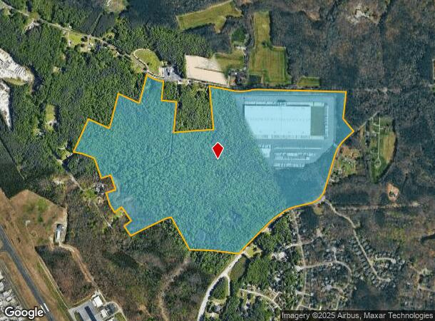
9250 Sliding Hill Rd
Richmond, VA
Wegmans Dist Ctr
7798-54-5903
WEGMANS DIST CTR BLK A
Commercialnec
Hanover
X
Virginia
51085C0310C
210.61 AC
2025
I-95 North/Chamberlayne
2025
Richmond VA
320602
DEMOGRAPHICS near 9250 Sliding Hill Rd
1 Mile
3 Mile
5 Mile
2024 Total Population
2,026
17,750
53,064
2029 Population
2,133
18,894
56,276
Pop Growth 2024-2029
+ 5.28%
+ 6.45%
+ 6.05%
Average Age
41
40
40
2024 Total Households
702
6,358
19,769
HH Growth 2024-2029
+ 5.41%
+ 6.78%
+ 6.08%
Median Household Inc
$129,918
$121,816
$96,442
Avg Household Size
2.90
2.80
2.60
2024 Avg HH Vehicles
3.00
2.00
2.00
Median Home Value
$353,731
$349,167
$332,391
Median Year Built
1992
1994
1994
Nearby Places
Map Layers
Map Styles
 Street
 Aerial
- Restaurants
- Banks
- Shops
- Fitness
- Groceries
PUBLIC TRANSPORTATION
COMMUTER RAIL
Ashland Amtrak (Northeast Regional - Amtrak)
DRIVE
WALK
Distance
Ashland Amtrak (Northeast Regional - Amtrak)
11 min
6.2 mi
AIRPORT
Richmond International
DRIVE
WALK
Distance
Richmond International
33 min
23.4 mi
Freight Ports
Virginia Port Authority - Richmond
DRIVE
WALK
Distance
Virginia Port Authority - Richmond
34 min
23.1 mi
SALE & LEASE HISTORY
LISTING DATE
SALE/LEASE

Sep 24, 2016
For Sale
Nov 04, 2016
For Sale
Nov 02, 2016
For Sale
Dec 14, 2016
For Sale
Nearby Properties
Address
Land Use
TOTAL SIZE
Lot Size
Zoning
Address
Land Use
TOTAL SIZE
Lot Size
Zoning
95.24 AC
A-1
Address
Land Use
TOTAL SIZE
Lot Size
Zoning
186,034 SF
13.86 AC
B-3C
Address
Land Use
TOTAL SIZE
Lot Size
Zoning
34.69 AC
A-1
Address
Land Use
TOTAL SIZE
Lot Size
Zoning
43.49 AC
M-2
Address
Land Use
TOTAL SIZE
Lot Size
Zoning
59.30 AC
M-2
Address
Land Use
TOTAL SIZE
Lot Size
Zoning
50.20 AC
M-2
Address
Land Use
TOTAL SIZE
Lot Size
Zoning
2,952 SF
20.87 AC
RM
Address
Land Use
TOTAL SIZE
Lot Size
Zoning
320,540 SF
18.50 AC
M-2
Address
Land Use
TOTAL SIZE
Lot Size
Zoning
159,432 SF
14 AC
R-5
Address
Land Use
TOTAL SIZE
Lot Size
Zoning
142,140 SF
10.01 AC
R-5
Address
Land Use
TOTAL SIZE
Lot Size
Zoning
21 AC
M-2
Address
Land Use
TOTAL SIZE
Lot Size
Zoning
293,114 SF
15.56 AC
M-2
Address
Land Use
TOTAL SIZE
Lot Size
Zoning
25.93 AC
M-2
Address
Land Use
TOTAL SIZE
Lot Size
Zoning
24.80 AC
M-2
Address
Land Use
TOTAL SIZE
Lot Size
Zoning
24.17 AC
M-1
Address
Land Use
TOTAL SIZE
Lot Size
Zoning
31.70 AC
M-2
Address
Land Use
TOTAL SIZE
Lot Size
Zoning
215,072 SF
16.32 AC
M-2
Address
Land Use
TOTAL SIZE
Lot Size
Zoning
17.80 AC
B-3
Address
Land Use
TOTAL SIZE
Lot Size
Zoning
146,751 SF
26.71 AC
M-3
Address
Land Use
TOTAL SIZE
Lot Size
Zoning
143.87 AC
M-3
Address
Land Use
TOTAL SIZE
Lot Size
Zoning
15.83 AC
M-2
Address
Land Use
TOTAL SIZE
Lot Size
Zoning
14.43 AC
M-2
Address
Land Use
TOTAL SIZE
Lot Size
Zoning
8.73 AC
M-2
Address
Land Use
TOTAL SIZE
Lot Size
Zoning
149,582 SF
12.76 AC
M-2
Address
Land Use
TOTAL SIZE
Lot Size
Zoning
7.39 AC
M-2
Address
Land Use
TOTAL SIZE
Lot Size
Zoning
40,415 SF
29.10 AC
M-2
Address
Land Use
TOTAL SIZE
Lot Size
Zoning
57,385 SF
2.38 AC
B-3
Address
Land Use
TOTAL SIZE
Lot Size
Zoning
133,536 SF
38.23 AC
M-3
Address
Land Use
TOTAL SIZE
Lot Size
Zoning
136,144 SF
6.27 AC
M-2
The World's #1 Commercial Real Estate Marketplace
Connect with us
© 2026 CoStar Group
The information above has been obtained from sources believed reliable. While we do not doubt its accuracy we have not verified it and make no guarantee, warranty or representation about it. It is your responsibility to independently confirm its accuracy and completeness. Any projections, opinions, assumptions, or estimates used are for example only and do not represent the current or future performance of the property. The value of this transaction to you depends on tax and other factors which should be evaluated by your tax, financial, and legal advisors. You and your advisors should conduct a careful, independent investigation of the property to determine to your satisfaction the suitability of the property for your needs.