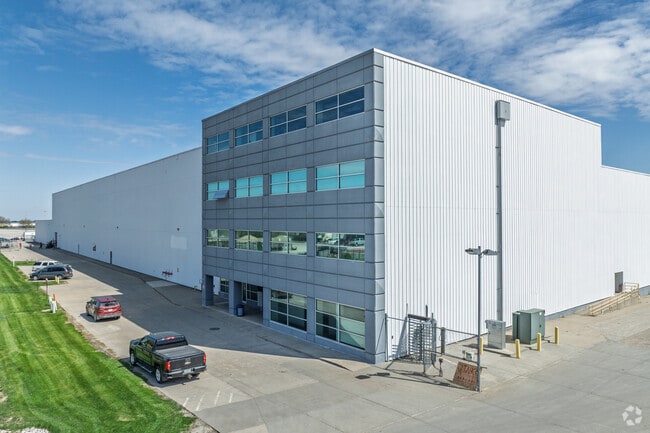
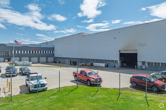
Property Record
927 N 19Th Ave E, Newton, IA 50208

Current Lease Availabilities
Property Detail
927 N 19Th Ave E
Des Moines-West Des Moines, IA
PT LOTS 9-10 NE 1/4 (OUTSIDE TIF DISTRICT)
08-27-226-002
Jasper
Warehouse
Iowa
B and X Area of moderate flood hazard, usually the area between the limits of the 100-year and 500-year floods.
9,10
2025
27.84 AC
2025
Jasper County
040300
Other Market Areas
800 SF
NEARBY LISTINGS FOR SALE OR LEASE
DEMOGRAPHICS near 927 N 19Th Ave E
1 mile
3 mile
5 mile
2025 Total Population
4,493
17,914
19,154
2030 Population
4,584
18,176
19,418
Pop Growth 2025-2030
+ 2.03%
+ 1.46%
+ 1.38%
Average Age
42
42
42
2025 Total Households
1,947
7,649
8,132
HH Growth 2025-2030
+ 2.05%
+ 1.48%
+ 1.40%
Median Household Inc
$55,606
$58,427
$60,165
Avg Household Size
2.20
2.20
2.30
2025 Avg HH Vehicles
2.00
2.00
2.00
Median Home Value
$143,106
$160,249
$165,692
Median Year Built
1964
1964
1964
Nearby Places
Map Layers
Map Styles
 Street
 Aerial
Layers
 Traffic
 Biking
Places
Listings with unknown addresses are not visible on the map
- Restaurants
- Banks
- Shops
- Fitness
- Groceries
Nearby Properties
Address
Land Use
TOTAL SIZE
Lot Size
Zoning
Address
Land Use
TOTAL SIZE
Lot Size
Zoning
5,200 SF
29.50 AC
Address
Land Use
TOTAL SIZE
Lot Size
Zoning
45,504 SF
83.15 AC
Address
Land Use
TOTAL SIZE
Lot Size
Zoning
220,239 SF
9.59 AC
Address
Land Use
TOTAL SIZE
Lot Size
Zoning
21,476 SF
10.85 AC
Address
Land Use
TOTAL SIZE
Lot Size
Zoning
336,482 SF
33.13 AC
Address
Land Use
TOTAL SIZE
Lot Size
Zoning
20,314 SF
0.79 AC
Address
Land Use
TOTAL SIZE
Lot Size
Zoning
161,016 SF
3.23 AC
Address
Land Use
TOTAL SIZE
Lot Size
Zoning
Address
Land Use
TOTAL SIZE
Lot Size
Zoning
20,087 SF
19.77 AC
Address
Land Use
TOTAL SIZE
Lot Size
Zoning
150,615 SF
17.01 AC
Address
Land Use
TOTAL SIZE
Lot Size
Zoning
26,256 SF
3.90 AC
Address
Land Use
TOTAL SIZE
Lot Size
Zoning
2,321 SF
0.93 AC
Address
Land Use
TOTAL SIZE
Lot Size
Zoning
63,208 SF
12.35 AC
Address
Land Use
TOTAL SIZE
Lot Size
Zoning
43,474 SF
7.16 AC
Address
Land Use
TOTAL SIZE
Lot Size
Zoning
5,000 SF
28.85 AC
Address
Land Use
TOTAL SIZE
Lot Size
Zoning
66,500 SF
14.22 AC
Address
Land Use
TOTAL SIZE
Lot Size
Zoning
74,446 SF
21.39 AC
Address
Land Use
TOTAL SIZE
Lot Size
Zoning
39,360 SF
1.88 AC
Address
Land Use
TOTAL SIZE
Lot Size
Zoning
432 SF
19.58 AC
Address
Land Use
TOTAL SIZE
Lot Size
Zoning
400 SF
12.59 AC
Address
Land Use
TOTAL SIZE
Lot Size
Zoning
1,040 SF
7.33 AC
Address
Land Use
TOTAL SIZE
Lot Size
Zoning
40,383 SF
0.96 AC
Address
Land Use
TOTAL SIZE
Lot Size
Zoning
7,996 SF
4.48 AC
Address
Land Use
TOTAL SIZE
Lot Size
Zoning
400 SF
18.34 AC
Address
Land Use
TOTAL SIZE
Lot Size
Zoning
19,592 SF
1.80 AC
Address
Land Use
TOTAL SIZE
Lot Size
Zoning
Address
Land Use
TOTAL SIZE
Lot Size
Zoning
20,335 SF
1.43 AC
Address
Land Use
TOTAL SIZE
Lot Size
Zoning
2,888 SF
3.55 AC
Address
Land Use
TOTAL SIZE
Lot Size
Zoning
6.48 AC
The World's #1 Commercial Real Estate Marketplace
Connect with us
© 2026 CoStar Group
The information above has been obtained from sources believed reliable. While we do not doubt its accuracy we have not verified it and make no guarantee, warranty or representation about it. It is your responsibility to independently confirm its accuracy and completeness. Any projections, opinions, assumptions, or estimates used are for example only and do not represent the current or future performance of the property. The value of this transaction to you depends on tax and other factors which should be evaluated by your tax, financial, and legal advisors. You and your advisors should conduct a careful, independent investigation of the property to determine to your satisfaction the suitability of the property for your needs.