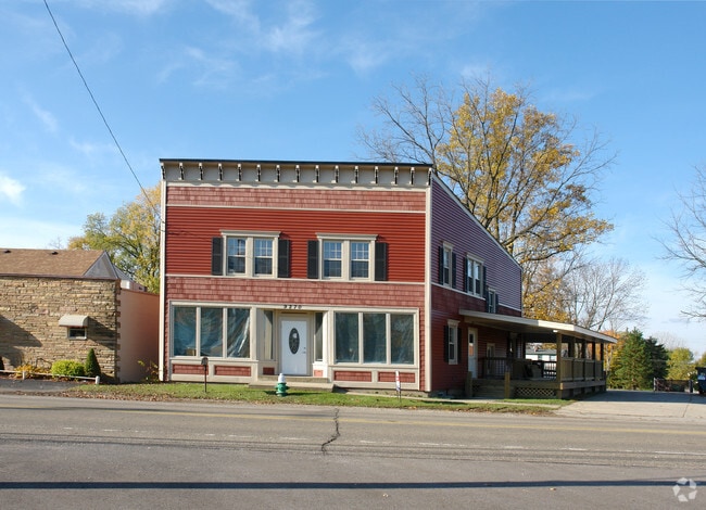
Property Record
9270 Olde 8 Rd, Northfield, OH 44067


NEARBY LISTINGS FOR SALE OR LEASE
Property Detail
9270 Olde 8 Rd
Cleveland
Northfield
Akron, OH
LOT 46 W OF DIA RD .340A
40-00063
Summit
Commercialnec
Ohio
2023
46
2025
0.29 AC
532703
Akron
2,954 SF
DEMOGRAPHICS near 9270 Olde 8 Rd
1 mile
3 mile
5 mile
2024 Total Population
3,470
27,874
59,821
2029 Population
3,398
27,311
58,615
Pop Growth 2024-2029
(2.07%)
(2.02%)
(2.02%)
Average Age
47
46
45
2024 Total Households
1,445
11,911
24,791
HH Growth 2024-2029
(2.21%)
(2.09%)
(2.08%)
Median Household Inc
$80,403
$90,167
$91,382
Avg Household Size
2.30
2.30
2.40
2024 Avg HH Vehicles
2.00
2.00
2.00
Median Home Value
$216,371
$239,634
$251,275
Median Year Built
1964
1980
1977
Nearby Places
Map Layers
Map Styles
 Street
 Aerial
Transit
 Traffic
 Biking
Places
Listings with unknown addresses are not visible on the map
- Restaurants
- Banks
- Shops
- Fitness
- Groceries
PUBLIC TRANSPORTATION
COMMUTER RAIL
Brecksville (National Park Scenic Railway - Cuyahoga Valley Scenic Railroad)
Drive
Walk
Distance
Brecksville (National Park Scenic Railway - Cuyahoga Valley Scenic Railroad)
8 min
3.6 mi
Boston Mill (National Park Scenic Railway - Cuyahoga Valley Scenic Railroad)
Drive
Walk
Distance
Boston Mill (National Park Scenic Railway - Cuyahoga Valley Scenic Railroad)
12 min
5.5 mi
AIRPORT
Cleveland-Hopkins International
Drive
Walk
Distance
Cleveland-Hopkins International
40 min
24.2 mi
Akron-Canton Regional
Drive
Walk
Distance
Akron-Canton Regional
42 min
31.5 mi
Freight Ports
Port of Toledo
Drive
Walk
Distance
Port of Toledo
149 min
124.1 mi
Nearby Properties
Address
Land Use
TOTAL SIZE
Lot Size
Zoning
Address
Land Use
TOTAL SIZE
Lot Size
Zoning
Address
Land Use
TOTAL SIZE
Lot Size
Zoning
49.31 AC
Address
Land Use
TOTAL SIZE
Lot Size
Zoning
Address
Land Use
TOTAL SIZE
Lot Size
Zoning
109.65 AC
MUD
Address
Land Use
TOTAL SIZE
Lot Size
Zoning
230,501 SF
39.59 AC
Address
Land Use
TOTAL SIZE
Lot Size
Zoning
155,897 SF
19.81 AC
Address
Land Use
TOTAL SIZE
Lot Size
Zoning
210,136 SF
21.69 AC
Address
Land Use
TOTAL SIZE
Lot Size
Zoning
180.16 AC
C-F
Address
Land Use
TOTAL SIZE
Lot Size
Zoning
Address
Land Use
TOTAL SIZE
Lot Size
Zoning
130,822 SF
17.50 AC
Address
Land Use
TOTAL SIZE
Lot Size
Zoning
260 AC
C-F
Address
Land Use
TOTAL SIZE
Lot Size
Zoning
320,818 SF
12 AC
Address
Land Use
TOTAL SIZE
Lot Size
Zoning
105,438 SF
9.59 AC
Address
Land Use
TOTAL SIZE
Lot Size
Zoning
60,908 SF
46.85 AC
Address
Land Use
TOTAL SIZE
Lot Size
Zoning
99,400 SF
3.96 AC
Address
Land Use
TOTAL SIZE
Lot Size
Zoning
85,808 SF
10.20 AC
Address
Land Use
TOTAL SIZE
Lot Size
Zoning
Address
Land Use
TOTAL SIZE
Lot Size
Zoning
14,247 SF
262 AC
Address
Land Use
TOTAL SIZE
Lot Size
Zoning
Address
Land Use
TOTAL SIZE
Lot Size
Zoning
141,290 SF
11.53 AC
Address
Land Use
TOTAL SIZE
Lot Size
Zoning
163,307 SF
9.90 AC
Address
Land Use
TOTAL SIZE
Lot Size
Zoning
64,145 SF
6.66 AC
Address
Land Use
TOTAL SIZE
Lot Size
Zoning
Address
Land Use
TOTAL SIZE
Lot Size
Zoning
32,400 SF
91.41 AC
IG
Address
Land Use
TOTAL SIZE
Lot Size
Zoning
79,986 SF
10.18 AC
Address
Land Use
TOTAL SIZE
Lot Size
Zoning
Address
Land Use
TOTAL SIZE
Lot Size
Zoning
120,260 SF
11.68 AC
Address
Land Use
TOTAL SIZE
Lot Size
Zoning
254,000 SF
20 AC
Address
Land Use
TOTAL SIZE
Lot Size
Zoning
128.27 AC
C-F
Address
Land Use
TOTAL SIZE
Lot Size
Zoning
The World's #1 Commercial Real Estate Marketplace
Connect with us
© 2026 CoStar Group
The information above has been obtained from sources believed reliable. While we do not doubt its accuracy we have not verified it and make no guarantee, warranty or representation about it. It is your responsibility to independently confirm its accuracy and completeness. Any projections, opinions, assumptions, or estimates used are for example only and do not represent the current or future performance of the property. The value of this transaction to you depends on tax and other factors which should be evaluated by your tax, financial, and legal advisors. You and your advisors should conduct a careful, independent investigation of the property to determine to your satisfaction the suitability of the property for your needs.