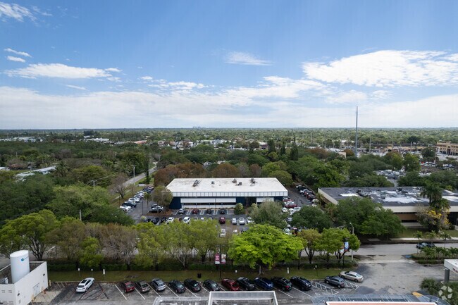
Property Record
9275 Sw 152Nd St, Palmetto Bay, FL 33157


NEARBY LISTINGS FOR SALE OR LEASE
Property Detail
9275 Sw 152Nd St
30-5021-036-0170
Coral Reef Medical Park Ii Condo
Commercialcondominium
CORAL REEF MEDICAL PK II CONDO UNIT 100 UNDIV 6.08% INT IN COMMON ELEMENTS OFF REC 10787-1888 OR 15096-3490 0691 4
X
Miami/Dade
12086C0437L
Florida
2024
South Dade
2025
South Florida
008305
Miami-Miami Beach-Kendall, FL
1,574 SF
DEMOGRAPHICS near 9275 Sw 152Nd St
1 Mile
3 Mile
5 Mile
2024 Total Population
11,154
91,452
285,454
2029 Population
10,792
88,815
278,144
Pop Growth 2024-2029
(3.25%)
(2.88%)
(2.56%)
Average Age
42
42
42
2024 Total Households
4,092
29,851
99,647
HH Growth 2024-2029
(3.71%)
(3.31%)
(2.91%)
Median Household Inc
$76,203
$90,247
$73,803
Avg Household Size
2.60
2.90
2.70
2024 Avg HH Vehicles
2.00
2.00
2.00
Median Home Value
$570,782
$497,978
$403,648
Median Year Built
1975
1974
1979
Nearby Places
Map Layers
Map Styles
 Street
 Aerial
- Restaurants
- Banks
- Shops
- Fitness
- Groceries
PUBLIC TRANSPORTATION
COMMUTER RAIL
Dadeland South (Metrorail Green Line - Miami-Dade Transit (Metrorail/Metromover))
DRIVE
WALK
Distance
Dadeland South (Metrorail Green Line - Miami-Dade Transit (Metrorail/Metromover))
9 min
4.6 mi
Dadeland North (Metrorail Green Line - Miami-Dade Transit (Metrorail/Metromover))
DRIVE
WALK
Distance
Dadeland North (Metrorail Green Line - Miami-Dade Transit (Metrorail/Metromover))
11 min
5.5 mi
AIRPORT
Miami International
DRIVE
WALK
Distance
Miami International
27 min
14.7 mi
Fort Lauderdale/Hollywood International
DRIVE
WALK
Distance
Fort Lauderdale/Hollywood International
58 min
37.5 mi
Freight Ports
Port of Miami
DRIVE
WALK
Distance
Port of Miami
33 min
17.1 mi
SALE & LEASE HISTORY
LISTING DATE
SALE/LEASE

Sep 28, 2021
For Lease
May 28, 2020
For Lease
Mar 04, 2020
For Lease
Feb 18, 2021
For Lease
Aug 05, 2017
For Sale
Apr 03, 2018
For Lease
Nearby Properties
Address
Land Use
TOTAL SIZE
Lot Size
Zoning
Address
Land Use
TOTAL SIZE
Lot Size
Zoning
846,804 SF
43 AC
6400
Address
Land Use
TOTAL SIZE
Lot Size
Zoning
340,763 SF
59.02 AC
0100
Address
Land Use
TOTAL SIZE
Lot Size
Zoning
504,698 SF
3.49 AC
6100
Address
Land Use
TOTAL SIZE
Lot Size
Zoning
425,003 SF
3.56 AC
4300
Address
Land Use
TOTAL SIZE
Lot Size
Zoning
199,915 SF
15.19 AC
6200
Address
Land Use
TOTAL SIZE
Lot Size
Zoning
426,436 SF
2.03 AC
6174
Address
Land Use
TOTAL SIZE
Lot Size
Zoning
250,133 SF
27.27 AC
6200
Address
Land Use
TOTAL SIZE
Lot Size
Zoning
360,424 SF
18.51 AC
2300
Address
Land Use
TOTAL SIZE
Lot Size
Zoning
318,925 SF
1.99 AC
6800
Address
Land Use
TOTAL SIZE
Lot Size
Zoning
350,683 SF
10.14 AC
6200
Address
Land Use
TOTAL SIZE
Lot Size
Zoning
313,755 SF
5 AC
2300
Address
Land Use
TOTAL SIZE
Lot Size
Zoning
269,198 SF
9.82 AC
3900
Address
Land Use
TOTAL SIZE
Lot Size
Zoning
251,016 SF
18.23 AC
6200
Address
Land Use
TOTAL SIZE
Lot Size
Zoning
235,115 SF
18.39 AC
2300
Address
Land Use
TOTAL SIZE
Lot Size
Zoning
237,857 SF
9.09 AC
2300
Address
Land Use
TOTAL SIZE
Lot Size
Zoning
187,775 SF
4.77 AC
9400
Address
Land Use
TOTAL SIZE
Lot Size
Zoning
96,075 SF
5.24 AC
6200
Address
Land Use
TOTAL SIZE
Lot Size
Zoning
574,534 SF
25.01 AC
4500
Address
Land Use
TOTAL SIZE
Lot Size
Zoning
77,861 SF
4.63 AC
6400
Address
Land Use
TOTAL SIZE
Lot Size
Zoning
141,192 SF
9.01 AC
6400
Address
Land Use
TOTAL SIZE
Lot Size
Zoning
205,043 SF
13.74 AC
6200
Address
Land Use
TOTAL SIZE
Lot Size
Zoning
166,464 SF
1.69 AC
7700
Address
Land Use
TOTAL SIZE
Lot Size
Zoning
72,334 SF
14.28 AC
4100
Address
Land Use
TOTAL SIZE
Lot Size
Zoning
176,865 SF
0.99 AC
7100
Address
Land Use
TOTAL SIZE
Lot Size
Zoning
134,794 SF
1.73 AC
6061
Address
Land Use
TOTAL SIZE
Lot Size
Zoning
147,505 SF
20 AC
2100
Address
Land Use
TOTAL SIZE
Lot Size
Zoning
163,619 SF
1.87 AC
7061
Address
Land Use
TOTAL SIZE
Lot Size
Zoning
148,982 SF
23.63 AC
0100
Address
Land Use
TOTAL SIZE
Lot Size
Zoning
129,920 SF
2.10 AC
7100
Address
Land Use
TOTAL SIZE
Lot Size
Zoning
46,955 SF
3.06 AC
6200
The World's #1 Commercial Real Estate Marketplace
Connect with us
© 2026 CoStar Group
The information above has been obtained from sources believed reliable. While we do not doubt its accuracy we have not verified it and make no guarantee, warranty or representation about it. It is your responsibility to independently confirm its accuracy and completeness. Any projections, opinions, assumptions, or estimates used are for example only and do not represent the current or future performance of the property. The value of this transaction to you depends on tax and other factors which should be evaluated by your tax, financial, and legal advisors. You and your advisors should conduct a careful, independent investigation of the property to determine to your satisfaction the suitability of the property for your needs.