Property Record
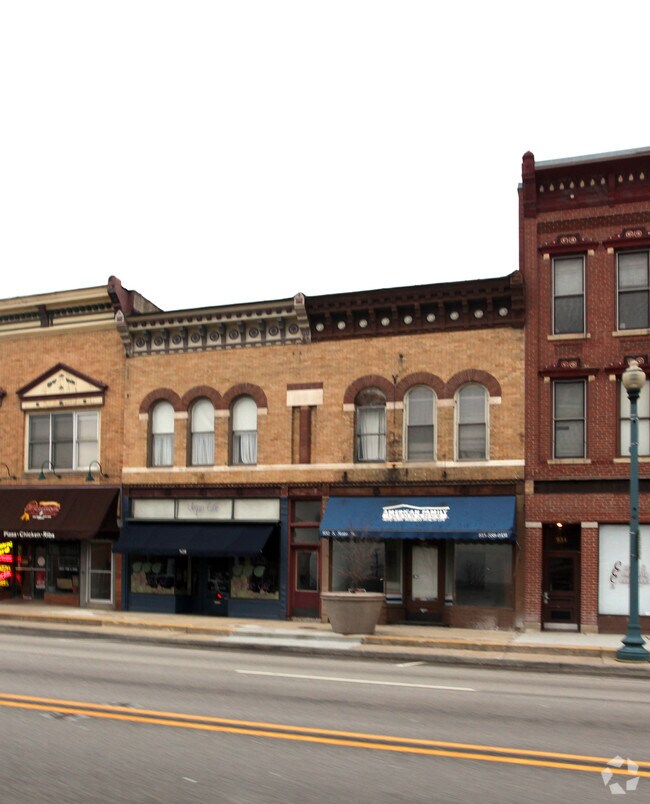
928 S State St, Lockport, IL 60441


NEARBY LISTINGS FOR SALE OR LEASE
Property Detail
928 S State St
Chicago-Naperville-Elgin, IL-IN-WI
City Of Lockport
11-04-23-325-013
LOT 6 BLOCK 81 THE N1/2 S1/2 OF LOT 6 BLK 81 IN THE E1/2 OF THE SW1/4 IN SEC 23, T36N-R10E.
Commercialnec
Will
X
Illinois
17197C0158G
6
2024
0.09 AC
2024
Joliet/Central Will
880602
Chicago
DEMOGRAPHICS near 928 S State St
1 Mile
3 Mile
5 Mile
2024 Total Population
6,944
37,923
148,908
2029 Population
6,889
37,940
148,557
Pop Growth 2024-2029
(0.79%)
+ 0.04%
(0.24%)
Average Age
41
39
39
2024 Total Households
2,969
12,868
52,082
HH Growth 2024-2029
(0.77%)
(0.04%)
(0.22%)
Median Household Inc
$70,478
$81,919
$72,404
Avg Household Size
2.30
2.70
2.70
2024 Avg HH Vehicles
2.00
2.00
2.00
Median Home Value
$232,599
$258,888
$223,315
Median Year Built
1957
1986
1976
Nearby Places
Map Layers
Map Styles
 Street
 Aerial
- Restaurants
- Banks
- Shops
- Fitness
- Groceries
PUBLIC TRANSPORTATION
TRANSIT/SUBWAY
Lockport Station (Heritage Corridor Line - Northeast Illinois Regional Commuter Railroad (Metra))
DRIVE
WALK
Distance
Lockport Station (Heritage Corridor Line - Northeast Illinois Regional Commuter Railroad (Metra))
2 min
7 min
0.4 mi
COMMUTER RAIL
Lockport Station (Heritage Corridor Line - Northeast Illinois Regional Commuter Railroad (Metra))
DRIVE
WALK
Distance
Lockport Station (Heritage Corridor Line - Northeast Illinois Regional Commuter Railroad (Metra))
2 min
7 min
0.4 mi
DRIVE
WALK
Distance
10 min
4.4 mi
AIRPORT
Chicago Midway International
DRIVE
WALK
Distance
Chicago Midway International
38 min
26.8 mi
Chicago O'Hare International
DRIVE
WALK
Distance
Chicago O'Hare International
54 min
38.2 mi
SALE & LEASE HISTORY
LISTING DATE
SALE/LEASE

Mar 22, 2018
For Lease
Nearby Properties
Address
Land Use
TOTAL SIZE
Lot Size
Zoning
Address
Land Use
TOTAL SIZE
Lot Size
Zoning
80.44 AC
Address
Land Use
TOTAL SIZE
Lot Size
Zoning
52.19 AC
Address
Land Use
TOTAL SIZE
Lot Size
Zoning
35.45 AC
Address
Land Use
TOTAL SIZE
Lot Size
Zoning
33.95 AC
Address
Land Use
TOTAL SIZE
Lot Size
Zoning
23.12 AC
Address
Land Use
TOTAL SIZE
Lot Size
Zoning
22.59 AC
Address
Land Use
TOTAL SIZE
Lot Size
Zoning
Address
Land Use
TOTAL SIZE
Lot Size
Zoning
78.48 AC
Address
Land Use
TOTAL SIZE
Lot Size
Zoning
17.56 AC
Address
Land Use
TOTAL SIZE
Lot Size
Zoning
15.78 AC
Address
Land Use
TOTAL SIZE
Lot Size
Zoning
228,690 SF
17.80 AC
Address
Land Use
TOTAL SIZE
Lot Size
Zoning
219,969 SF
23.30 AC
Address
Land Use
TOTAL SIZE
Lot Size
Zoning
128.58 AC
Address
Land Use
TOTAL SIZE
Lot Size
Zoning
228,690 SF
13.15 AC
Address
Land Use
TOTAL SIZE
Lot Size
Zoning
20.14 AC
Address
Land Use
TOTAL SIZE
Lot Size
Zoning
228,690 SF
10.54 AC
Address
Land Use
TOTAL SIZE
Lot Size
Zoning
136.20 AC
Address
Land Use
TOTAL SIZE
Lot Size
Zoning
14,376 SF
234.23 AC
Address
Land Use
TOTAL SIZE
Lot Size
Zoning
245,839 SF
29.90 AC
Address
Land Use
TOTAL SIZE
Lot Size
Zoning
2.45 AC
Address
Land Use
TOTAL SIZE
Lot Size
Zoning
65,591 SF
8.87 AC
Address
Land Use
TOTAL SIZE
Lot Size
Zoning
3.19 AC
Address
Land Use
TOTAL SIZE
Lot Size
Zoning
12.62 AC
Address
Land Use
TOTAL SIZE
Lot Size
Zoning
5.11 AC
Address
Land Use
TOTAL SIZE
Lot Size
Zoning
5.75 AC
Address
Land Use
TOTAL SIZE
Lot Size
Zoning
8.20 AC
Address
Land Use
TOTAL SIZE
Lot Size
Zoning
31,991 SF
9.49 AC
Address
Land Use
TOTAL SIZE
Lot Size
Zoning
35.51 AC
Address
Land Use
TOTAL SIZE
Lot Size
Zoning
67.90 AC
Address
Land Use
TOTAL SIZE
Lot Size
Zoning
29,994 SF
3.80 AC
The World's #1 Commercial Real Estate Marketplace
Connect with us
© 2025 CoStar Group
The information above has been obtained from sources believed reliable. While we do not doubt its accuracy we have not verified it and make no guarantee, warranty or representation about it. It is your responsibility to independently confirm its accuracy and completeness. Any projections, opinions, assumptions, or estimates used are for example only and do not represent the current or future performance of the property. The value of this transaction to you depends on tax and other factors which should be evaluated by your tax, financial, and legal advisors. You and your advisors should conduct a careful, independent investigation of the property to determine to your satisfaction the suitability of the property for your needs.