Property Record
928 E Baltimore Pike, Kennett Square, PA 19348


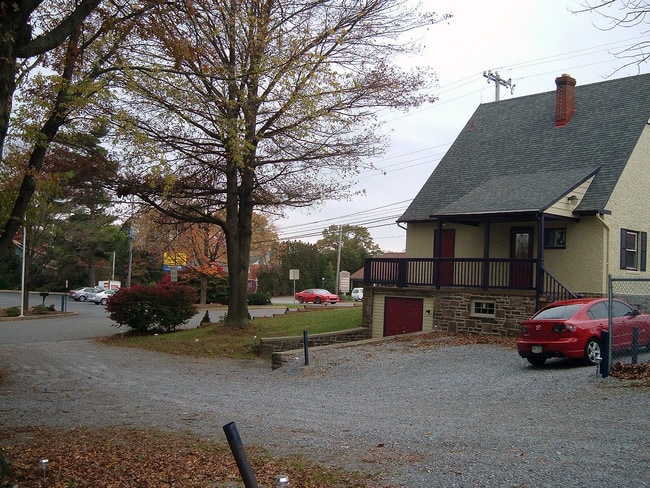
Property Detail
928 E Baltimore Pike
61-06Q-0020.0000
LOT & COMM BLDG
Officebuilding
Chester
MU
Pennsylvania
B and X Area of moderate flood hazard, usually the area between the limits of the 100-year and 500-year floods.
2
2024
0.48 AC
2025
Outer Chester County
303501
Philadelphia
2,506 SF
Philadelphia-Camden-Wilmington, PA-NJ-DE-MD
NEARBY LISTINGS FOR SALE OR LEASE
DEMOGRAPHICS near 928 E Baltimore Pike
1 mile
3 mile
5 mile
2025 Total Population
2,001
25,088
43,676
2030 Population
2,081
26,102
45,204
Pop Growth 2025-2030
+ 4.00%
+ 4.04%
+ 3.50%
Average Age
44
44
44
2025 Total Households
804
9,267
15,418
HH Growth 2025-2030
+ 3.86%
+ 4.21%
+ 3.74%
Median Household Inc
$115,584
$131,760
$146,113
Avg Household Size
2.30
2.60
2.70
2025 Avg HH Vehicles
2.00
2.00
2.00
Median Home Value
$466,241
$610,130
$655,746
Median Year Built
1994
1984
1984
Nearby Places
Map Layers
Map Styles
 Street
 Aerial
Layers
 Traffic
 Biking
Places
Listings with unknown addresses are not visible on the map
- Restaurants
- Banks
- Shops
- Fitness
- Groceries
PUBLIC TRANSPORTATION
AIRPORT
Philadelphia International
Drive
Walk
Distance
Philadelphia International
41 min
25.2 mi
Freight Ports
Port of Wilmington, RI
Drive
Walk
Distance
Port of Wilmington, RI
32 min
15.2 mi
Nearby Properties
Address
Land Use
TOTAL SIZE
Lot Size
Zoning
Address
Land Use
TOTAL SIZE
Lot Size
Zoning
260,160 SF
315.10 AC
RB
Address
Land Use
TOTAL SIZE
Lot Size
Zoning
387,796 SF
41.80 AC
ES1
Address
Land Use
TOTAL SIZE
Lot Size
Zoning
458,327 SF
122.55 AC
R4
Address
Land Use
TOTAL SIZE
Lot Size
Zoning
412,884 SF
100.50 AC
R5
Address
Land Use
TOTAL SIZE
Lot Size
Zoning
193,520 SF
89.60 AC
RA
Address
Land Use
TOTAL SIZE
Lot Size
Zoning
215,130 SF
11.80 AC
R2
Address
Land Use
TOTAL SIZE
Lot Size
Zoning
144,384 SF
25.30 AC
HC
Address
Land Use
TOTAL SIZE
Lot Size
Zoning
238,215 SF
35.70 AC
R3
Address
Land Use
TOTAL SIZE
Lot Size
Zoning
159,484 SF
22.01 AC
HC
Address
Land Use
TOTAL SIZE
Lot Size
Zoning
121,326 SF
14.98 AC
R2
Address
Land Use
TOTAL SIZE
Lot Size
Zoning
121,326 SF
14.98 AC
R2
Address
Land Use
TOTAL SIZE
Lot Size
Zoning
131,082 SF
35.70 AC
RB
Address
Land Use
TOTAL SIZE
Lot Size
Zoning
99,228 SF
0.57 AC
C2
Address
Land Use
TOTAL SIZE
Lot Size
Zoning
67,011 SF
6.78 AC
R2A
Address
Land Use
TOTAL SIZE
Lot Size
Zoning
67,244 SF
9.50 AC
MU
Address
Land Use
TOTAL SIZE
Lot Size
Zoning
78,491 SF
38.30 AC
R3
Address
Land Use
TOTAL SIZE
Lot Size
Zoning
112,074 SF
40 AC
R3
Address
Land Use
TOTAL SIZE
Lot Size
Zoning
59,836 SF
6.33 AC
R2
Address
Land Use
TOTAL SIZE
Lot Size
Zoning
74,992 SF
16.26 AC
R2
Address
Land Use
TOTAL SIZE
Lot Size
Zoning
64,946 SF
0.18 AC
C1
Address
Land Use
TOTAL SIZE
Lot Size
Zoning
65,227 SF
24.50 AC
R2
Address
Land Use
TOTAL SIZE
Lot Size
Zoning
53,134 SF
1.76 AC
R2
Address
Land Use
TOTAL SIZE
Lot Size
Zoning
60,936 SF
3.53 AC
R2
Address
Land Use
TOTAL SIZE
Lot Size
Zoning
65,310 SF
5.07 AC
RB
Address
Land Use
TOTAL SIZE
Lot Size
Zoning
35,784 SF
119.80 AC
R2
Address
Land Use
TOTAL SIZE
Lot Size
Zoning
17,781 SF
6.70 AC
MU
Address
Land Use
TOTAL SIZE
Lot Size
Zoning
175,250 SF
50 AC
SA
Address
Land Use
TOTAL SIZE
Lot Size
Zoning
54,097 SF
3.80 AC
R3
Address
Land Use
TOTAL SIZE
Lot Size
Zoning
46,364 SF
2.15 AC
RB
Address
Land Use
TOTAL SIZE
Lot Size
Zoning
85,568 SF
6.20 AC
C1
The World's #1 Commercial Real Estate Marketplace
Connect with us
© 2026 CoStar Group
The information above has been obtained from sources believed reliable. While we do not doubt its accuracy we have not verified it and make no guarantee, warranty or representation about it. It is your responsibility to independently confirm its accuracy and completeness. Any projections, opinions, assumptions, or estimates used are for example only and do not represent the current or future performance of the property. The value of this transaction to you depends on tax and other factors which should be evaluated by your tax, financial, and legal advisors. You and your advisors should conduct a careful, independent investigation of the property to determine to your satisfaction the suitability of the property for your needs.