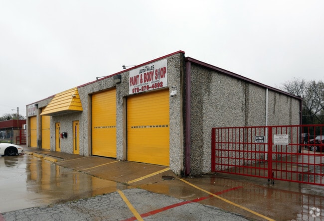
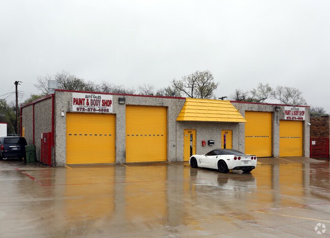
Property Record
928 S 1St St, Garland, TX 75040
NEARBY LISTINGS FOR SALE OR LEASE
Property Detail
928 S 1St St
Dallas-Fort Worth-Arlington, TX
Web Roc Shopping Center
26658500000020000
WEB ROC SHOPPING CENTER LT 2 INT200900313486 DD10292009 CO-DC 6585000000200 2CG65850000
Autorepair
Dallas
X
Texas
48113C0220L
2
2024
0.44 AC
2025
Garland
018204
Dallas/Ft Worth
3,430 SF
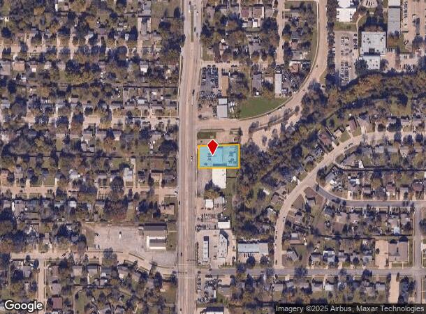
DEMOGRAPHICS near 928 S 1St St
1 Mile
3 Mile
5 Mile
2024 Total Population
16,847
118,867
317,171
2029 Population
16,684
117,145
313,188
Pop Growth 2024-2029
(0.97%)
(1.45%)
(1.26%)
Average Age
35
37
37
2024 Total Households
4,805
36,882
107,336
HH Growth 2024-2029
(1.06%)
(1.68%)
(1.47%)
Median Household Inc
$53,740
$63,319
$64,252
Avg Household Size
3.40
3.10
2.90
2024 Avg HH Vehicles
2.00
2.00
2.00
Median Home Value
$164,021
$207,783
$236,617
Median Year Built
1964
1972
1978
Nearby Places
Map Layers
Map Styles
 Street
 Aerial
- Restaurants
- Banks
- Shops
- Fitness
- Groceries
PUBLIC TRANSPORTATION
AIRPORT
Dallas Love Field
DRIVE
WALK
Distance
Dallas Love Field
33 min
17.5 mi
Dallas-Fort Worth International
DRIVE
WALK
Distance
Dallas-Fort Worth International
41 min
30.5 mi
Nearby Properties
Address
Land Use
TOTAL SIZE
Lot Size
Zoning
Address
Land Use
TOTAL SIZE
Lot Size
Zoning
181,854 SF
14.51 AC
Z239
Address
Land Use
TOTAL SIZE
Lot Size
Zoning
107,686 SF
30.09 AC
Z386
Address
Land Use
TOTAL SIZE
Lot Size
Zoning
480,000 SF
25.27 AC
Z239
Address
Land Use
TOTAL SIZE
Lot Size
Zoning
65,595 SF
19.22 AC
Z239
Address
Land Use
TOTAL SIZE
Lot Size
Zoning
187,440 SF
1.68 AC
Z25
Address
Land Use
TOTAL SIZE
Lot Size
Zoning
77,102 SF
27.47 AC
Z144
Address
Land Use
TOTAL SIZE
Lot Size
Zoning
392,736 SF
19.58 AC
Z144
Address
Land Use
TOTAL SIZE
Lot Size
Zoning
327,600 SF
17.70 AC
Z144
Address
Land Use
TOTAL SIZE
Lot Size
Zoning
198,488 SF
10.17 AC
Z239
Address
Land Use
TOTAL SIZE
Lot Size
Zoning
870,902 SF
53.53 AC
Z144
Address
Land Use
TOTAL SIZE
Lot Size
Zoning
223,969 SF
12.09 AC
Z160
Address
Land Use
TOTAL SIZE
Lot Size
Zoning
331,200 SF
15.96 AC
Z144
Address
Land Use
TOTAL SIZE
Lot Size
Zoning
0.12 AC
Z63
Address
Land Use
TOTAL SIZE
Lot Size
Zoning
168,537 SF
2 AC
Address
Land Use
TOTAL SIZE
Lot Size
Zoning
138,865 SF
11.38 AC
Z239
Address
Land Use
TOTAL SIZE
Lot Size
Zoning
139,133 SF
3.34 AC
Z239
Address
Land Use
TOTAL SIZE
Lot Size
Zoning
133,249 SF
9.71 AC
Z239
Address
Land Use
TOTAL SIZE
Lot Size
Zoning
59,546 SF
60.69 AC
Z390
Address
Land Use
TOTAL SIZE
Lot Size
Zoning
65,917 SF
7.99 AC
Z239
Address
Land Use
TOTAL SIZE
Lot Size
Zoning
292,300 SF
12.70 AC
Z144
Address
Land Use
TOTAL SIZE
Lot Size
Zoning
301,686 SF
28.08 AC
Z52
Address
Land Use
TOTAL SIZE
Lot Size
Zoning
216,722 SF
12.15 AC
Z239
Address
Land Use
TOTAL SIZE
Lot Size
Zoning
177,739 SF
11.10 AC
Z390
Address
Land Use
TOTAL SIZE
Lot Size
Zoning
117,036 SF
11.89 AC
Z239
Address
Land Use
TOTAL SIZE
Lot Size
Zoning
145,203 SF
12.86 AC
Z239
Address
Land Use
TOTAL SIZE
Lot Size
Zoning
156,000 SF
2 AC
Address
Land Use
TOTAL SIZE
Lot Size
Zoning
228,800 SF
10.49 AC
Z144
Address
Land Use
TOTAL SIZE
Lot Size
Zoning
119,397 SF
7.41 AC
Z160
Address
Land Use
TOTAL SIZE
Lot Size
Zoning
183,664 SF
10.75 AC
Z144
Address
Land Use
TOTAL SIZE
Lot Size
Zoning
76,812 SF
9.22 AC
Z144
The World's #1 Commercial Real Estate Marketplace
Connect with us
© 2026 CoStar Group
The information above has been obtained from sources believed reliable. While we do not doubt its accuracy we have not verified it and make no guarantee, warranty or representation about it. It is your responsibility to independently confirm its accuracy and completeness. Any projections, opinions, assumptions, or estimates used are for example only and do not represent the current or future performance of the property. The value of this transaction to you depends on tax and other factors which should be evaluated by your tax, financial, and legal advisors. You and your advisors should conduct a careful, independent investigation of the property to determine to your satisfaction the suitability of the property for your needs.