Property Record
929 2Nd Ave, Coraopolis, PA 15108
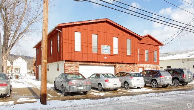
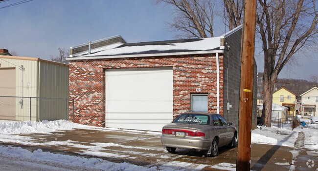
Property Detail
929 2Nd Ave
Pittsburgh, PA
T H WATSON PLAN PT 42 LOT 45X80 -2ND AVE 2 STY ASB SHG HSE 921
0342-A-00239-0000-00
ALLEGHENY
Storebuilding
Pennsylvania
AE The base floodplain where base flood elevations are provided. AE Zones are now used on new format FIRMs instead of A1-A30 Zones.
231
2024
0.09 AC
2025
West Pittsburgh
450800
Pittsburgh
NEARBY LISTINGS FOR SALE OR LEASE
DEMOGRAPHICS near 929 2Nd Ave
1 mile
3 mile
5 mile
2024 Total Population
6,429
33,187
78,761
2029 Population
6,355
32,913
78,009
Pop Growth 2024-2029
(1.15%)
(0.83%)
(0.95%)
Average Age
43
43
43
2024 Total Households
3,044
13,833
32,298
HH Growth 2024-2029
(1.12%)
(1.06%)
(1.10%)
Median Household Inc
$65,927
$94,204
$99,743
Avg Household Size
2.00
2.20
2.30
2024 Avg HH Vehicles
1.00
2.00
2.00
Median Home Value
$181,923
$297,274
$308,527
Median Year Built
1948
1961
1969
Nearby Places
Map Layers
Map Styles
 Street
 Aerial
Transit
 Traffic
 Biking
Places
Listings with unknown addresses are not visible on the map
- Restaurants
- Banks
- Shops
- Fitness
- Groceries
PUBLIC TRANSPORTATION
AIRPORT
Pittsburgh International
Drive
Walk
Distance
Pittsburgh International
14 min
5.4 mi
Freight Ports
Port of Toledo
Drive
Walk
Distance
Port of Toledo
256 min
220.6 mi
Nearby Properties
Address
Land Use
TOTAL SIZE
Lot Size
Zoning
Address
Land Use
TOTAL SIZE
Lot Size
Zoning
3,320 SF
180.98 AC
Address
Land Use
TOTAL SIZE
Lot Size
Zoning
3,827 SF
59.64 AC
Address
Land Use
TOTAL SIZE
Lot Size
Zoning
6.24 AC
Address
Land Use
TOTAL SIZE
Lot Size
Zoning
2,364 SF
17.51 AC
Address
Land Use
TOTAL SIZE
Lot Size
Zoning
25.97 AC
Address
Land Use
TOTAL SIZE
Lot Size
Zoning
14.70 AC
Address
Land Use
TOTAL SIZE
Lot Size
Zoning
11.42 AC
Address
Land Use
TOTAL SIZE
Lot Size
Zoning
2.86 AC
Address
Land Use
TOTAL SIZE
Lot Size
Zoning
Address
Land Use
TOTAL SIZE
Lot Size
Zoning
Address
Land Use
TOTAL SIZE
Lot Size
Zoning
16.26 AC
Address
Land Use
TOTAL SIZE
Lot Size
Zoning
5.98 AC
Address
Land Use
TOTAL SIZE
Lot Size
Zoning
5.32 AC
Address
Land Use
TOTAL SIZE
Lot Size
Zoning
Address
Land Use
TOTAL SIZE
Lot Size
Zoning
Address
Land Use
TOTAL SIZE
Lot Size
Zoning
Address
Land Use
TOTAL SIZE
Lot Size
Zoning
21.50 AC
Address
Land Use
TOTAL SIZE
Lot Size
Zoning
42.80 AC
Address
Land Use
TOTAL SIZE
Lot Size
Zoning
8.33 AC
Address
Land Use
TOTAL SIZE
Lot Size
Zoning
Address
Land Use
TOTAL SIZE
Lot Size
Zoning
30.48 AC
Address
Land Use
TOTAL SIZE
Lot Size
Zoning
55.31 AC
Address
Land Use
TOTAL SIZE
Lot Size
Zoning
8.69 AC
Address
Land Use
TOTAL SIZE
Lot Size
Zoning
33.06 AC
Address
Land Use
TOTAL SIZE
Lot Size
Zoning
16.31 AC
Address
Land Use
TOTAL SIZE
Lot Size
Zoning
18.14 AC
Address
Land Use
TOTAL SIZE
Lot Size
Zoning
7.80 AC
Address
Land Use
TOTAL SIZE
Lot Size
Zoning
Address
Land Use
TOTAL SIZE
Lot Size
Zoning
5.61 AC
Address
Land Use
TOTAL SIZE
Lot Size
Zoning
19.72 AC
The World's #1 Commercial Real Estate Marketplace
Connect with us
© 2026 CoStar Group
The information above has been obtained from sources believed reliable. While we do not doubt its accuracy we have not verified it and make no guarantee, warranty or representation about it. It is your responsibility to independently confirm its accuracy and completeness. Any projections, opinions, assumptions, or estimates used are for example only and do not represent the current or future performance of the property. The value of this transaction to you depends on tax and other factors which should be evaluated by your tax, financial, and legal advisors. You and your advisors should conduct a careful, independent investigation of the property to determine to your satisfaction the suitability of the property for your needs.