Property Record
9290 Nys Rte 3, Henderson, NY 13650
NEARBY LISTINGS FOR SALE OR LEASE
-
-
View all Henderson listings for sale on LoopNet.com
Property Detail
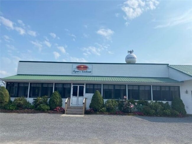
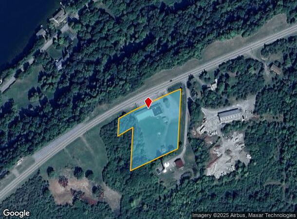
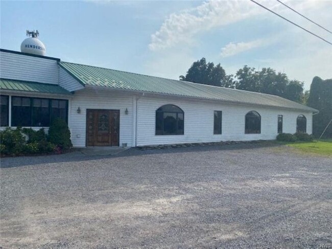
9290 Nys Rte 3
223600-098-017-0001-034-300
Jefferson
Restaurantbuilding
New York
ARE
34.300
36045C0856G
2.33 AC
2025
Jefferson County
2024
Syracuse
061700
Watertown-Fort Drum, NY
6,080 SF
DEMOGRAPHICS near 9290 Nys Rte 3
1 Mile
3 Mile
5 Mile
2024 Total Population
153
945
1,953
2029 Population
153
958
1,971
Pop Growth 2024-2029
0.00%
+ 1.38%
+ 0.92%
Average Age
48
49
47
2024 Total Households
73
439
869
HH Growth 2024-2029
(1.37%)
+ 1.14%
+ 0.81%
Median Household Inc
$72,856
$72,034
$72,678
Avg Household Size
2.10
2.10
2.20
2024 Avg HH Vehicles
2.00
2.00
2.00
Median Home Value
$197,618
$207,658
$207,426
Median Year Built
1960
1967
1967
Nearby Places
- Restaurants
- Banks
- Shops
- Fitness
- Groceries
SALE & LEASE HISTORY
LISTING DATE
SALE/LEASE

Oct 19, 2021
For Sale
Nearby Properties
Address
Land Use
TOTAL SIZE
Lot Size
Zoning
Address
Land Use
TOTAL SIZE
Lot Size
Zoning
4,574 SF
98.32 AC
LF
Address
Land Use
TOTAL SIZE
Lot Size
Zoning
34,500 SF
2.40 AC
Address
Land Use
TOTAL SIZE
Lot Size
Zoning
2,100 SF
15.85 AC
LF
Address
Land Use
TOTAL SIZE
Lot Size
Zoning
6.50 AC
LF
Address
Land Use
TOTAL SIZE
Lot Size
Zoning
1,200 SF
8.40 AC
LF
Address
Land Use
TOTAL SIZE
Lot Size
Zoning
8,505 SF
8.95 AC
Address
Land Use
TOTAL SIZE
Lot Size
Zoning
71.30 AC
LF
Address
Land Use
TOTAL SIZE
Lot Size
Zoning
2,449 SF
4.94 AC
LF
Address
Land Use
TOTAL SIZE
Lot Size
Zoning
1,008 SF
114.60 AC
AR
Address
Land Use
TOTAL SIZE
Lot Size
Zoning
3,208 SF
1.04 AC
LF
Address
Land Use
TOTAL SIZE
Lot Size
Zoning
9,500 SF
0.50 AC
LF
Address
Land Use
TOTAL SIZE
Lot Size
Zoning
650.70 AC
AR
Address
Land Use
TOTAL SIZE
Lot Size
Zoning
7,180 SF
1.91 AC
HB
Address
Land Use
TOTAL SIZE
Lot Size
Zoning
2,392 SF
1 AC
LF
Address
Land Use
TOTAL SIZE
Lot Size
Zoning
3,692 SF
1.30 AC
LF
Address
Land Use
TOTAL SIZE
Lot Size
Zoning
7,968 SF
5.79 AC
HB
Address
Land Use
TOTAL SIZE
Lot Size
Zoning
8,572 SF
1.10 AC
H-
Address
Land Use
TOTAL SIZE
Lot Size
Zoning
1.04 AC
LF
Address
Land Use
TOTAL SIZE
Lot Size
Zoning
2,903 SF
0.44 AC
LF
Address
Land Use
TOTAL SIZE
Lot Size
Zoning
6,276 SF
0.34 AC
H-
Address
Land Use
TOTAL SIZE
Lot Size
Zoning
4.61 AC
07 - MIXED
Address
Land Use
TOTAL SIZE
Lot Size
Zoning
8,716 SF
0.57 AC
HB
Address
Land Use
TOTAL SIZE
Lot Size
Zoning
43.11 AC
LF
Address
Land Use
TOTAL SIZE
Lot Size
Zoning
253.11 AC
AR
Address
Land Use
TOTAL SIZE
Lot Size
Zoning
3,345 SF
1.04 AC
Address
Land Use
TOTAL SIZE
Lot Size
Zoning
2,784 SF
0.12 AC
LF
Address
Land Use
TOTAL SIZE
Lot Size
Zoning
2.10 AC
RES
Address
Land Use
TOTAL SIZE
Lot Size
Zoning
4,289 SF
0.55 AC
LF
Address
Land Use
TOTAL SIZE
Lot Size
Zoning
1,120 SF
0.89 AC
LF
The World's #1 Commercial Real Estate Marketplace
Connect with us
© 2025 CoStar Group
The information above has been obtained from sources believed reliable. While we do not doubt its accuracy we have not verified it and make no guarantee, warranty or representation about it. It is your responsibility to independently confirm its accuracy and completeness. Any projections, opinions, assumptions, or estimates used are for example only and do not represent the current or future performance of the property. The value of this transaction to you depends on tax and other factors which should be evaluated by your tax, financial, and legal advisors. You and your advisors should conduct a careful, independent investigation of the property to determine to your satisfaction the suitability of the property for your needs.