Property Record
9296 Airbase Rd N, Columbus, OH 43217
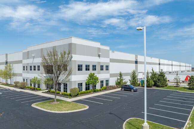
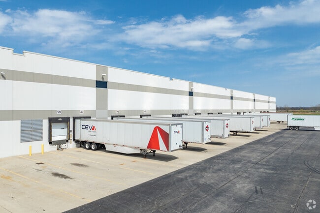
Property Detail
9296 Airbase Rd N
Columbus, OH
LOT 2 RICKENBACKER INTERMODAL CAMPUS NORTH SEC 18
F16-0-001-00-001-04
PICKAWAY
Officebuilding
Ohio
B and X Area of moderate flood hazard, usually the area between the limits of the 100-year and 500-year floods.
2
2025
15.24 AC
2025
Pickaway County
310,127 SF
Columbus
NEARBY LISTINGS FOR SALE OR LEASE
DEMOGRAPHICS near 9296 Airbase Rd N
1 mile
3 mile
5 mile
2025 Total Population
9
5,615
17,347
2030 Population
10
5,944
18,184
Pop Growth 2025-2030
+ 11.11%
+ 5.86%
+ 4.83%
Average Age
37
35
39
2025 Total Households
4
1,943
6,473
HH Growth 2025-2030
0.00%
+ 6.12%
+ 4.90%
Median Household Inc
$47,500
$54,728
$73,111
Avg Household Size
2.30
2.90
2.70
2025 Avg HH Vehicles
2.00
2.00
2.00
Median Home Value
$50,000
$175,555
$243,434
Median Year Built
1972
1971
1977
Nearby Places
Map Layers
Map Styles
 Street
 Aerial
Layers
 Traffic
 Biking
Places
Listings with unknown addresses are not visible on the map
- Restaurants
- Banks
- Shops
- Fitness
- Groceries
PUBLIC TRANSPORTATION
AIRPORT
Rickenbacker International
Drive
Walk
Distance
Rickenbacker International
9 min
4.4 mi
John Glenn Columbus International
Drive
Walk
Distance
John Glenn Columbus International
32 min
19.1 mi
Freight Ports
Port of Toledo
Drive
Walk
Distance
Port of Toledo
210 min
165.7 mi
SALE & LEASE HISTORY
LISTING DATE
SALE/LEASE

Jun 03, 2025
For Lease
Jan 16, 2020
For Lease
Jan 16, 2020
For Lease
Nearby Properties
Address
Land Use
TOTAL SIZE
Lot Size
Zoning
Address
Land Use
TOTAL SIZE
Lot Size
Zoning
4,200 SF
852.55 AC
Address
Land Use
TOTAL SIZE
Lot Size
Zoning
1,466,512 SF
49.72 AC
Address
Land Use
TOTAL SIZE
Lot Size
Zoning
43,254 SF
300.98 AC
Address
Land Use
TOTAL SIZE
Lot Size
Zoning
1,600,052 SF
70.19 AC
Address
Land Use
TOTAL SIZE
Lot Size
Zoning
150.29 AC
Address
Land Use
TOTAL SIZE
Lot Size
Zoning
816,200 SF
51.08 AC
Address
Land Use
TOTAL SIZE
Lot Size
Zoning
903,780 SF
45.43 AC
Address
Land Use
TOTAL SIZE
Lot Size
Zoning
676,000 SF
35.76 AC
Address
Land Use
TOTAL SIZE
Lot Size
Zoning
592,120 SF
38.67 AC
Address
Land Use
TOTAL SIZE
Lot Size
Zoning
547,200 SF
43.58 AC
Address
Land Use
TOTAL SIZE
Lot Size
Zoning
639,600 SF
43.91 AC
Address
Land Use
TOTAL SIZE
Lot Size
Zoning
590,225 SF
42.21 AC
Address
Land Use
TOTAL SIZE
Lot Size
Zoning
245,756 SF
102.40 AC
Address
Land Use
TOTAL SIZE
Lot Size
Zoning
Address
Land Use
TOTAL SIZE
Lot Size
Zoning
362,940 SF
8.69 AC
Address
Land Use
TOTAL SIZE
Lot Size
Zoning
943,080 SF
63.91 AC
Address
Land Use
TOTAL SIZE
Lot Size
Zoning
613,995 SF
38.31 AC
Address
Land Use
TOTAL SIZE
Lot Size
Zoning
507,600 SF
28.80 AC
Address
Land Use
TOTAL SIZE
Lot Size
Zoning
509,068 SF
35.69 AC
Address
Land Use
TOTAL SIZE
Lot Size
Zoning
261,000 SF
22.92 AC
Address
Land Use
TOTAL SIZE
Lot Size
Zoning
510,408 SF
46.52 AC
Address
Land Use
TOTAL SIZE
Lot Size
Zoning
418,418 SF
42.30 AC
Address
Land Use
TOTAL SIZE
Lot Size
Zoning
592,120 SF
38.67 AC
Address
Land Use
TOTAL SIZE
Lot Size
Zoning
47,622 SF
167.59 AC
Address
Land Use
TOTAL SIZE
Lot Size
Zoning
289,800 SF
23.71 AC
Address
Land Use
TOTAL SIZE
Lot Size
Zoning
Address
Land Use
TOTAL SIZE
Lot Size
Zoning
205,428 SF
14.71 AC
Address
Land Use
TOTAL SIZE
Lot Size
Zoning
257,082 SF
16.16 AC
Address
Land Use
TOTAL SIZE
Lot Size
Zoning
354,510 SF
21.89 AC
Address
Land Use
TOTAL SIZE
Lot Size
Zoning
156,718 SF
8.65 AC
The World's #1 Commercial Real Estate Marketplace
Connect with us
© 2026 CoStar Group
The information above has been obtained from sources believed reliable. While we do not doubt its accuracy we have not verified it and make no guarantee, warranty or representation about it. It is your responsibility to independently confirm its accuracy and completeness. Any projections, opinions, assumptions, or estimates used are for example only and do not represent the current or future performance of the property. The value of this transaction to you depends on tax and other factors which should be evaluated by your tax, financial, and legal advisors. You and your advisors should conduct a careful, independent investigation of the property to determine to your satisfaction the suitability of the property for your needs.