Property Record
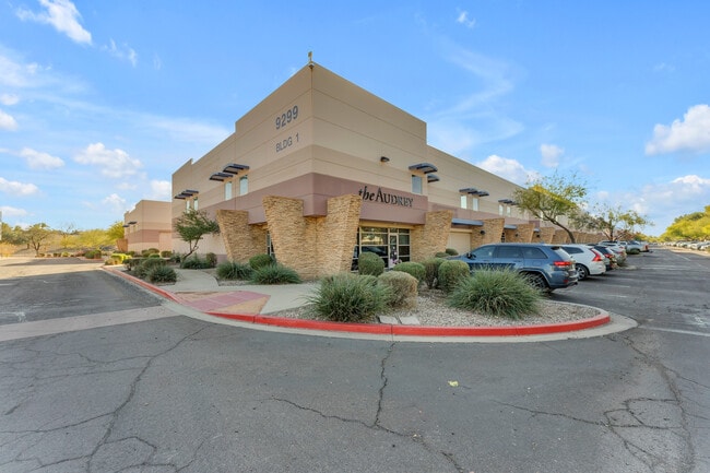
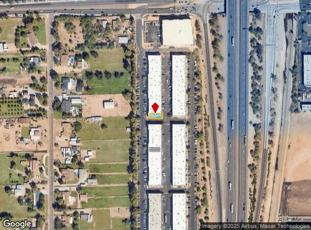
9299 W Olive Ave, Peoria, AZ 85345
Current Lease Availabilities
NEARBY LISTINGS FOR SALE OR LEASE
Property Detail
9299 W Olive Ave
Phoenix-Mesa-Scottsdale, AZ
Olive Avenue Business Park Condominium
142-55-544
OLIVE AVENUE BUSINESS PARK CONDOMINIUM MCR 811-40
Warehouse
Maricopa
X
Arizona
04013C1685M
13
2025
0.05 AC
2025
Glendale
092708
Phoenix
31,345 SF
DEMOGRAPHICS near 9299 W Olive Ave
1 Mile
3 Mile
5 Mile
2024 Total Population
13,747
103,970
314,782
2029 Population
14,825
113,002
341,551
Pop Growth 2024-2029
+ 7.84%
+ 8.69%
+ 8.50%
Average Age
40
42
39
2024 Total Households
5,033
40,086
112,925
HH Growth 2024-2029
+ 7.87%
+ 8.86%
+ 8.68%
Median Household Inc
$62,202
$60,230
$61,154
Avg Household Size
2.60
2.50
2.70
2024 Avg HH Vehicles
2.00
2.00
2.00
Median Home Value
$298,796
$261,721
$277,232
Median Year Built
1989
1987
1986
Nearby Places
Map Layers
Map Styles
 Street
 Aerial
- Restaurants
- Banks
- Shops
- Fitness
- Groceries
PUBLIC TRANSPORTATION
AIRPORT
Phoenix Sky Harbor International
DRIVE
WALK
Distance
Phoenix Sky Harbor International
34 min
25.2 mi
Freight Ports
Port of San Diego
DRIVE
WALK
Distance
Port of San Diego
391 min
351.1 mi
Nearby Properties
Address
Land Use
TOTAL SIZE
Lot Size
Zoning
Address
Land Use
TOTAL SIZE
Lot Size
Zoning
1,449,251 SF
25.30 AC
A1
Address
Land Use
TOTAL SIZE
Lot Size
Zoning
127,011 SF
30.62 AC
PAD
Address
Land Use
TOTAL SIZE
Lot Size
Zoning
15.17 AC
Address
Land Use
TOTAL SIZE
Lot Size
Zoning
0.68 AC
Address
Land Use
TOTAL SIZE
Lot Size
Zoning
630,367 SF
13.50 AC
PAD
Address
Land Use
TOTAL SIZE
Lot Size
Zoning
74,628 SF
2.74 AC
PAD
Address
Land Use
TOTAL SIZE
Lot Size
Zoning
13,861 SF
3.40 AC
PAD
Address
Land Use
TOTAL SIZE
Lot Size
Zoning
242,300 SF
41.79 AC
C-C
Address
Land Use
TOTAL SIZE
Lot Size
Zoning
443,840 SF
37.94 AC
PAD
Address
Land Use
TOTAL SIZE
Lot Size
Zoning
926 SF
37.32 AC
I-1
Address
Land Use
TOTAL SIZE
Lot Size
Zoning
1,113,127 SF
48.24 AC
C2
Address
Land Use
TOTAL SIZE
Lot Size
Zoning
359,639 SF
16.29 AC
PAD
Address
Land Use
TOTAL SIZE
Lot Size
Zoning
603,148 SF
13.63 AC
PAD
Address
Land Use
TOTAL SIZE
Lot Size
Zoning
303,051 SF
9.11 AC
AG
Address
Land Use
TOTAL SIZE
Lot Size
Zoning
135,052 SF
5.52 AC
PAD
Address
Land Use
TOTAL SIZE
Lot Size
Zoning
307,822 SF
26.49 AC
PAD
Address
Land Use
TOTAL SIZE
Lot Size
Zoning
547,083 SF
10.94 AC
C-C
Address
Land Use
TOTAL SIZE
Lot Size
Zoning
366,400 SF
19.99 AC
PAD
Address
Land Use
TOTAL SIZE
Lot Size
Zoning
342,527 SF
16.52 AC
PAD
Address
Land Use
TOTAL SIZE
Lot Size
Zoning
330,321 SF
3.85 AC
PAD
Address
Land Use
TOTAL SIZE
Lot Size
Zoning
637,538 SF
9.74 AC
Address
Land Use
TOTAL SIZE
Lot Size
Zoning
318,282 SF
15.23 AC
PAD
Address
Land Use
TOTAL SIZE
Lot Size
Zoning
334,769 SF
12.01 AC
Address
Land Use
TOTAL SIZE
Lot Size
Zoning
4,742 SF
1.18 AC
PAD
Address
Land Use
TOTAL SIZE
Lot Size
Zoning
325,529 SF
10.85 AC
PAD
Address
Land Use
TOTAL SIZE
Lot Size
Zoning
20,948 SF
2.39 AC
R-6
Address
Land Use
TOTAL SIZE
Lot Size
Zoning
291,028 SF
20.62 AC
Address
Land Use
TOTAL SIZE
Lot Size
Zoning
131,031 SF
26.44 AC
R-43
Address
Land Use
TOTAL SIZE
Lot Size
Zoning
327,311 SF
21.14 AC
RM-1
Address
Land Use
TOTAL SIZE
Lot Size
Zoning
321,976 SF
13 AC
R-43
The World's #1 Commercial Real Estate Marketplace
Connect with us
© 2025 CoStar Group
The information above has been obtained from sources believed reliable. While we do not doubt its accuracy we have not verified it and make no guarantee, warranty or representation about it. It is your responsibility to independently confirm its accuracy and completeness. Any projections, opinions, assumptions, or estimates used are for example only and do not represent the current or future performance of the property. The value of this transaction to you depends on tax and other factors which should be evaluated by your tax, financial, and legal advisors. You and your advisors should conduct a careful, independent investigation of the property to determine to your satisfaction the suitability of the property for your needs.