Property Record
93 Hyde Park Ave, Jamaica Plain, MA 02130
NEARBY LISTINGS FOR SALE OR LEASE
Property Detail
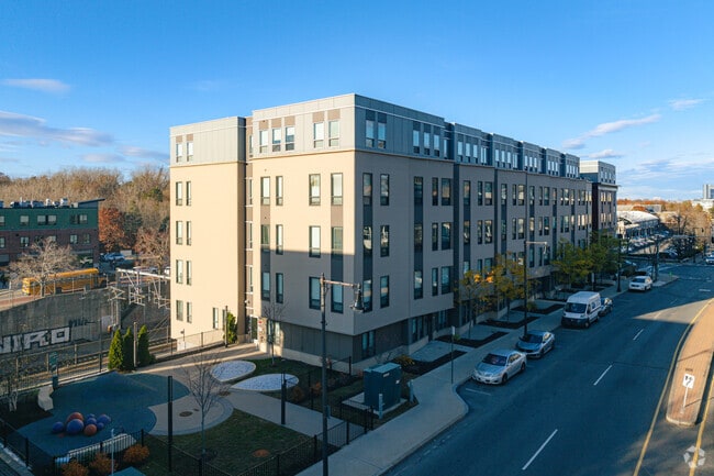
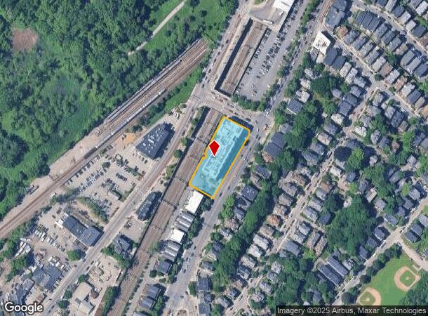
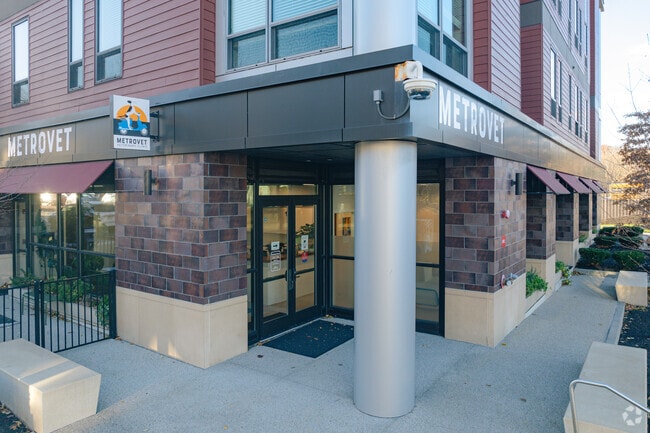
93 Hyde Park Ave
Commercialofficeresidentialmixeduse
Suffolk
X
Massachusetts
25025C0086G
0.88 AC
2024
Forest Hills-Woodbourne
2025
Boston
110105
Boston-Cambridge-Newton, MA-NH
88,331 SF
JAMA-000000-000019-005052-000050
DEMOGRAPHICS near 93 Hyde Park Ave
1 Mile
3 Mile
5 Mile
2024 Total Population
21,596
298,487
746,777
2029 Population
20,335
283,216
718,245
Pop Growth 2024-2029
(5.84%)
(5.12%)
(3.82%)
Average Age
40
39
38
2024 Total Households
8,974
111,691
299,835
HH Growth 2024-2029
(6.46%)
(5.64%)
(4.18%)
Median Household Inc
$99,157
$75,797
$89,156
Avg Household Size
2.30
2.50
2.20
2024 Avg HH Vehicles
1.00
1.00
1.00
Median Home Value
$702,979
$696,302
$772,129
Median Year Built
1947
1948
1949
Nearby Places
Map Layers
Map Styles
 Street
 Aerial
- Restaurants
- Banks
- Shops
- Fitness
- Groceries
PUBLIC TRANSPORTATION
TRANSIT/SUBWAY
Forest Hills Station (Orange Line - Massachusetts Bay Transportation Authority Subway (The T))
DRIVE
WALK
Distance
Forest Hills Station (Orange Line - Massachusetts Bay Transportation Authority Subway (The T))
0 min
4 min
0.3 mi
COMMUTER RAIL
Forest Hills (Needham Line - Massachusetts Bay Transportation Authority Commuter Rail (Purple Line))
DRIVE
WALK
Distance
Forest Hills (Needham Line - Massachusetts Bay Transportation Authority Commuter Rail (Purple Line))
0 min
4 min
0.3 mi
Roslindale Village (Needham Line - Massachusetts Bay Transportation Authority Commuter Rail (Purple Line))
DRIVE
WALK
Distance
Roslindale Village (Needham Line - Massachusetts Bay Transportation Authority Commuter Rail (Purple Line))
5 min
1.5 mi
AIRPORT
General Edward Lawrence Logan International
DRIVE
WALK
Distance
General Edward Lawrence Logan International
17 min
8.5 mi
Freight Ports
Port of Boston
DRIVE
WALK
Distance
Port of Boston
15 min
6.8 mi
SALE & LEASE HISTORY
LISTING DATE
SALE/LEASE

Jul 10, 2019
For Lease
Nearby Properties
Address
Land Use
TOTAL SIZE
Lot Size
Zoning
Address
Land Use
TOTAL SIZE
Lot Size
Zoning
909,764 SF
25.13 AC
E
Address
Land Use
TOTAL SIZE
Lot Size
Zoning
596,972 SF
7.32 AC
E
Address
Land Use
TOTAL SIZE
Lot Size
Zoning
254,208 SF
3.83 AC
E
Address
Land Use
TOTAL SIZE
Lot Size
Zoning
262,120 SF
0.62 AC
C
Address
Land Use
TOTAL SIZE
Lot Size
Zoning
468,308 SF
0.78 AC
E
Address
Land Use
TOTAL SIZE
Lot Size
Zoning
249,135 SF
1.99 AC
RC
Address
Land Use
TOTAL SIZE
Lot Size
Zoning
208,468 SF
1.44 AC
RC
Address
Land Use
TOTAL SIZE
Lot Size
Zoning
268,675 SF
1.72 AC
I
Address
Land Use
TOTAL SIZE
Lot Size
Zoning
147,997 SF
2.03 AC
GMR2
Address
Land Use
TOTAL SIZE
Lot Size
Zoning
0.20 AC
E
Address
Land Use
TOTAL SIZE
Lot Size
Zoning
285,456 SF
1.43 AC
E
Address
Land Use
TOTAL SIZE
Lot Size
Zoning
432,703 SF
10.46 AC
E
Address
Land Use
TOTAL SIZE
Lot Size
Zoning
146,751 SF
3.39 AC
E
Address
Land Use
TOTAL SIZE
Lot Size
Zoning
317,049 SF
11.22 AC
M05
Address
Land Use
TOTAL SIZE
Lot Size
Zoning
428,271 SF
9.65 AC
E
Address
Land Use
TOTAL SIZE
Lot Size
Zoning
14.59 AC
S40
Address
Land Use
TOTAL SIZE
Lot Size
Zoning
203,252 SF
236.88 AC
S40
Address
Land Use
TOTAL SIZE
Lot Size
Zoning
139,965 SF
9.27 AC
E
Address
Land Use
TOTAL SIZE
Lot Size
Zoning
45,000 SF
14.30 AC
E
Address
Land Use
TOTAL SIZE
Lot Size
Zoning
134,136 SF
1.35 AC
M25
Address
Land Use
TOTAL SIZE
Lot Size
Zoning
282,420 SF
5.98 AC
E
Address
Land Use
TOTAL SIZE
Lot Size
Zoning
163,364 SF
3.08 AC
O10
Address
Land Use
TOTAL SIZE
Lot Size
Zoning
351,680 SF
4.01 AC
RC
Address
Land Use
TOTAL SIZE
Lot Size
Zoning
25,744 SF
35.80 AC
S40
Address
Land Use
TOTAL SIZE
Lot Size
Zoning
179.13 AC
E
Address
Land Use
TOTAL SIZE
Lot Size
Zoning
5,119 SF
119.98 AC
S15
Address
Land Use
TOTAL SIZE
Lot Size
Zoning
103,544 SF
0.61 AC
E
Address
Land Use
TOTAL SIZE
Lot Size
Zoning
1,940 SF
58.17 AC
E
Address
Land Use
TOTAL SIZE
Lot Size
Zoning
181,164 SF
0.85 AC
M25
Address
Land Use
TOTAL SIZE
Lot Size
Zoning
240.18 AC
E
The World's #1 Commercial Real Estate Marketplace
Connect with us
© 2025 CoStar Group
The information above has been obtained from sources believed reliable. While we do not doubt its accuracy we have not verified it and make no guarantee, warranty or representation about it. It is your responsibility to independently confirm its accuracy and completeness. Any projections, opinions, assumptions, or estimates used are for example only and do not represent the current or future performance of the property. The value of this transaction to you depends on tax and other factors which should be evaluated by your tax, financial, and legal advisors. You and your advisors should conduct a careful, independent investigation of the property to determine to your satisfaction the suitability of the property for your needs.