Property Record
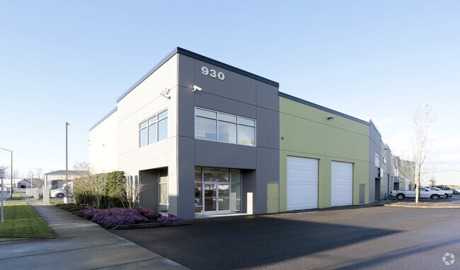
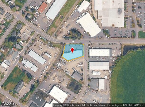
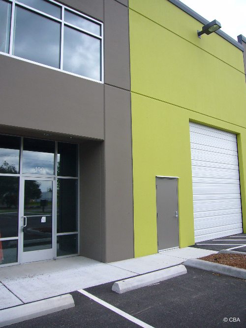
930 Battersby Ave, Enumclaw, WA 98022

NEARBY LISTINGS FOR SALE OR LEASE
Property Detail
930 Battersby Ave
Seattle-Tacoma-Bellevue, WA
Enumclaw Railroad Tracts
236150-0100
ENUMCLAW RAILROAD TRACTS
Warehouse
King
X
Washington
53033C1530G
tract
2025
0.86 AC
2024
E King County
031400
Seattle/Puget Sound
15,462 SF
DEMOGRAPHICS near 930 Battersby Ave
1 Mile
3 Mile
5 Mile
2024 Total Population
7,441
16,662
26,239
2029 Population
7,507
16,802
26,461
Pop Growth 2024-2029
+ 0.89%
+ 0.84%
+ 0.85%
Average Age
41
41
41
2024 Total Households
3,004
6,490
9,928
HH Growth 2024-2029
+ 0.53%
+ 0.57%
+ 0.59%
Median Household Inc
$105,804
$106,588
$112,411
Avg Household Size
2.40
2.50
2.60
2024 Avg HH Vehicles
2.00
2.00
2.00
Median Home Value
$440,348
$508,424
$533,824
Median Year Built
1980
1981
1981
Nearby Places
Map Layers
Map Styles
 Street
 Aerial
- Restaurants
- Banks
- Shops
- Fitness
- Groceries
PUBLIC TRANSPORTATION
AIRPORT
Seattle-Tacoma International
DRIVE
WALK
Distance
Seattle-Tacoma International
45 min
33.1 mi
Freight Ports
Port of Tacoma
DRIVE
WALK
Distance
Port of Tacoma
1 min
20.4 mi
SALE & LEASE HISTORY
LISTING DATE
SALE/LEASE

Sep 25, 2016
For Lease
Nearby Properties
Address
Land Use
TOTAL SIZE
Lot Size
Zoning
Address
Land Use
TOTAL SIZE
Lot Size
Zoning
257,034 SF
39.18 AC
P
Address
Land Use
TOTAL SIZE
Lot Size
Zoning
90,817 SF
3.38 AC
H
Address
Land Use
TOTAL SIZE
Lot Size
Zoning
Address
Land Use
TOTAL SIZE
Lot Size
Zoning
126,225 SF
8.42 AC
R-4
Address
Land Use
TOTAL SIZE
Lot Size
Zoning
145,161 SF
9.07 AC
LI
Address
Land Use
TOTAL SIZE
Lot Size
Zoning
33,150 SF
7.86 AC
LI
Address
Land Use
TOTAL SIZE
Lot Size
Zoning
28,384 SF
6.15 AC
P
Address
Land Use
TOTAL SIZE
Lot Size
Zoning
100,000 SF
44.10 AC
P
Address
Land Use
TOTAL SIZE
Lot Size
Zoning
47,375 SF
40.51 AC
P
Address
Land Use
TOTAL SIZE
Lot Size
Zoning
14.27 AC
P
Address
Land Use
TOTAL SIZE
Lot Size
Zoning
65,352 SF
5.62 AC
R-4
Address
Land Use
TOTAL SIZE
Lot Size
Zoning
90,242 SF
0.21 AC
CB1
Address
Land Use
TOTAL SIZE
Lot Size
Zoning
42,444 SF
3.12 AC
R-4
Address
Land Use
TOTAL SIZE
Lot Size
Zoning
87,334 SF
33.88 AC
P
Address
Land Use
TOTAL SIZE
Lot Size
Zoning
155,590 SF
63.56 AC
P
Address
Land Use
TOTAL SIZE
Lot Size
Zoning
5,870 SF
1.03 AC
LI
Address
Land Use
TOTAL SIZE
Lot Size
Zoning
60,000 SF
4.70 AC
P
Address
Land Use
TOTAL SIZE
Lot Size
Zoning
1,180 SF
2.21 AC
R-4
Address
Land Use
TOTAL SIZE
Lot Size
Zoning
39,600 SF
2.66 AC
R-4
Address
Land Use
TOTAL SIZE
Lot Size
Zoning
21,640 SF
2.42 AC
GO
Address
Land Use
TOTAL SIZE
Lot Size
Zoning
52,557 SF
3.59 AC
P
Address
Land Use
TOTAL SIZE
Lot Size
Zoning
45,007 SF
11.59 AC
P
Address
Land Use
TOTAL SIZE
Lot Size
Zoning
33,280 SF
2.79 AC
R-4
Address
Land Use
TOTAL SIZE
Lot Size
Zoning
2.39 AC
LI
Address
Land Use
TOTAL SIZE
Lot Size
Zoning
56,514 SF
3.66 AC
HCB
Address
Land Use
TOTAL SIZE
Lot Size
Zoning
44,284 SF
4.31 AC
HCB
Address
Land Use
TOTAL SIZE
Lot Size
Zoning
24,052 SF
1.91 AC
R-4
Address
Land Use
TOTAL SIZE
Lot Size
Zoning
20,592 SF
2.41 AC
R-4
Address
Land Use
TOTAL SIZE
Lot Size
Zoning
18,131 SF
1.11 AC
GO-H
Address
Land Use
TOTAL SIZE
Lot Size
Zoning
10,573 SF
5.51 AC
P
The World's #1 Commercial Real Estate Marketplace
Connect with us
© 2026 CoStar Group
The information above has been obtained from sources believed reliable. While we do not doubt its accuracy we have not verified it and make no guarantee, warranty or representation about it. It is your responsibility to independently confirm its accuracy and completeness. Any projections, opinions, assumptions, or estimates used are for example only and do not represent the current or future performance of the property. The value of this transaction to you depends on tax and other factors which should be evaluated by your tax, financial, and legal advisors. You and your advisors should conduct a careful, independent investigation of the property to determine to your satisfaction the suitability of the property for your needs.