Property Record
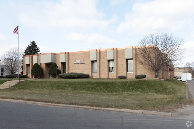
930 E 80Th St, Minneapolis, MN 55420

Property Detail
930 E 80Th St
Minneapolis-St. Paul-Bloomington, MN-WI
LOT 009 BLOCK 002 A BLOOMINGTON INDUSTRIAL PARK W 115 FT OF LOT 9 AND THE E 8 FT OF LOT 10 123 X 356.99
02-027-24-24-0008
HENNEPIN
Industrialgeneral
Minnesota
B and X Area of moderate flood hazard, usually the area between the limits of the 100-year and 500-year floods.
9
0
1.11 AC
2024
South Central
025403
Minneapolis/St Paul
20,336 SF
NEARBY LISTINGS FOR SALE OR LEASE
DEMOGRAPHICS near 930 E 80Th St
1 mile
3 mile
5 mile
2024 Total Population
14,943
81,034
239,392
2029 Population
14,848
81,125
240,484
Pop Growth 2024-2029
(0.64%)
+ 0.11%
+ 0.46%
Average Age
37
41
41
2024 Total Households
5,229
34,038
101,810
HH Growth 2024-2029
(0.73%)
+ 0.12%
+ 0.51%
Median Household Inc
$77,177
$83,420
$96,310
Avg Household Size
2.70
2.30
2.30
2024 Avg HH Vehicles
2.00
2.00
2.00
Median Home Value
$317,273
$333,962
$369,912
Median Year Built
1957
1960
1962
Nearby Places
Map Layers
Map Styles
 Street
 Aerial
Transit
 Traffic
 Biking
Places
Listings with unknown addresses are not visible on the map
- Restaurants
- Banks
- Shops
- Fitness
- Groceries
PUBLIC TRANSPORTATION
COMMUTER RAIL
Target Field Station (Northstar Corridor - Northstar Commuter Rail)
Drive
Walk
Distance
Target Field Station (Northstar Corridor - Northstar Commuter Rail)
20 min
9.9 mi
AIRPORT
Minneapolis-St Paul International/Wold-Chamberlain
Drive
Walk
Distance
Minneapolis-St Paul International/Wold-Chamberlain
9 min
3.7 mi
SALE & LEASE HISTORY
LISTING DATE
SALE/LEASE

Aug 02, 2023
For Sale
Nearby Properties
Address
Land Use
TOTAL SIZE
Lot Size
Zoning
Address
Land Use
TOTAL SIZE
Lot Size
Zoning
1,233,880 SF
63.49 AC
Address
Land Use
TOTAL SIZE
Lot Size
Zoning
4.26 AC
Address
Land Use
TOTAL SIZE
Lot Size
Zoning
21.50 AC
Address
Land Use
TOTAL SIZE
Lot Size
Zoning
3.86 AC
Address
Land Use
TOTAL SIZE
Lot Size
Zoning
4.29 AC
Address
Land Use
TOTAL SIZE
Lot Size
Zoning
35.28 AC
Address
Land Use
TOTAL SIZE
Lot Size
Zoning
78,800 SF
2.12 AC
Address
Land Use
TOTAL SIZE
Lot Size
Zoning
435,796 SF
36.44 AC
Address
Land Use
TOTAL SIZE
Lot Size
Zoning
4.20 AC
Address
Land Use
TOTAL SIZE
Lot Size
Zoning
98,676 SF
8.77 AC
Address
Land Use
TOTAL SIZE
Lot Size
Zoning
Address
Land Use
TOTAL SIZE
Lot Size
Zoning
114,617 SF
17.68 AC
Address
Land Use
TOTAL SIZE
Lot Size
Zoning
122,021 SF
21.74 AC
Address
Land Use
TOTAL SIZE
Lot Size
Zoning
60,320 SF
11.50 AC
Address
Land Use
TOTAL SIZE
Lot Size
Zoning
2.23 AC
Address
Land Use
TOTAL SIZE
Lot Size
Zoning
2.49 AC
Address
Land Use
TOTAL SIZE
Lot Size
Zoning
6.87 AC
Address
Land Use
TOTAL SIZE
Lot Size
Zoning
32,748 SF
2.24 AC
Address
Land Use
TOTAL SIZE
Lot Size
Zoning
19,441 SF
1.37 AC
Address
Land Use
TOTAL SIZE
Lot Size
Zoning
4.20 AC
Address
Land Use
TOTAL SIZE
Lot Size
Zoning
33,246 SF
5.16 AC
Address
Land Use
TOTAL SIZE
Lot Size
Zoning
47,397 SF
6.78 AC
Address
Land Use
TOTAL SIZE
Lot Size
Zoning
Address
Land Use
TOTAL SIZE
Lot Size
Zoning
4.20 AC
Address
Land Use
TOTAL SIZE
Lot Size
Zoning
138,826 SF
23.39 AC
Address
Land Use
TOTAL SIZE
Lot Size
Zoning
14,568 SF
14.97 AC
Address
Land Use
TOTAL SIZE
Lot Size
Zoning
Address
Land Use
TOTAL SIZE
Lot Size
Zoning
16,825 SF
2.75 AC
Address
Land Use
TOTAL SIZE
Lot Size
Zoning
Address
Land Use
TOTAL SIZE
Lot Size
Zoning
10.96 AC
The World's #1 Commercial Real Estate Marketplace
Connect with us
© 2026 CoStar Group
The information above has been obtained from sources believed reliable. While we do not doubt its accuracy we have not verified it and make no guarantee, warranty or representation about it. It is your responsibility to independently confirm its accuracy and completeness. Any projections, opinions, assumptions, or estimates used are for example only and do not represent the current or future performance of the property. The value of this transaction to you depends on tax and other factors which should be evaluated by your tax, financial, and legal advisors. You and your advisors should conduct a careful, independent investigation of the property to determine to your satisfaction the suitability of the property for your needs.