Property Record
930 Hensley Ln, Wylie, TX 75098


Property Detail
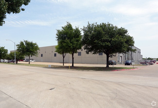
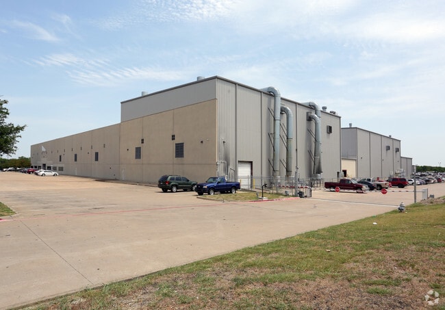
930 Hensley Ln
Dallas-Fort Worth-Arlington, TX
PREMIER INDUSTRIAL PARK SOUTH, BLK B, LOT 1
R-4329-00B-0010-1
COLLIN
Industrialgeneral
Texas
A Areas with a 1% annual chance of flooding and a 26% chance of flooding over the life of a 30-year mortgage.
1
2025
17.21 AC
2025
Plano
031336
Dallas/Ft Worth
221,982 SF
NEARBY LISTINGS FOR SALE OR LEASE
DEMOGRAPHICS near 930 Hensley Ln
1 mile
3 mile
5 mile
2025 Total Population
8,742
89,082
181,966
2030 Population
10,096
99,858
202,111
Pop Growth 2025-2030
+ 15.49%
+ 12.10%
+ 11.07%
Average Age
37
37
38
2025 Total Households
2,973
28,266
57,713
HH Growth 2025-2030
+ 15.71%
+ 12.27%
+ 11.06%
Median Household Inc
$123,788
$123,390
$129,614
Avg Household Size
2.90
3.10
3.10
2025 Avg HH Vehicles
2.00
2.00
2.00
Median Home Value
$499,690
$441,410
$465,039
Median Year Built
2007
2005
2004
Nearby Places
Map Layers
Map Styles
 Street
 Aerial
Layers
 Traffic
 Biking
Places
Listings with unknown addresses are not visible on the map
- Restaurants
- Banks
- Shops
- Fitness
- Groceries
PUBLIC TRANSPORTATION
AIRPORT
Dallas Love Field
Drive
Walk
Distance
Dallas Love Field
43 min
28.4 mi
Dallas-Fort Worth International
Drive
Walk
Distance
Dallas-Fort Worth International
49 min
36.5 mi
Nearby Properties
Address
Land Use
TOTAL SIZE
Lot Size
Zoning
Address
Land Use
TOTAL SIZE
Lot Size
Zoning
339,663 SF
95.04 AC
Address
Land Use
TOTAL SIZE
Lot Size
Zoning
350,553 SF
18.71 AC
MF-M
Address
Land Use
TOTAL SIZE
Lot Size
Zoning
367,458 SF
13.42 AC
Address
Land Use
TOTAL SIZE
Lot Size
Zoning
285,392 SF
19.44 AC
MF-M
Address
Land Use
TOTAL SIZE
Lot Size
Zoning
441,356 SF
74.94 AC
Address
Land Use
TOTAL SIZE
Lot Size
Zoning
385,735 SF
13.13 AC
Address
Land Use
TOTAL SIZE
Lot Size
Zoning
266,957 SF
11.34 AC
MFR
Address
Land Use
TOTAL SIZE
Lot Size
Zoning
332,047 SF
18.48 AC
MF-L
Address
Land Use
TOTAL SIZE
Lot Size
Zoning
393,054 SF
55.95 AC
Address
Land Use
TOTAL SIZE
Lot Size
Zoning
257,718 SF
13.10 AC
RESIDENTIA
Address
Land Use
TOTAL SIZE
Lot Size
Zoning
228,536 SF
10.54 AC
MF-M
Address
Land Use
TOTAL SIZE
Lot Size
Zoning
274,329 SF
44.89 AC
Address
Land Use
TOTAL SIZE
Lot Size
Zoning
114,945 SF
19.71 AC
TC
Address
Land Use
TOTAL SIZE
Lot Size
Zoning
746 SF
115.14 AC
Address
Land Use
TOTAL SIZE
Lot Size
Zoning
83,564 SF
10.81 AC
Address
Land Use
TOTAL SIZE
Lot Size
Zoning
140,130 SF
19.67 AC
Address
Land Use
TOTAL SIZE
Lot Size
Zoning
132,306 SF
7.85 AC
MF
Address
Land Use
TOTAL SIZE
Lot Size
Zoning
78,708 SF
9.55 AC
Address
Land Use
TOTAL SIZE
Lot Size
Zoning
102,786 SF
28.88 AC
Address
Land Use
TOTAL SIZE
Lot Size
Zoning
77,225 SF
9.59 AC
Address
Land Use
TOTAL SIZE
Lot Size
Zoning
106,866 SF
15.69 AC
Address
Land Use
TOTAL SIZE
Lot Size
Zoning
97,898 SF
10.82 AC
Address
Land Use
TOTAL SIZE
Lot Size
Zoning
186,220 SF
13.64 AC
Address
Land Use
TOTAL SIZE
Lot Size
Zoning
123,621 SF
12.22 AC
Address
Land Use
TOTAL SIZE
Lot Size
Zoning
128,849 SF
7.70 AC
Address
Land Use
TOTAL SIZE
Lot Size
Zoning
141,396 SF
8.40 AC
NS
Address
Land Use
TOTAL SIZE
Lot Size
Zoning
304,978 SF
81.51 AC
Address
Land Use
TOTAL SIZE
Lot Size
Zoning
145,268 SF
16.34 AC
Address
Land Use
TOTAL SIZE
Lot Size
Zoning
79,636 SF
10.16 AC
The World's #1 Commercial Real Estate Marketplace
Connect with us
© 2026 CoStar Group
The information above has been obtained from sources believed reliable. While we do not doubt its accuracy we have not verified it and make no guarantee, warranty or representation about it. It is your responsibility to independently confirm its accuracy and completeness. Any projections, opinions, assumptions, or estimates used are for example only and do not represent the current or future performance of the property. The value of this transaction to you depends on tax and other factors which should be evaluated by your tax, financial, and legal advisors. You and your advisors should conduct a careful, independent investigation of the property to determine to your satisfaction the suitability of the property for your needs.