Property Record
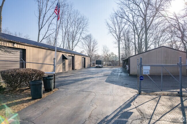
930 King Rd, Toledo, OH 43617


Property Detail
930 King Rd
65-46742
GARDEN LAND LOT 97 S 132.45 FT
Warehouse
Lucas
19-C2
Ohio
B and X Area of moderate flood hazard, usually the area between the limits of the 100-year and 500-year floods.
97
0
1.06 AC
2025
West/Sylvania
008701
Toledo
4,400 SF
Toledo, OH
NEARBY LISTINGS FOR SALE OR LEASE
DEMOGRAPHICS near 930 King Rd
1 mile
3 mile
5 mile
2025 Total Population
4,446
44,472
115,754
2030 Population
4,456
43,918
114,327
Pop Growth 2025-2030
+ 0.22%
(1.25%)
(1.23%)
Average Age
42
42
42
2025 Total Households
1,834
18,915
49,573
HH Growth 2025-2030
+ 0.49%
(1.14%)
(1.18%)
Median Household Inc
$90,744
$83,839
$78,204
Avg Household Size
2.30
2.30
2.20
2025 Avg HH Vehicles
2.00
2.00
2.00
Median Home Value
$296,637
$238,377
$249,713
Median Year Built
1987
1984
1979
Nearby Places
Map Layers
Map Styles
 Street
 Aerial
Transit
 Traffic
 Biking
Places
Listings with unknown addresses are not visible on the map
- Restaurants
- Banks
- Shops
- Fitness
- Groceries
PUBLIC TRANSPORTATION
AIRPORT
Eugene F Kranz Toledo Express
Drive
Walk
Distance
Eugene F Kranz Toledo Express
25 min
11.9 mi
Nearby Properties
Address
Land Use
TOTAL SIZE
Lot Size
Zoning
Address
Land Use
TOTAL SIZE
Lot Size
Zoning
329,064 SF
69.74 AC
10-RS6
Address
Land Use
TOTAL SIZE
Lot Size
Zoning
186,190 SF
14 AC
19-C2
Address
Land Use
TOTAL SIZE
Lot Size
Zoning
209,351 SF
49.06 AC
31-R1
Address
Land Use
TOTAL SIZE
Lot Size
Zoning
78,678 SF
10.20 AC
31-R1
Address
Land Use
TOTAL SIZE
Lot Size
Zoning
178,915 SF
13 AC
19-R3
Address
Land Use
TOTAL SIZE
Lot Size
Zoning
89,031 SF
15.83 AC
31-M2
Address
Land Use
TOTAL SIZE
Lot Size
Zoning
212,664 SF
21.43 AC
24-B3
Address
Land Use
TOTAL SIZE
Lot Size
Zoning
203,839 SF
16.39 AC
24-SUP
Address
Land Use
TOTAL SIZE
Lot Size
Zoning
130,387 SF
8.50 AC
20-R5
Address
Land Use
TOTAL SIZE
Lot Size
Zoning
217,992 SF
39.78 AC
20-C2
Address
Land Use
TOTAL SIZE
Lot Size
Zoning
156,420 SF
12 AC
19-R3
Address
Land Use
TOTAL SIZE
Lot Size
Zoning
137,081 SF
12 AC
20-C2
Address
Land Use
TOTAL SIZE
Lot Size
Zoning
111,195 SF
13.64 AC
19-C2
Address
Land Use
TOTAL SIZE
Lot Size
Zoning
120,077 SF
9.53 AC
24-B3
Address
Land Use
TOTAL SIZE
Lot Size
Zoning
214,400 SF
13.07 AC
20-C2
Address
Land Use
TOTAL SIZE
Lot Size
Zoning
90,782 SF
18.24 AC
20-RA
Address
Land Use
TOTAL SIZE
Lot Size
Zoning
119,804 SF
5.02 AC
31-R4
Address
Land Use
TOTAL SIZE
Lot Size
Zoning
140,008 SF
10 AC
19-R3
Address
Land Use
TOTAL SIZE
Lot Size
Zoning
70,550 SF
8.25 AC
31-B1
Address
Land Use
TOTAL SIZE
Lot Size
Zoning
36,153 SF
4.43 AC
20-C2
Address
Land Use
TOTAL SIZE
Lot Size
Zoning
130,168 SF
12 AC
31-R2
Address
Land Use
TOTAL SIZE
Lot Size
Zoning
103,406 SF
7.55 AC
24-SUP
Address
Land Use
TOTAL SIZE
Lot Size
Zoning
218,603 SF
18 AC
10-MX
Address
Land Use
TOTAL SIZE
Lot Size
Zoning
104,367 SF
10.51 AC
19-C2
Address
Land Use
TOTAL SIZE
Lot Size
Zoning
88,152 SF
11 AC
19-C2
Address
Land Use
TOTAL SIZE
Lot Size
Zoning
122,154 SF
10.62 AC
20-MX
Address
Land Use
TOTAL SIZE
Lot Size
Zoning
65,182 SF
8.40 AC
19-PO
Address
Land Use
TOTAL SIZE
Lot Size
Zoning
59,620 SF
4.18 AC
10-RS9
Address
Land Use
TOTAL SIZE
Lot Size
Zoning
121,446 SF
8.87 AC
20-MX
Address
Land Use
TOTAL SIZE
Lot Size
Zoning
140,702 SF
12 AC
19-C2
The World's #1 Commercial Real Estate Marketplace
Connect with us
© 2026 CoStar Group
The information above has been obtained from sources believed reliable. While we do not doubt its accuracy we have not verified it and make no guarantee, warranty or representation about it. It is your responsibility to independently confirm its accuracy and completeness. Any projections, opinions, assumptions, or estimates used are for example only and do not represent the current or future performance of the property. The value of this transaction to you depends on tax and other factors which should be evaluated by your tax, financial, and legal advisors. You and your advisors should conduct a careful, independent investigation of the property to determine to your satisfaction the suitability of the property for your needs.