Property Record
930 Main St, Acton, MA 01720


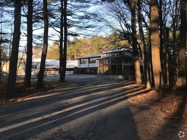
Property Detail
930 Main St
ACTO-000006B-000014
Middlesex
Industrialgeneral
Massachusetts
SM
8.03 AC
AE The base floodplain where base flood elevations are provided. AE Zones are now used on new format FIRMs instead of A1-A30 Zones.
Concord/Maynard
2025
Boston
2025
Boston-Cambridge-Newton, MA-NH
363106
NEARBY LISTINGS FOR SALE OR LEASE
DEMOGRAPHICS near 930 Main St
1 mile
3 mile
5 mile
2025 Total Population
1,591
19,958
63,115
2030 Population
1,676
20,958
65,798
Pop Growth 2025-2030
+ 5.34%
+ 5.01%
+ 4.25%
Average Age
42
42
43
2025 Total Households
640
7,410
23,340
HH Growth 2025-2030
+ 5.47%
+ 5.11%
+ 4.39%
Median Household Inc
$101,812
$164,921
$172,268
Avg Household Size
2.40
2.60
2.60
2025 Avg HH Vehicles
1.00
2.00
2.00
Median Home Value
$799,999
$833,065
$788,182
Median Year Built
1997
1985
1977
Nearby Places
Map Layers
Map Styles
 Street
 Aerial
Transit
 Traffic
 Biking
Places
Listings with unknown addresses are not visible on the map
- Restaurants
- Banks
- Shops
- Fitness
- Groceries
PUBLIC TRANSPORTATION
COMMUTER RAIL
West Concord (Fitchburg/South Acton Line - Massachusetts Bay Transportation Authority Commuter Rail (Purple Line))
Drive
Walk
Distance
West Concord (Fitchburg/South Acton Line - Massachusetts Bay Transportation Authority Commuter Rail (Purple Line))
11 min
5.6 mi
Littleton/Route 495 (Fitchburg/South Acton Line - Massachusetts Bay Transportation Authority Commuter Rail (Purple Line))
Drive
Walk
Distance
Littleton/Route 495 (Fitchburg/South Acton Line - Massachusetts Bay Transportation Authority Commuter Rail (Purple Line))
15 min
8.0 mi
AIRPORT
General Edward Lawrence Logan International
Drive
Walk
Distance
General Edward Lawrence Logan International
47 min
28.8 mi
Manchester Boston Regional
Drive
Walk
Distance
Manchester Boston Regional
54 min
34.3 mi
Worcester Regional
Drive
Walk
Distance
Worcester Regional
57 min
39.7 mi
Freight Ports
Port of Boston
Drive
Walk
Distance
Port of Boston
47 min
28.9 mi
SALE & LEASE HISTORY
LISTING DATE
SALE/LEASE

May 22, 2019
For Lease
Jul 12, 2017
For Lease
Jan 10, 2019
For Lease
Jan 03, 2019
For Lease
Aug 15, 2017
For Lease
Apr 10, 2017
For Lease
Nearby Properties
Address
Land Use
TOTAL SIZE
Lot Size
Zoning
Address
Land Use
TOTAL SIZE
Lot Size
Zoning
2,080 SF
289.85 AC
AA
Address
Land Use
TOTAL SIZE
Lot Size
Zoning
310,328 SF
22.24 AC
IH
Address
Land Use
TOTAL SIZE
Lot Size
Zoning
8.39 AC
OP1
Address
Land Use
TOTAL SIZE
Lot Size
Zoning
7.32 AC
R
Address
Land Use
TOTAL SIZE
Lot Size
Zoning
161,850 SF
18.41 AC
CH
Address
Land Use
TOTAL SIZE
Lot Size
Zoning
14.47 AC
R108
Address
Land Use
TOTAL SIZE
Lot Size
Zoning
291,926 SF
31.78 AC
IH
Address
Land Use
TOTAL SIZE
Lot Size
Zoning
9.96 AC
OP1
Address
Land Use
TOTAL SIZE
Lot Size
Zoning
10.34 AC
LB
Address
Land Use
TOTAL SIZE
Lot Size
Zoning
79,254 SF
18.14 AC
RA
Address
Land Use
TOTAL SIZE
Lot Size
Zoning
133,782 SF
19 AC
A
Address
Land Use
TOTAL SIZE
Lot Size
Zoning
155,922 SF
14.61 AC
CH
Address
Land Use
TOTAL SIZE
Lot Size
Zoning
396,023 SF
23.53 AC
OP1
Address
Land Use
TOTAL SIZE
Lot Size
Zoning
171,494 SF
15.68 AC
CH
Address
Land Use
TOTAL SIZE
Lot Size
Zoning
39,250 SF
0.39 AC
R2
Address
Land Use
TOTAL SIZE
Lot Size
Zoning
130,524 SF
19.74 AC
IH
Address
Land Use
TOTAL SIZE
Lot Size
Zoning
175,718 SF
20.12 AC
IH
Address
Land Use
TOTAL SIZE
Lot Size
Zoning
38,552 SF
5.34 AC
LB
Address
Land Use
TOTAL SIZE
Lot Size
Zoning
78,564 SF
3.43 AC
LB
Address
Land Use
TOTAL SIZE
Lot Size
Zoning
119,000 SF
11.19 AC
OP1
Address
Land Use
TOTAL SIZE
Lot Size
Zoning
78,722 SF
7.54 AC
LB
Address
Land Use
TOTAL SIZE
Lot Size
Zoning
3.85 AC
RA
Address
Land Use
TOTAL SIZE
Lot Size
Zoning
60,850 SF
31.75 AC
R
Address
Land Use
TOTAL SIZE
Lot Size
Zoning
80,974 SF
14.36 AC
CH
Address
Land Use
TOTAL SIZE
Lot Size
Zoning
44,586 SF
8.28 AC
CH
Address
Land Use
TOTAL SIZE
Lot Size
Zoning
66,515 SF
23.98 AC
SM
Address
Land Use
TOTAL SIZE
Lot Size
Zoning
4.49 AC
SM
Address
Land Use
TOTAL SIZE
Lot Size
Zoning
45,718 SF
10.23 AC
RA
Address
Land Use
TOTAL SIZE
Lot Size
Zoning
104,160 SF
8.01 AC
IB
Address
Land Use
TOTAL SIZE
Lot Size
Zoning
92,520 SF
11.54 AC
IH
The World's #1 Commercial Real Estate Marketplace
Connect with us
© 2026 CoStar Group
The information above has been obtained from sources believed reliable. While we do not doubt its accuracy we have not verified it and make no guarantee, warranty or representation about it. It is your responsibility to independently confirm its accuracy and completeness. Any projections, opinions, assumptions, or estimates used are for example only and do not represent the current or future performance of the property. The value of this transaction to you depends on tax and other factors which should be evaluated by your tax, financial, and legal advisors. You and your advisors should conduct a careful, independent investigation of the property to determine to your satisfaction the suitability of the property for your needs.